File:Fort Chimo, Quebec aeronautical chart section.jpg
Jump to navigation
Jump to search

Size of this preview: 692 × 599 pixels. Other resolutions: 277 × 240 pixels | 554 × 480 pixels | 887 × 768 pixels | 1,246 × 1,079 pixels.
Original file (1,246 × 1,079 pixels, file size: 1,017 KB, MIME type: image/jpeg)
Captions
Captions
Add a one-line explanation of what this file represents
Summary
[edit]
| Description |
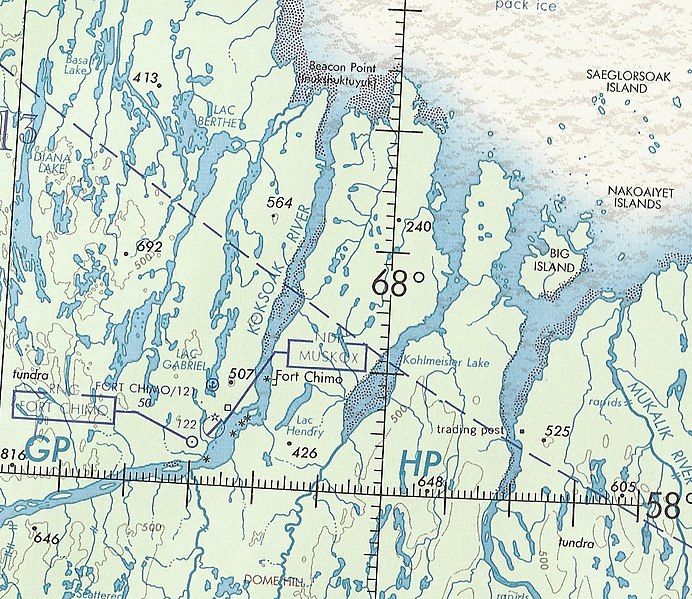
English: Section of U.S. Department of Defense Operational Navigation Chart, ONC D-15, February 1971. 1:1,000,000. |
| Date | |
| Source | Published Chart |
| Author | U.S. Department of Defense |
Licensing
[edit]
This image is a work of a U.S. military or Department of Defense employee, taken or made as part of that person's official duties. As a work of the U.S. federal government, the image is in the public domain in the United States.
|
 |
File history
Click on a date/time to view the file as it appeared at that time.
| Date/Time | Thumbnail | Dimensions | User | Comment | |
|---|---|---|---|---|---|
| current | 15:44, 19 November 2012 | | 1,246 × 1,079 (1,017 KB) | Archivist2 (talk | contribs) | Uploading a public-domain item using File Upload Wizard |
You cannot overwrite this file.
File usage on Commons
There are no pages that use this file.
File usage on other wikis
The following other wikis use this file:
- Usage on en.wikipedia.org