File:Fort-Duquesne.jpg
Jump to navigation
Jump to search
Size of this preview: 800 × 600 pixels. Other resolutions: 320 × 240 pixels | 640 × 480 pixels | 1,024 × 768 pixels | 1,280 × 960 pixels | 2,560 × 1,920 pixels | 4,896 × 3,672 pixels.
Original file (4,896 × 3,672 pixels, file size: 6.6 MB, MIME type: image/jpeg)
Captions
Captions
Add a one-line explanation of what this file represents
Summary
[edit]
| Description |
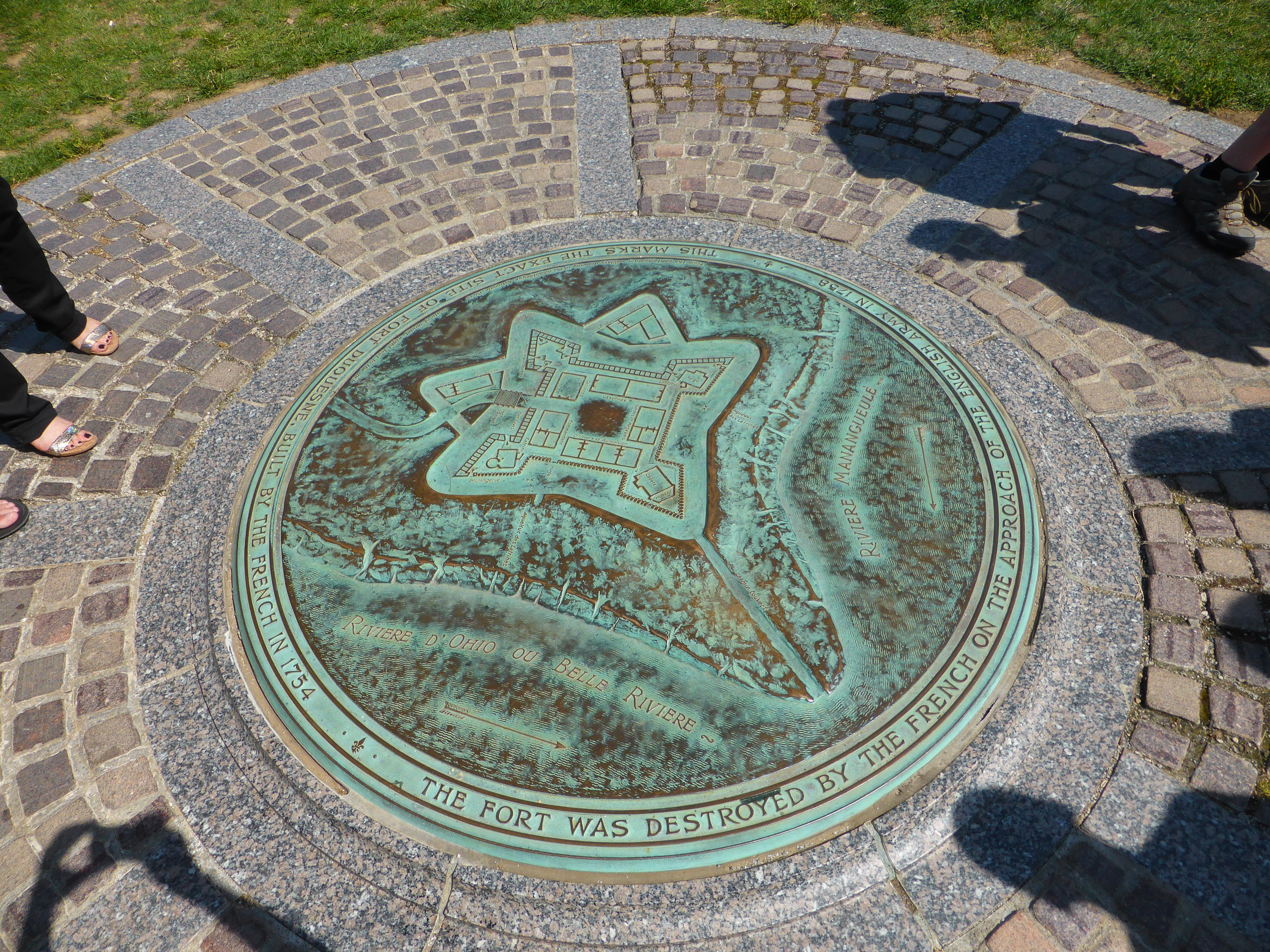
English: Marker for Fort Duquesne. It says : This marks the exact site of Fort Duquesne, built by the French in 1754. The fort was destroyed by the French on the approach of the English army in 1758.
Deutsch: Marker für Fort Duquesne.
Français : Plaque marquant l'emplacement de Fort Duquesne, ouvrage construit par les Français en 1754 pour contrôler l'Ohio, région alors disputée avec les colons anglais. La plaque montre le plan du fort en français avec l'Ohio appelé à l'époque « Belle Rivière ». Fort abandonné en 1758 et détruit lors de la Guerre de la Conquête (Guerre de Sept Ans en Europe). Après le guerre, le fort, reconstruit et rebaptisé par les Anglais « Fort Pitt » a donné naissance à la ville de Pittsburg. |
| Date | |
| Source | Own work |
| Author | MartinThoma |
Licensing
[edit]
I, the copyright holder of this work, hereby publish it under the following license:
| This file is made available under the Creative Commons CC0 1.0 Universal Public Domain Dedication. | |
| The person who associated a work with this deed has dedicated the work to the public domain by waiving all of their rights to the work worldwide under copyright law, including all related and neighboring rights, to the extent allowed by law. You can copy, modify, distribute and perform the work, even for commercial purposes, all without asking permission.
|
File history
Click on a date/time to view the file as it appeared at that time.
| Date/Time | Thumbnail | Dimensions | User | Comment | |
|---|---|---|---|---|---|
| current | 15:12, 8 June 2014 | | 4,896 × 3,672 (6.6 MB) | MartinThoma (talk | contribs) | {{Information |Description ={{en|1=Marker for Fort Duquesne. It says: This marks the exact site of Fort Duquesne, built by the French in 1754. The fort was destroyed by the French on the approach of the English army in 1758.}} {{de|1=Marker für F... |
You cannot overwrite this file.
File usage on Commons
There are no pages that use this file.
File usage on other wikis
The following other wikis use this file: