File:Former St Paul's Church Scouthead.jpg
From Wikimedia Commons, the free media repository
Jump to navigation
Jump to search
Former_St_Paul's_Church_Scouthead.jpg (640 × 480 pixels, file size: 71 KB, MIME type: image/jpeg)
File information
Structured data
Captions
Summary
[edit]DescriptionFormer St Paul's Church Scouthead.jpg |
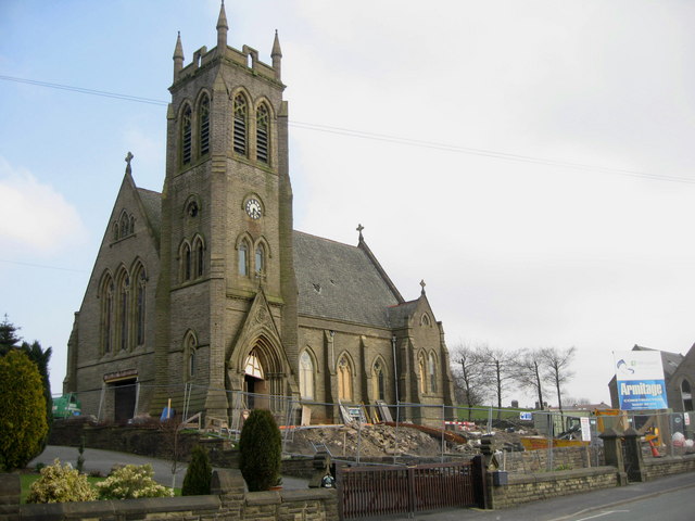
English: Former parish church of St Paul, Scouthead, Saddleworth, Greater Manchester, seen from the southwest |
||
Date | Taken on 31 March 2007 | ||
Source | Sourced from geograph.co.uk | ||
Author | Paul Anderson | ||
Permission (Reusing this file) |
This file is licensed under the Creative Commons Attribution-Share Alike 2.0 Generic license. Attribution: Paul Anderson
|
Camera location | 53° 32′ 56.09″ N, 2° 02′ 46.12″ W | View this and other nearby images on: OpenStreetMap | 53.548915; -2.046145 |
---|
Object location | 53° 32′ 57″ N, 2° 02′ 44″ W | View this and other nearby images on: OpenStreetMap | 53.549230; -2.045500 |
---|
File history
Click on a date/time to view the file as it appeared at that time.
Date/Time | Thumbnail | Dimensions | User | Comment | |
---|---|---|---|---|---|
current | 02:38, 3 July 2008 | 640 × 480 (71 KB) | Jza84 (talk | contribs) | == Summary == {{Information |Description=Former St Paul's Church at Scouthead, Saddleworth, Greater Manchester, England. |Date= Taken 31 March, 2007. |Source=Sourced from [http://www.geograph.org.uk/photo/383491 Geograph.co.uk]. |Author=Paul Anderson |Pe |
You cannot overwrite this file.
File usage on Commons
The following page uses this file:
File usage on other wikis
The following other wikis use this file:
Metadata
This file contains additional information such as Exif metadata which may have been added by the digital camera, scanner, or software program used to create or digitize it. If the file has been modified from its original state, some details such as the timestamp may not fully reflect those of the original file. The timestamp is only as accurate as the clock in the camera, and it may be completely wrong.
Camera manufacturer | Canon |
---|---|
Camera model | Canon DIGITAL IXUS 900Ti |
Exposure time | 1/500 sec (0.002) |
F-number | f/2.8 |
Date and time of data generation | 11:58, 31 March 2007 |
Lens focal length | 7.7 mm |
Orientation | Normal |
Horizontal resolution | 180 dpi |
Vertical resolution | 180 dpi |
File change date and time | 11:58, 31 March 2007 |
Y and C positioning | Centered |
Exif version | 2.2 |
Date and time of digitizing | 11:58, 31 March 2007 |
Meaning of each component |
|
APEX shutter speed | 8.96875 |
APEX aperture | 2.96875 |
APEX exposure bias | 0 |
Flash | Flash did not fire, auto mode |
Supported Flashpix version | 1 |
Color space | sRGB |
Focal plane X resolution | 9,811.8466898955 |
Focal plane Y resolution | 9,823.2558139535 |
Focal plane resolution unit | inches |
File source | Digital still camera |
Custom image processing | Custom process |
Exposure mode | Auto exposure |
White balance | Auto white balance |
Digital zoom ratio | 1 |
Scene capture type | Standard |
Structured data
Items portrayed in this file
depicts
31 March 2007
53°32'56.094"N, 2°2'46.122"W
53°32'57.23"N, 2°2'43.80"W
0.002 second
2.8
7.7 millimetre
Hidden categories:
- CC-BY-SA-2.0
- Images from Geograph Britain and Ireland
- Images from Geograph Britain and Ireland missing SDC depicts
- Images from Geograph Britain and Ireland missing SDC creator
- Images from Geograph Britain and Ireland missing SDC source of file
- Images from Geograph Britain and Ireland missing SDC location of creation
- Images from Geograph Britain and Ireland missing SDC MIME type
- Files with coordinates missing SDC location of creation (53° N, 3° W)
- United Kingdom photographs taken on 2007-03-31