File:Forest cover map (28192734909).jpg

From Wikimedia Commons, the free media repository
Jump to navigation Jump to search

Original file (921 × 531 pixels, file size: 67 KB, MIME type: image/jpeg)

Captions

Captions

Add a one-line explanation of what this file represents

Summary

[edit]
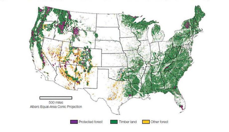
Description Forest area in the U.S. has remained remarkably stable over the last 50 years, and the amount of wood growing on these forests has increased over 20 percent since 1990. Map developed by Forest Service Research & Development.
Date
Source Forest cover map
Author U.S. Department of Agriculture

Licensing

[edit]
Public domain
This image is a work of the Forest Service of the United States Department of Agriculture. As a work of the U.S. federal government, the image is in the public domain.
This image, originally posted to Flickr, was reviewed on 22 February 2018 by the administrator or reviewer ALH, who confirmed that it was available on Flickr under the stated license on that date.

File history

Click on a date/time to view the file as it appeared at that time.

Date/TimeThumbnailDimensionsUserComment
current11:29, 15 February 2018Thumbnail for version as of 11:29, 15 February 2018921 × 531 (67 KB)Junior Jumper (talk | contribs)Transferred from Flickr via Flickr2Commons

There are no pages that use this file.