File:Fonuafoon tonga 1928.jpg
Jump to navigation
Jump to search

Size of this preview: 577 × 600 pixels. Other resolutions: 231 × 240 pixels | 633 × 658 pixels.
Original file (633 × 658 pixels, file size: 98 KB, MIME type: image/jpeg)
Captions
Captions
Add a one-line explanation of what this file represents
Summary
[edit]
| Description |
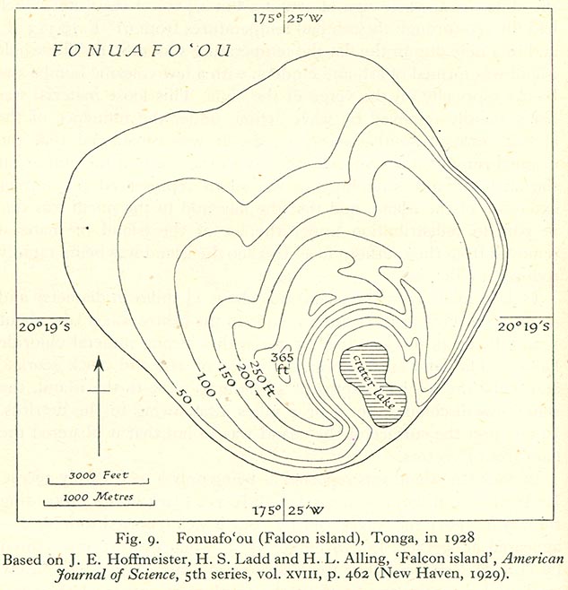
English: 1928 map of Fonuafoʻou Island, a periodically existing island in the west of the Haʻapai Group, Tonga, Pacific Ocean |
| Date | |
| Source | http://www.lib.utexas.edu/maps/historical/pacific_islands_1943_1945/fonuafoon_tonga_1928.jpg |
| Author | Unknown author |
| Permission (Reusing this file) |
"Most of the maps scanned by the University of Texas Libraries and served from this web site are in the public domain. No permissions are needed to copy them. You may download them and use them as you wish. A few maps are copyrighted, and are clearly marked as such." |
Licensing
[edit]
| This work has been released into the public domain by its copyright holder, University of Texas Libraries. This applies worldwide. In some countries this may not be legally possible; if so: University of Texas Libraries grants anyone the right to use this work for any purpose, without any conditions, unless such conditions are required by law.
|
File history
Click on a date/time to view the file as it appeared at that time.
| Date/Time | Thumbnail | Dimensions | User | Comment | |
|---|---|---|---|---|---|
| current | 06:50, 25 June 2010 | | 633 × 658 (98 KB) | Ratzer (talk | contribs) | {{Information |Description={{en|1=x}} |Source=x |Author=x |Date=x |Permission= |other_versions= }} |
You cannot overwrite this file.
File usage on Commons
There are no pages that use this file.
File usage on other wikis
The following other wikis use this file:
- Usage on de.wikipedia.org
- Usage on fr.wikipedia.org
- Usage on to.wikipedia.org
- Usage on uk.wikipedia.org