File:Fonseca gulf (rotated 301.5).jpg
Jump to navigation
Jump to search
No higher resolution available.
Fonseca_gulf_(rotated_301.5).jpg (435 × 472 pixels, file size: 95 KB, MIME type: image/jpeg)
Captions
Captions
Add a one-line explanation of what this file represents
Summary
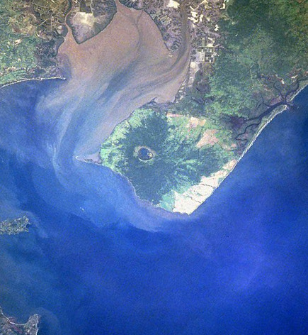
[edit]| Description |
Gulf of Fonseca, El Salvador, Honduras, Nicaragua |
| Date | |
| Source | eol.jsc.nasa.gov |
| Author | NASA |
| Other versions |

.jpg&action=edit§ion=1)
Licensing
[edit].jpg&action=edit§ion=2)
| This file is in the public domain in the United States because it was solely created by NASA. NASA copyright policy states that "NASA material is not protected by copyright unless noted". (See Template:PD-USGov, NASA copyright policy page or JPL Image Use Policy.) | ||
 |
Warnings:
|
File history
Click on a date/time to view the file as it appeared at that time.
| Date/Time | Thumbnail | Dimensions | User | Comment | |
|---|---|---|---|---|---|
| current | 09:40, 22 November 2022 | | 435 × 472 (95 KB) | SteinsplitterBot (talk | contribs) | Bot: Image rotated by 270° |
| 08:35, 22 November 2022 |  | 478 × 435 (96 KB) | Argo Navis (talk | contribs) | File:Fonseca gulf.jpg cropped 24 % horizontally, 32 % vertically, rotated 301.5° using CropTool with precise mode. |
You cannot overwrite this file.
File usage on Commons
The following page uses this file:
Metadata
.jpg&oldid=852493128)
Categories:
- Shrimp farms
- Satellite pictures of Honduras
- Aerial photographs of El Salvador
- 1997 in El Salvador
- Geography of Nicaragua
- Earth photography during STS-94
- 1997 in Central America
- Mangroves in Honduras
- Satellite pictures of Gulf of Fonseca
- Mangroves in Nicaragua
- Sediment plumes
- Satellite pictures of volcanoes
- Conchagüita
- Marine sediment transport
- Conchagua (volcano)