File:Folkestone Harbour - geograph-5200287-by-John-Baker.jpg
Jump to navigation
Jump to search
Size of this preview: 800 × 600 pixels. Other resolutions: 320 × 240 pixels | 640 × 480 pixels | 1,024 × 768 pixels | 1,280 × 960 pixels | 2,560 × 1,920 pixels | 3,264 × 2,448 pixels.
Original file (3,264 × 2,448 pixels, file size: 2.24 MB, MIME type: image/jpeg)
Captions
Captions
Add a one-line explanation of what this file represents
Summary
[edit]
| Description |
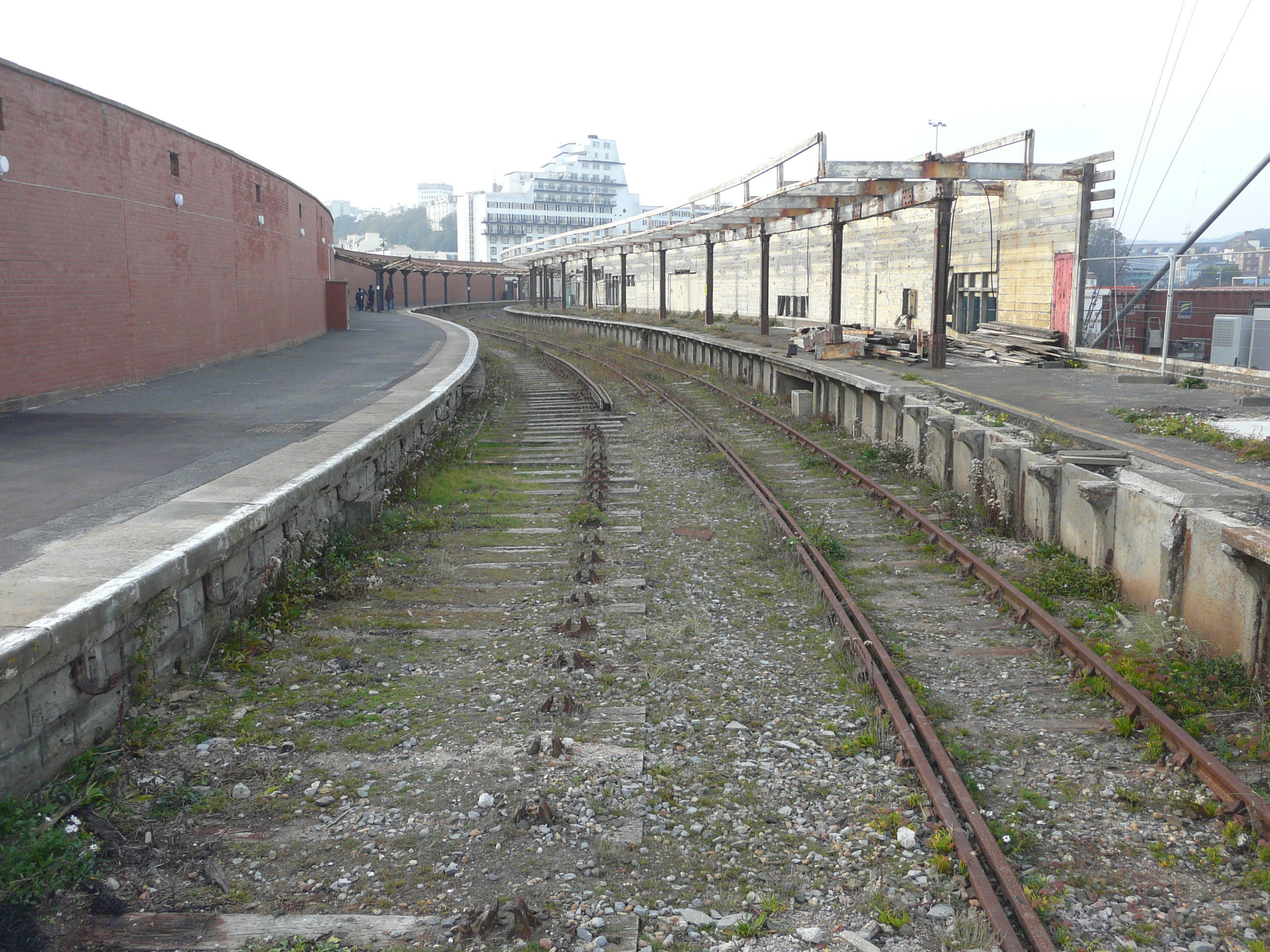
English: Folkestone Harbour station A walkway had been laid, between the platforms, to enable temporary pedestrian access to the Harbour Arm during ongoing work, which is being undertaken by W W Martin. The firm issued a notice on 20 May 2016 that read: Our Special Projects Team have commenced the ‘Link Works - Phase A’ project together with our sister company WWM Civils for our client Folkestone Harbour (GP) Ltd. The works include refurbishments and alterations to afford public access to the former station and platform areas including the level crossing on South Quay, Signal Box, Harbour Masters House, Platforms 1, 2 and 3 and the Upper Harbour Arm. |
| Date | |
| Source | From geograph.org.uk |
| Author | John Baker |
| Permission (Reusing this file) |
Creative Commons Attribution Share-alike license 2.0 |
| Attribution (required by the license) | John Baker / Folkestone Harbour station / |
| Camera location | | View this and other nearby images on: OpenStreetMap |
|---|
_region:GB-GBN_heading:315.00&language=en)
| Object location | | View this and other nearby images on: OpenStreetMap |
|---|
_region:GB-GBN_heading:315.00&language=en)
Licensing
[edit]

|
This image was taken from the Geograph project collection. See this photograph's page on the Geograph website for the photographer's contact details. The copyright on this image is owned by John Baker and is licensed for reuse under the Creative Commons Attribution-ShareAlike 2.0 license.
|
This file is licensed under the Creative Commons Attribution-Share Alike 2.0 Generic license.
Attribution: John Baker
- You are free:
- to share – to copy, distribute and transmit the work
- to remix – to adapt the work
- Under the following conditions:
- attribution – You must give appropriate credit, provide a link to the license, and indicate if changes were made. You may do so in any reasonable manner, but not in any way that suggests the licensor endorses you or your use.
- share alike – If you remix, transform, or build upon the material, you must distribute your contributions under the same or compatible license as the original.
File history
Click on a date/time to view the file as it appeared at that time.
| Date/Time | Thumbnail | Dimensions | User | Comment | |
|---|---|---|---|---|---|
| current | 21:53, 24 November 2020 | | 3,264 × 2,448 (2.24 MB) | Lamberhurst (talk | contribs) | == {{int:filedesc}} == {{Information |Description={{en|1=<b>Folkestone Harbour station</b><br>A walkway had been laid, between the platforms, to enable temporary pedestrian access to the Harbour Arm during ongoing work, which is being undertaken by W W Martin. The firm issued a notice on 20 May 2016 that read: Our Special Projects Team have commenced the ‘Link Works - Phase A’ project together with our sister company WWM Civils for our client Folkestone Harbour (GP) Ltd. The works include ref... |
You cannot overwrite this file.
File usage on Commons
The following page uses this file: