File:Fohr-kort.gif
Jump to navigation
Jump to search

Size of this preview: 800 × 600 pixels. Other resolutions: 320 × 240 pixels | 640 × 480 pixels | 930 × 697 pixels.
Original file (930 × 697 pixels, file size: 163 KB, MIME type: image/gif)
Captions
Captions
Add a one-line explanation of what this file represents
Summary
[edit]
| Description |
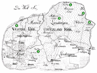
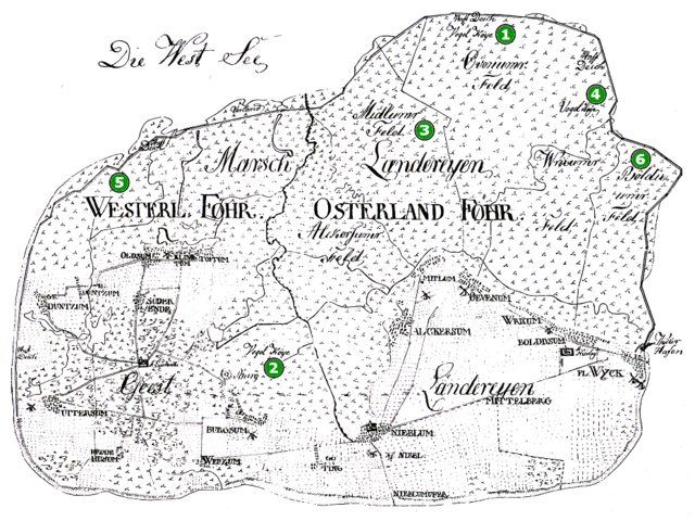
English: map of the North Frisian island of Föhr, Germany, when it was divided between Denmark (west) and the Duchy of Schleswig (east), in or before 1864
|
| Date | before 1864 |
| Source | http://www.aldus.dk/fanoe/fuglekojer/volquardsen.html |
| Author | Unknown author |
Licensing
[edit]
|
This work is in the public domain in its country of origin and other countries and areas where the copyright term is the author's life plus 100 years or fewer. | |
| This file has been identified as being free of known restrictions under copyright law, including all related and neighboring rights. | |
File history
Click on a date/time to view the file as it appeared at that time.
| Date/Time | Thumbnail | Dimensions | User | Comment | |
|---|---|---|---|---|---|
| current | 16:36, 22 December 2012 | | 930 × 697 (163 KB) | Ratzer (talk | contribs) | {{Information |Description ={{en|1=map of the North Frisian island of Föhr, Germany, when it was divided between Denmark (west) and the Duchy of Schleswig (east), in or before 1864}} |Source =http://www.aldus.dk/fanoe/fuglekojer/volquardsen... |
You cannot overwrite this file.
File usage on Commons
There are no pages that use this file.
File usage on other wikis
The following other wikis use this file:
- Usage on da.wikipedia.org
- Usage on de.wikipedia.org
- Usage on frr.wikipedia.org