File:Foel Fenlli from Offa's Dyke Path.jpg
Jump to navigation
Jump to search
No higher resolution available.
Foel_Fenlli_from_Offa's_Dyke_Path.jpg (640 × 480 pixels, file size: 70 KB, MIME type: image/jpeg)
Captions
Captions
Add a one-line explanation of what this file represents
Summary
[edit]
| Description |
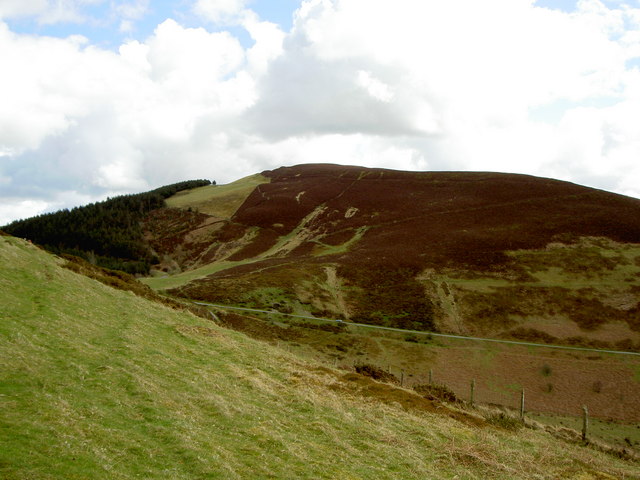
English: Foel Fenlli A view of Foel Fenlli from the Offa's Dyke path. Foel Fenlli is one of many iron-age hill-forts in the area, including nearby Moel y Gaer and Moel Arthur. The footpath erosion that caused the rerouting of Offa's Dyke Path around the summit of Foel Fenlli is visible on the slopes. |
| Date | |
| Source | From geograph.org.uk |
| Author | David Quinn |
| Attribution (required by the license) | David Quinn / Foel Fenlli / |
| Camera location | | View this and other nearby images on: OpenStreetMap |
|---|
Licensing
[edit]

|
This image was taken from the Geograph project collection. See this photograph's page on the Geograph website for the photographer's contact details. The copyright on this image is owned by David Quinn and is licensed for reuse under the Creative Commons Attribution-ShareAlike 2.0 license.
|
This file is licensed under the Creative Commons Attribution-Share Alike 2.0 Generic license.
Attribution: David Quinn
- You are free:
- to share – to copy, distribute and transmit the work
- to remix – to adapt the work
- Under the following conditions:
- attribution – You must give appropriate credit, provide a link to the license, and indicate if changes were made. You may do so in any reasonable manner, but not in any way that suggests the licensor endorses you or your use.
- share alike – If you remix, transform, or build upon the material, you must distribute your contributions under the same or compatible license as the original.
File history
Click on a date/time to view the file as it appeared at that time.
| Date/Time | Thumbnail | Dimensions | User | Comment | |
|---|---|---|---|---|---|
| current | 14:17, 20 October 2009 | | 640 × 480 (70 KB) | Deor (talk | contribs) | {{Information |Description={{en|1=Foel Fenlli in Denbighshire, Wales, viewed from the Offa's Dyke Path}} |Source=http://www.geograph.org.uk/photo/760556 |Author=David Quinn |Date=12 April 2008 |Permission={{cc-by-sa-2.0}} |other_versions= }} |
You cannot overwrite this file.
File usage on Commons
There are no pages that use this file.
File usage on other wikis
The following other wikis use this file:
- Usage on br.wikipedia.org
- Usage on cy.wikipedia.org
- Usage on en.wikipedia.org
- Usage on ga.wikipedia.org
- Usage on nn.wikipedia.org
- Usage on olo.wikipedia.org