File:Florence, MT, USA - 2003-04-08 - Landsat 7 ETM+.png
Jump to navigation
Jump to search
Size of this preview: 800 × 258 pixels. Other resolutions: 320 × 103 pixels | 1,358 × 438 pixels.
Original file (1,358 × 438 pixels, file size: 1.62 MB, MIME type: image/png)
Captions
Captions
Add a one-line explanation of what this file represents
Summary
[edit]
| Description |
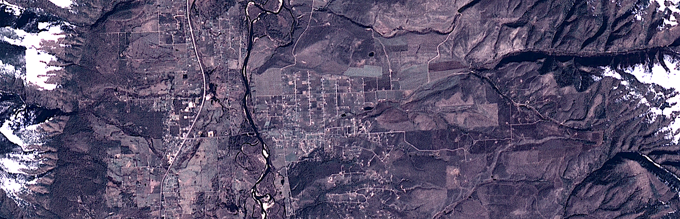
English: Composite "true color" multispectral satellite image of Florence, MT, USA and surrounding area.
NASA Landsat 7 ETM+ bands used were 3 (red), 2 (green), 1 (blue), and the image was pan-sharpened to 15m resolution. Imagery courtesy of NASA/USGS. |
| Date | |
| Source | NASA Landsat satellite image GeoTIFF archive, http://glovis.usgs.gov |
| Author | NASA |
| Camera location | | View this and other nearby images on: OpenStreetMap |
|---|
The town of Florence itself is an extent in about the center-left 50% of the image. The majority of the town's commercial buildings are along Highway 93 (the most prominent road in the image) in a single strip.
I will try to replace this image in the future if I can locate anything that is higher resolution.
Licensing
[edit]
| This file is in the public domain in the United States because it was solely created by NASA. NASA copyright policy states that "NASA material is not protected by copyright unless noted". (See Template:PD-USGov, NASA copyright policy page or JPL Image Use Policy.) | ||
 |
Warnings:
|
File history
Click on a date/time to view the file as it appeared at that time.
| Date/Time | Thumbnail | Dimensions | User | Comment | |
|---|---|---|---|---|---|
| current | 14:07, 24 September 2012 | 1,358 × 438 (1.62 MB) | Разрывные (talk | contribs) | User created page with UploadWizard |
You cannot overwrite this file.
File usage on Commons
There are no pages that use this file.