File:Flooding in the Middle East (MODIS 2024-04-22).jpg

Original file (2,480 × 1,949 pixels, file size: 308 KB, MIME type: image/jpeg)
Captions
Captions
Summary
[edit].jpg&action=edit§ion=1)
| Description |
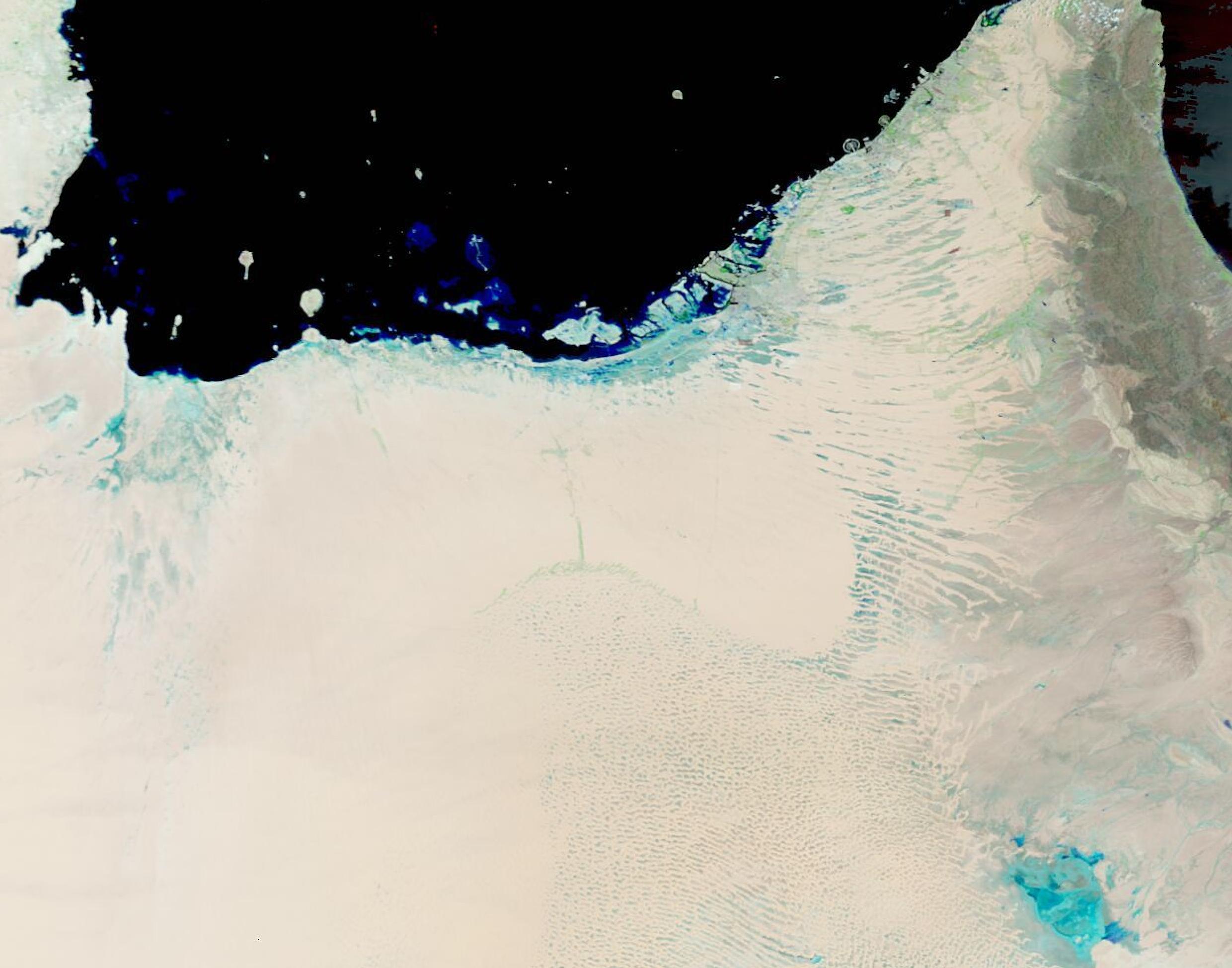
English: April 17, 2024 April 6, 2024
A slow-moving storm system pummeled parts of the Middle East in April 2024. The system first hit northeastern Oman on April 14-15, and continued to batter the United Arab Emirates (UAE) on April 15-16. Michael Mann, a climate scientist at the University of Pennsylvania, told the Associated Press that three low-pressure systems formed a train of storms slowly moving along the jet stream—the river of air that moves weather systems—toward the Persian Gulf. The strong low-pressure system delivered multiple rounds of high winds and heavy rain to the region. The system caused flash flooding, school closures, and other damage in Oman, according to a report published by Global Disaster Alert and Coordination System (GDACS). In addition, at least 17 people died in the Ash Sharqiyah North Governorate from the storms. In the UAE, more than a year’s worth of rain fell on some cities due to the storm, breaking all-time records for rainfall over the 75 years of record-keeping. The rain and wind triggered flash flooding which inundated roads, trapped people in their houses, and disrupted transportation. The UAE’s National Center for Meteorology reported that eastern parts of the country measured up to 250 millimeters (10 inches) of rain in less than 24 hours. UAE, known for its dry desert climate, receives only about 140 to 200 millimeters (5.5 to 8 inches) of rainfall per year. Dubai International Airport recorded 119 millimeters on April 16, which is 1.5 times its typical annual rainfall. The deluge temporarily halted flights at the airport, which is among the world’s busiest for international travel. As of April 18, some of the UAE was working to recover from the flooding, according to news reports. Dubai’s international airport was reportedly still experiencing delays, but some flights had resumed. The Moderate Resolution Imaging Spectroradiometer (MODIS) on NASA’s Aqua satellite acquired a pair of false-color images, one acquired on April 17 and the other on April 6, that show widespread flooding from the storm. In this type of false-color image, deep water (such as the Persian Gulf) appears dark inky-blue, while shallower water looks lighter blue. Vegetation would look green and open land, such as desert, may look light tan or nearly white. In the April 17 image, standing water can be seen across the UAE, including along the Persian Gulf, in the eastern part of the country, and in the northwest section. Some flooding extends into Saudia Arabia (west). Clicking on the April 6 date below the images reveals a more normal spring day in the UAE. In the east, green vegetation is visible, but there is no standing water. |
||
| Date | Taken on 18 April 2024 | ||
| Source |
Flooding in the Middle East (direct link)
|
||
| Author | MODIS Land Rapid Response Team, NASA GSFC |
| This media is a product of the Aqua mission Credit and attribution belongs to the mission team, if not already specified in the "author" row |
Licensing
[edit].jpg&action=edit§ion=2)
| This file is in the public domain in the United States because it was solely created by NASA. NASA copyright policy states that "NASA material is not protected by copyright unless noted". (See Template:PD-USGov, NASA copyright policy page or JPL Image Use Policy.) | ||
 |
Warnings:
|
File history
Click on a date/time to view the file as it appeared at that time.
| Date/Time | Thumbnail | Dimensions | User | Comment | |
|---|---|---|---|---|---|
| current | 05:05, 22 April 2024 | | 2,480 × 1,949 (308 KB) | OptimusPrimeBot (talk | contribs) | #Spacemedia - Upload of http://modis.gsfc.nasa.gov/gallery/images/image04222024_250m.jpg via Commons:Spacemedia |
You cannot overwrite this file.
File usage on Commons
There are no pages that use this file.
.jpg&oldid=870372365)