File:Flag-map of Northern Ireland.svg
Jump to navigation
Jump to search

Size of this PNG preview of this SVG file: 752 × 600 pixels. Other resolutions: 301 × 240 pixels | 602 × 480 pixels | 963 × 768 pixels | 1,280 × 1,021 pixels | 2,560 × 2,042 pixels | 791 × 631 pixels.
Original file (SVG file, nominally 791 × 631 pixels, file size: 118 KB)
Captions
Captions
Add a one-line explanation of what this file represents
Summary
[edit]
| Description |
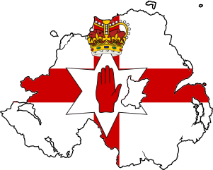
English: Flag-map of Northern Ireland. NOte: The included flag does not currently have official status. |
| Date | |
| Source | Own work |
| Author | Дмитрий-5-Аверин |
Licensing
[edit]
I, the copyright holder of this work, hereby publish it under the following license:
This file is licensed under the Creative Commons Attribution-Share Alike 3.0 Unported license.
- You are free:
- to share – to copy, distribute and transmit the work
- to remix – to adapt the work
- Under the following conditions:
- attribution – You must give appropriate credit, provide a link to the license, and indicate if changes were made. You may do so in any reasonable manner, but not in any way that suggests the licensor endorses you or your use.
- share alike – If you remix, transform, or build upon the material, you must distribute your contributions under the same or compatible license as the original.
File history
Click on a date/time to view the file as it appeared at that time.
| Date/Time | Thumbnail | Dimensions | User | Comment | |
|---|---|---|---|---|---|
| current | 15:19, 1 July 2024 | | 791 × 631 (118 KB) | BroCharacterFan (talk | contribs) | Reverted to version as of 22:51, 13 July 2016 (UTC) |
| 04:53, 13 October 2020 |  | 186 × 149 (3.51 MB) | Inna869 (talk | contribs) | Reverted to version as of 17:44, 18 January 2012 (UTC) | |
| 22:51, 13 July 2016 |  | 791 × 631 (118 KB) | Stasyan117 (talk | contribs) | More correct map and reduce | |
| 16:32, 1 February 2012 |  | 186 × 142 (3.42 MB) | Дмитрий-5-Аверин (talk | contribs) | Обводка | |
| 17:44, 18 January 2012 |  | 186 × 149 (3.51 MB) | Дмитрий-5-Аверин (talk | contribs) | → | |
| 10:33, 17 December 2011 |  | 185 × 149 (3.51 MB) | Дмитрий-5-Аверин (talk | contribs) |
You cannot overwrite this file.
File usage on Commons
The following 2 pages use this file:
File usage on other wikis
The following other wikis use this file:
- Usage on el.wikipedia.org
- Usage on en.wikipedia.org
- User talk:SteveGOLD
- Template:NorthernIreland-geo-stub
- Katesbridge
- Ulster Way
- Dunnamore
- Newbridge, County Londonderry
- Template:User in Ulster British
- Belvoir Park Forest
- Ramore Head
- Agivey Abbey
- Ballinamallard River
- Ess na Larach
- Lough Gullion
- Camowen River
- River Faughan
- Balmoral Park, Lisburn
- User:Tcr25/Userbox/User Northern Ireland Counties Visited
- User:Tcr25/Userbox/User Northern Ireland Counties Visited/doc
- Wikipedia talk:WikiProject Userboxes/New Userboxes/Archive 30
- Loanends
- Usage on es.wikipedia.org
- Usage on kbd.wikipedia.org
- Usage on lt.wikipedia.org
- Usage on mk.wikipedia.org
- Usage on ru.wikipedia.org
- Usage on sr.wikipedia.org
- Usage on www.wikidata.org