File:Fjords 5.81273E 61.84781N.jpg
Jump to navigation
Jump to search
Size of this preview: 442 × 599 pixels. Other resolutions: 177 × 240 pixels | 354 × 480 pixels | 944 × 1,280 pixels.
Original file (944 × 1,280 pixels, file size: 254 KB, MIME type: image/jpeg)
Captions
Captions
Add a one-line explanation of what this file represents
Summary
[edit]
| Description |
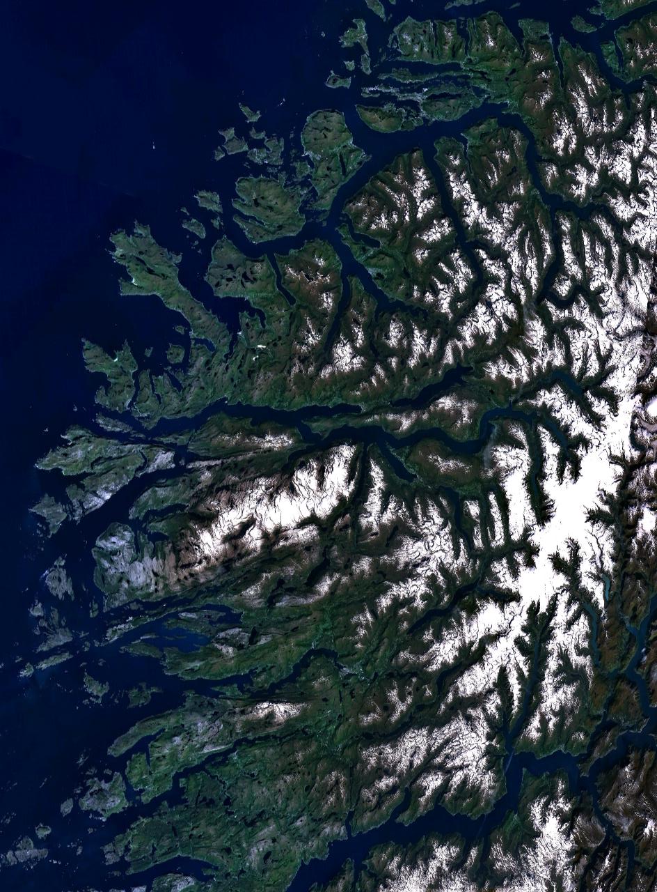
English: NASA World Wind screenshot of fjords in Sogn og Fjordane, Norway. The straight fjord in the middle is Nordfjord. |
| Date | 16 May 2005 (upload date) |
| Source | Screenshot from NASA World Wind software |
| Author | NASA |
| Object location | | View this and other nearby images on: OpenStreetMap |
|---|
Licensing
[edit]
| This image is in the public domain because it is a screenshot from NASA’s globe software World Wind using a public domain layer, such as Blue Marble, MODIS, Landsat, SRTM, USGS or GLOBE.
|
 |
File history
Click on a date/time to view the file as it appeared at that time.
| Date/Time | Thumbnail | Dimensions | User | Comment | |
|---|---|---|---|---|---|
| current | 15:10, 20 January 2012 | | 944 × 1,280 (254 KB) | Rotatebot (talk | contribs) | Bot: Image rotated by 90° |
| 10:21, 16 May 2005 |  | 1,280 × 958 (255 KB) | Rex (talk | contribs) | NASA World Wind screenshot. {{PD-USGov-NASA}} Category:Maps of Norway Cateogry:Fjords |
You cannot overwrite this file.
File usage on Commons
There are no pages that use this file.
File usage on other wikis
The following other wikis use this file:
- Usage on ca.wikipedia.org
- Usage on cs.wikipedia.org
- Usage on es.wikisource.org
- Usage on fi.wikivoyage.org
- Usage on nl.wikipedia.org
- Usage on oc.wikipedia.org
- Usage on pl.wikipedia.org