File:First Powell Expedition 1869 USGS Pioh120.jpg
Jump to navigation
Jump to search
Size of this preview: 479 × 600 pixels. Other resolutions: 192 × 240 pixels | 383 × 480 pixels | 613 × 768 pixels | 817 × 1,024 pixels | 1,635 × 2,048 pixels | 4,356 × 5,456 pixels.
Original file (4,356 × 5,456 pixels, file size: 3.7 MB, MIME type: image/jpeg)
Captions
Captions
Add a one-line explanation of what this file represents
Summary
[edit]
| Description |
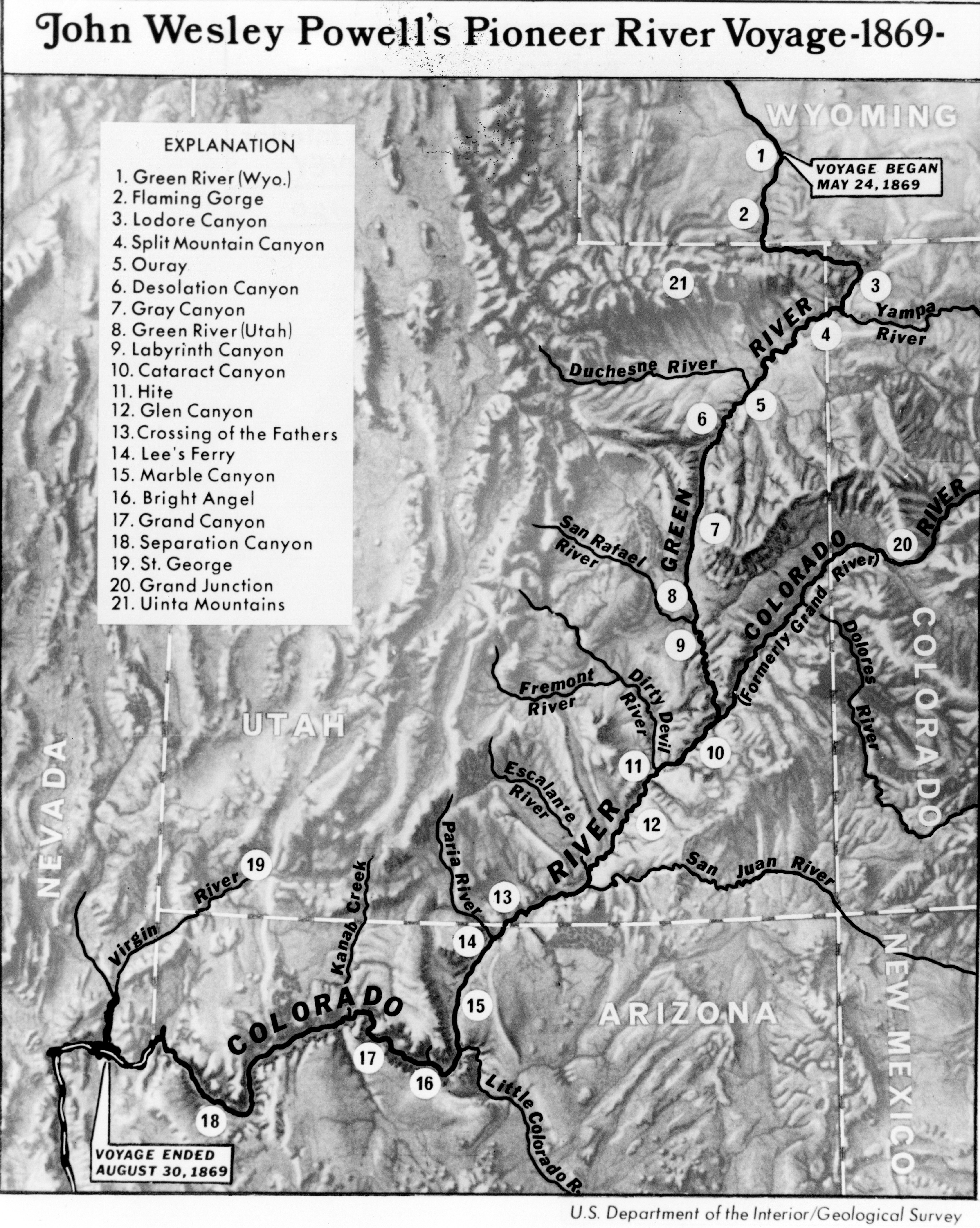
English: First Powell Expedition 1869
Map of John Wesley Powell's Pioneer River Voyage, 1869 Area of map used by Major John Wesley Powell during Colorado River expeditions. Utah. 1869 U.S. Department of the Interior/Geological Survey USGS |
| Date | 19th century |
| Source | https://www.usgs.gov/media/images/map-john-wesley-powells-pioneer-river-voyage |
| Author | John Wesley Powell |
Licensing
[edit]
This image is in the public domain in the United States because it only contains materials that originally came from the United States Geological Survey, an agency of the United States Department of the Interior. For more information, see the official USGS copyright policy.
|
File history
Click on a date/time to view the file as it appeared at that time.
| Date/Time | Thumbnail | Dimensions | User | Comment | |
|---|---|---|---|---|---|
| current | 13:50, 21 March 2022 | | 4,356 × 5,456 (3.7 MB) | Broichmore (talk | contribs) | Uploaded a work by John Wesley Powell from https://www.usgs.gov/media/images/map-john-wesley-powells-pioneer-river-voyage with UploadWizard |
You cannot overwrite this file.
File usage on Commons
There are no pages that use this file.