File:First Map of the Bologna Ptolemy.png
Jump to navigation
Jump to search

Size of this preview: 800 × 463 pixels. Other resolutions: 320 × 185 pixels | 640 × 371 pixels | 1,024 × 593 pixels | 1,280 × 741 pixels | 2,560 × 1,483 pixels | 4,000 × 2,317 pixels.
Original file (4,000 × 2,317 pixels, file size: 7.08 MB, MIME type: image/png)
Captions
Captions
Add a one-line explanation of what this file represents
Summary
[edit]| Description |
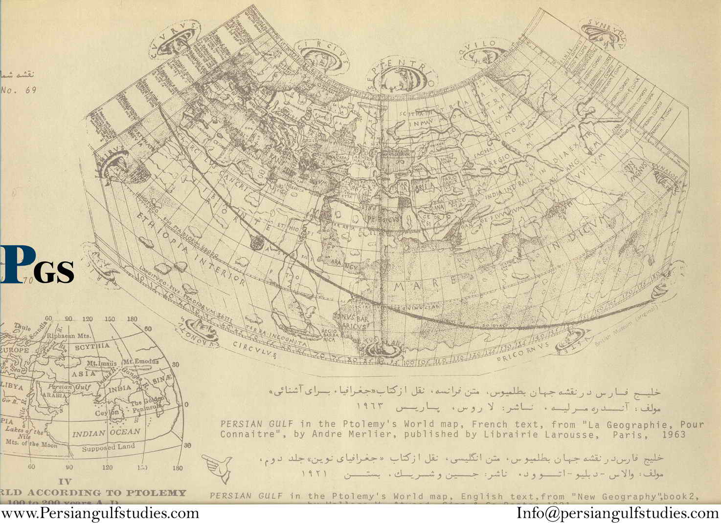
English: The First Map, a world map using Ptolemy's first projection, from the Bologna edition of the Geography. |
| Date | |
| Source | Persian Gulf Studies |
| Author | Ptolemy |
| Other versions |
|


Licensing
[edit]
|
This work is in the public domain in its country of origin and other countries and areas where the copyright term is the author's life plus 70 years or fewer. This work is in the public domain in the United States because it was published (or registered with the U.S. Copyright Office) before January 1, 1929. | |
| This file has been identified as being free of known restrictions under copyright law, including all related and neighboring rights. | |
File history
Click on a date/time to view the file as it appeared at that time.
| Date/Time | Thumbnail | Dimensions | User | Comment | |
|---|---|---|---|---|---|
| current | 23:55, 17 September 2016 | | 4,000 × 2,317 (7.08 MB) | LlywelynII (talk | contribs) | User created page with UploadWizard |
You cannot overwrite this file.
File usage on Commons
The following 4 pages use this file:
File usage on other wikis
The following other wikis use this file:
- Usage on de.wikipedia.org