File:Fires in Oregon (MODIS 2018-09-08).jpg

Original file (2,063 × 1,686 pixels, file size: 455 KB, MIME type: image/jpeg)
Captions
Captions
Summary
[edit].jpg&action=edit§ion=1)
| Description |
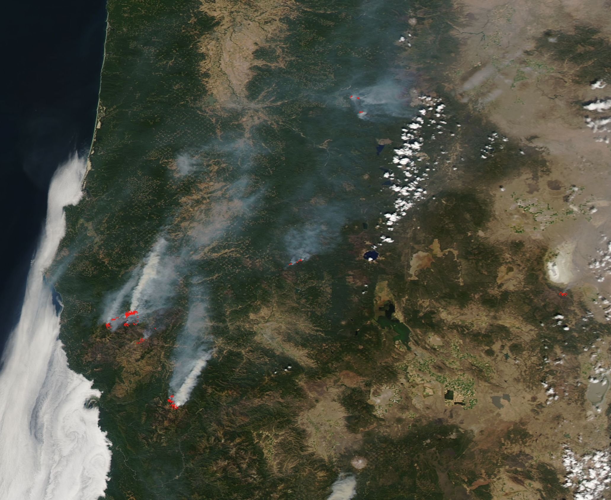
English: On September 5, 2018, the Moderate Resolution Imaging Spectroradiometer (MODIS) on board NASA’s Aqua satellite passed over the Pacific Northwest and acquired a true-color image of multiple fires burning across Oregon. Dry, hot conditions have spurred a strong fire season across the western United States. Although California’s critically intense wildfires have captured most attention, many dozens of fires have blazed across Washington and Oregon as well as other western states.
In this image, each red hot spot marks an area where the thermal bands on the MODIS instrument detected high temperatures. When accompanied by typical smoke, as in this image, such hot spots mark actively burning fire. The most southerly fire appears to be the Natchez Fire, which burns just south of the Oregon/California border between Happy Camp, California and Cave Junction, Oregon. Sparked by lightning on July 15, the flames had consumed 31,361 acres of timber, brush, and hardwood litter. The update from Inciweb on September 7 noted that hot temperatures and low relative humidity are providing active burning conditions and the south end of the fire continues to make uphill runs with short range spotting. All fuel types are burning readily and contributing to active fire. More than 300 personnel are working the fire and it remains only 70% contained. To the northwest, two fires burn closely together: the Klondike Fire and the Taylor Creek Fire. Both fires were ignited by lightning on July 15. As of September 3, the Taylor Creek Fire was considered 95% contained after consuming 52,839 acres. On September 7, the Klondike Fire was only 51% contained and had charred 117,458 acres. |
||
| Date | Taken on 5 September 2018 | ||
| Source |
|
||
| Author | MODIS Land Rapid Response Team, NASA GSFC |
| This media is a product of the Aqua mission Credit and attribution belongs to the mission team, if not already specified in the "author" row |
Licensing
[edit].jpg&action=edit§ion=2)
| This file is in the public domain in the United States because it was solely created by NASA. NASA copyright policy states that "NASA material is not protected by copyright unless noted". (See Template:PD-USGov, NASA copyright policy page or JPL Image Use Policy.) | ||
 |
Warnings:
|
File history
Click on a date/time to view the file as it appeared at that time.
| Date/Time | Thumbnail | Dimensions | User | Comment | |
|---|---|---|---|---|---|
| current | 01:32, 17 February 2024 | | 2,063 × 1,686 (455 KB) | OptimusPrimeBot (talk | contribs) | #Spacemedia - Upload of http://modis.gsfc.nasa.gov/gallery/images/image09082018_250m.jpg via Commons:Spacemedia |
You cannot overwrite this file.
File usage on Commons
There are no pages that use this file.
.jpg&oldid=909382399)