File:Fires in Australia's Northern Territory (MODIS).jpg

Original file (4,724 × 3,450 pixels, file size: 1.26 MB, MIME type: image/jpeg)
Captions
Captions
Summary
[edit].jpg&action=edit§ion=1)
| Description |
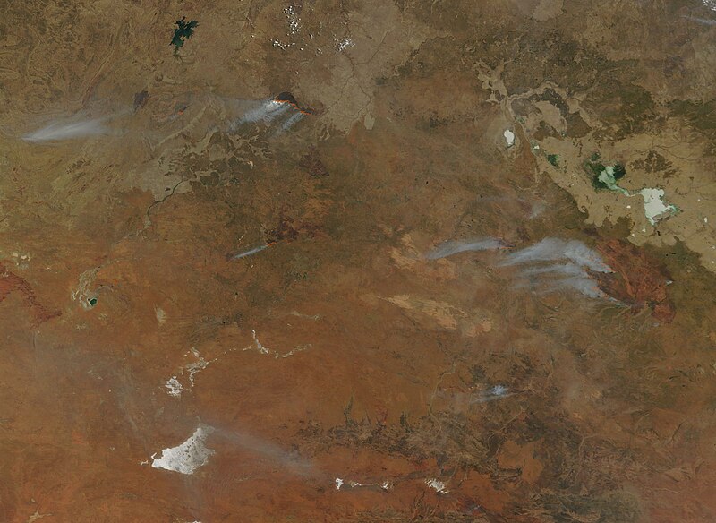
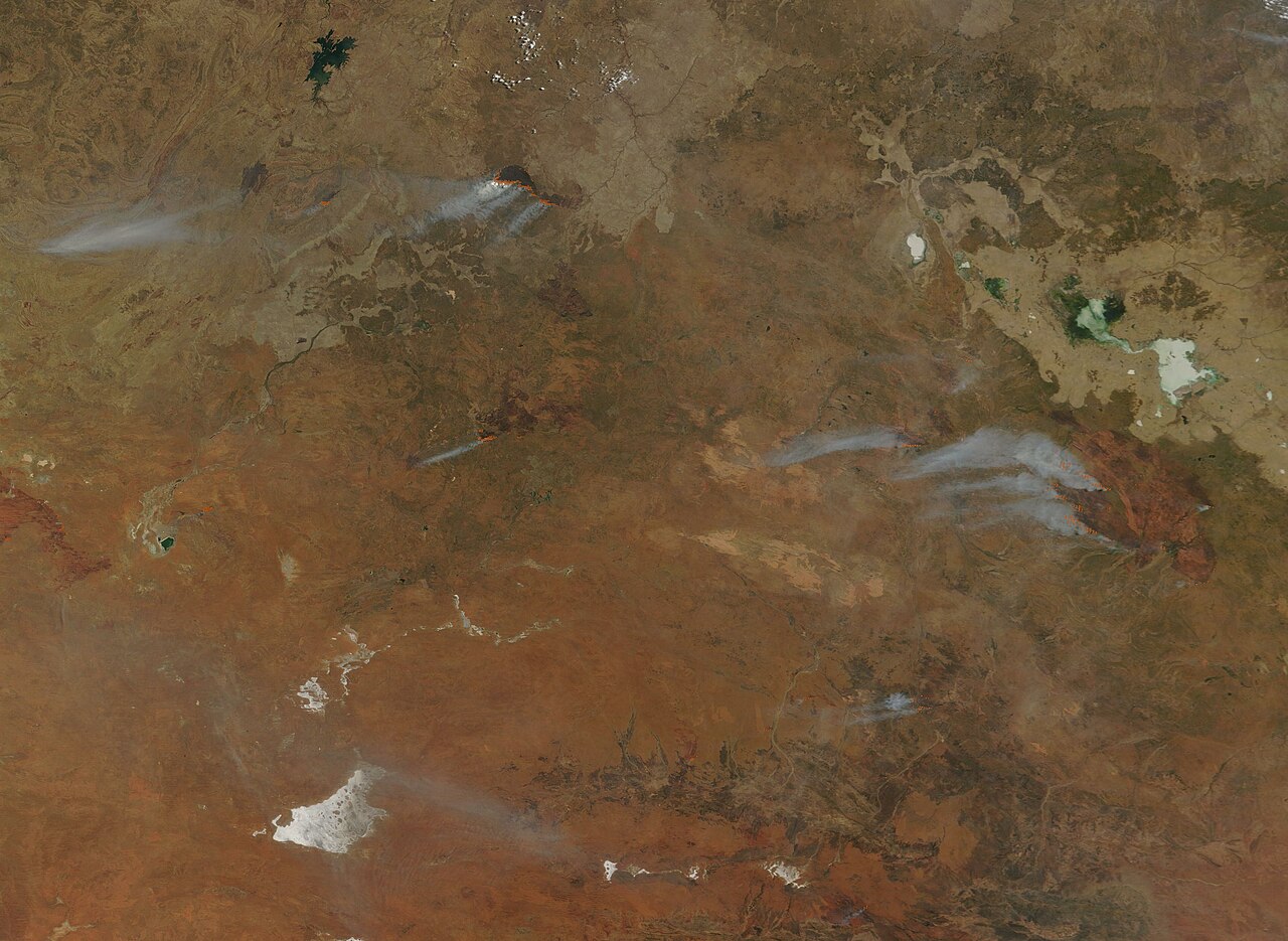
English: On September 13, 2023, the Moderate Resolution Imaging Spectroradiometer (MODIS) on NASA’s Terra satellite acquired a true-color image of numerous bushfires burning across Northern Territory, Australia.
The Barkly Fire, located in the eastern section of this image, began in early September. By September 13 the blaze had expanded to over 2.5 million hectares (9,652 square miles) and was burning only 30 kilometers (18 miles) from the edge of Tennant Creek. Tennant Creek is the seventh-largest town in Northern Territory and located on the Stuart Highway, the main road between Adelaide and Darwin. Heavy fuel loads between the fire and Tennant Creek and gusty winds have increased risk of the fire reaching the outskirts of the town, but a heavy presence of firefighters and equipment, including three large water-bomber aircraft, have been able to slow or stop the movement towards Tennant Creek. Another large fire, seen at the top of the image, is a fire near Buntine Highway. First reported on September 7, this blaze has scorched 139,982 hectares (540 square miles) as of September 14, according to ABC Emergency. Campgrounds and roads remain closed within Gregory National Park due to this fire. |
||
| Date | Taken on 13 September 2023 | ||
| Source |
Fires in Australia's Northern Territory (direct link)
|
||
| Author | MODIS Land Rapid Response Team, NASA GSFC |
| This media is a product of the Terra mission Credit and attribution belongs to the mission team, if not already specified in the "author" row |
Licensing
[edit].jpg&action=edit§ion=2)
| This file is in the public domain in the United States because it was solely created by NASA. NASA copyright policy states that "NASA material is not protected by copyright unless noted". (See Template:PD-USGov, NASA copyright policy page or JPL Image Use Policy.) | ||
 |
Warnings:
|
File history
Click on a date/time to view the file as it appeared at that time.
| Date/Time | Thumbnail | Dimensions | User | Comment | |
|---|---|---|---|---|---|
| current | 05:05, 15 September 2023 | | 4,724 × 3,450 (1.26 MB) | OptimusPrimeBot (talk | contribs) | #Spacemedia - Upload of http://modis.gsfc.nasa.gov/gallery/images/image09152023_250m.jpg via Commons:Spacemedia |
You cannot overwrite this file.
File usage on Commons
There are no pages that use this file.
.jpg&oldid=801790228)