File:Fires at Neah Bay, Washington (MODIS).jpg

Original file (3,433 × 2,600 pixels, file size: 931 KB, MIME type: image/jpeg)
Captions
Captions
Summary
[edit].jpg&action=edit§ion=1)
| Description |
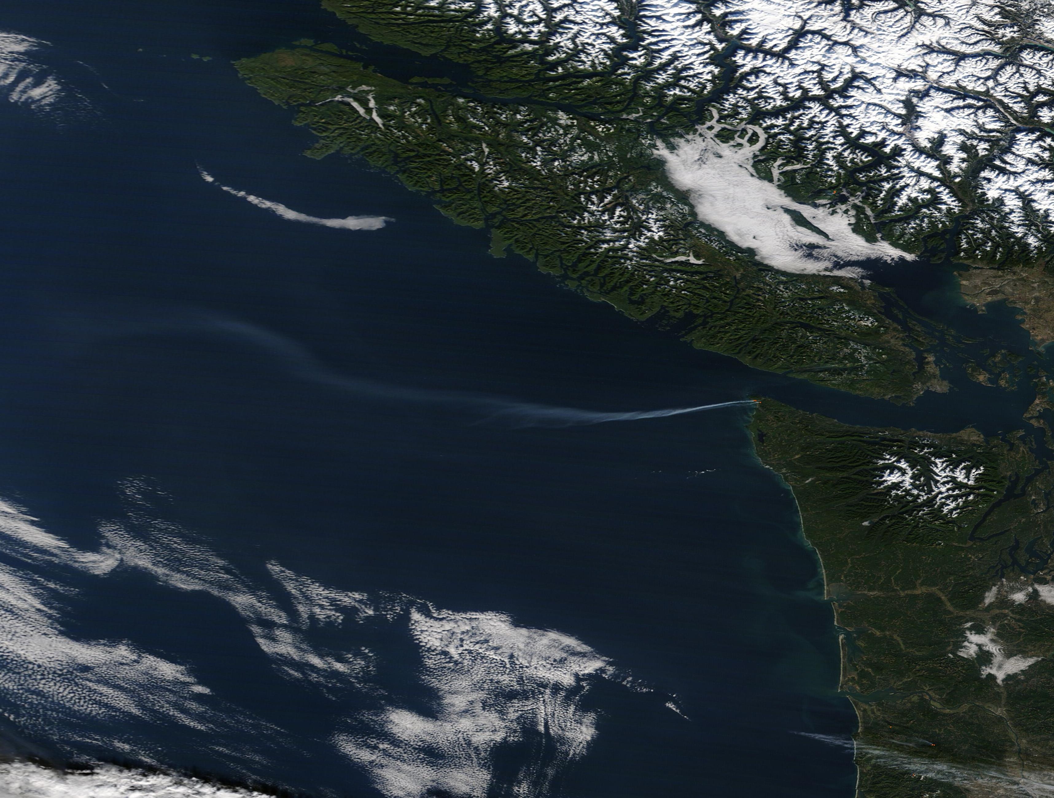
English: In the early morning hours of November 17, 2022, residents living near Hobuck Lake in Neah Bay, Washington reported seeing embers floating on the wind. The smoking ash turned out to be the result of three individual fires that ignited in Neah Bay that morning. Driven by strong winds, the fires quickly burnt more than 140 acres and caused evacuation of about 100 people, according to the Peninsula Daily News. Both the Washington State Department of Natural Resources and the United States Coast Guard responded to aid firefighting.
On November 18, the fires had been sufficiently contained to permit residents to return to their homes. The Cape Fire, which was the largest and the fastest-growing in the outbreak, had burnt 100 acres but had been reduced to 60 acres as of 11:00 a.m. local time. The smallest fire, the Johnny Fire, had been quenched by the time it reached two acres. The first fire discovered, called the Hobuck Lake Fire, initially charged toward a residential area, but ended up burning into nearby wetlands and was quenched. The cause of the fires is not known. On November 18, the Moderate Resolution Imaging Spectroradiometer (MODIS) on board NASA’s Terra satellite acquired a true-color image of the Olympic Peninsula of Washington. Red hot spots mark areas where the thermal bands on the MODIS instrument detected high temperatures and indicate actively burning fire. A long plume of gray smoke rises from the fires and is being carried on strong wind more than 155 miles (250 km) westward over the Pacific Ocean. |
||
| Date | Taken on 17 November 2022 | ||
| Source |
Fires at Neah Bay, Washington (direct link)
|
||
| Author | MODIS Land Rapid Response Team, NASA GSFC |
| This media is a product of the Terra mission Credit and attribution belongs to the mission team, if not already specified in the "author" row |
Licensing
[edit].jpg&action=edit§ion=2)
| This file is in the public domain in the United States because it was solely created by NASA. NASA copyright policy states that "NASA material is not protected by copyright unless noted". (See Template:PD-USGov, NASA copyright policy page or JPL Image Use Policy.) | ||
 |
Warnings:
|
File history
Click on a date/time to view the file as it appeared at that time.
| Date/Time | Thumbnail | Dimensions | User | Comment | |
|---|---|---|---|---|---|
| current | 11:59, 1 September 2023 | | 3,433 × 2,600 (931 KB) | OptimusPrimeBot (talk | contribs) | #Spacemedia - Upload of http://modis.gsfc.nasa.gov/gallery/images/image11192022_250m.jpg via Commons:Spacemedia |
You cannot overwrite this file.
File usage on Commons
There are no pages that use this file.
.jpg&oldid=797535397)