File:Finland motorways.png
Jump to navigation
Jump to search

Size of this preview: 362 × 600 pixels. Other resolutions: 145 × 240 pixels | 289 × 480 pixels | 463 × 768 pixels | 618 × 1,024 pixels | 2,067 × 3,425 pixels.
Original file (2,067 × 3,425 pixels, file size: 169 KB, MIME type: image/png)
Captions
Captions
Add a one-line explanation of what this file represents
Summary
[edit]
| Description |
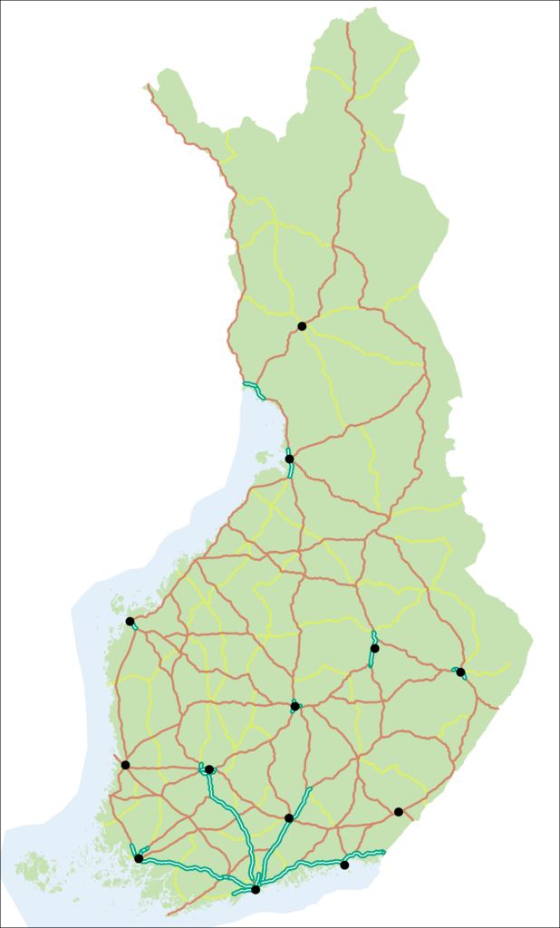
English: Map of motorways in Finland. Motorways (moottoritie) in green, other main roads (numbers 1–29) are red, 2nd class main roads (numbers 40–98) yellow. Black dots show urban agglomerations with more than 50,000 inhabitants.
Suomi: Kartta Suomen moottoriteistä. Moottoritiet on merkitty karttaan vihreallä, muut valtatiet (numerot 1–29) punaisella, kantatiet (numerot 40–98) keltaisella. Yli 50 000 asukkaan taajamat on merkitty mustilla pisteillä. |
| Date | |
| Source | Own work. Contains material by Maanmittauslaitos and Liikennevirasto (CC BY 4.0) |
| Author | Migro |
Licensing
[edit]
| I, the copyright holder of this work, release this work into the public domain. This applies worldwide. In some countries this may not be legally possible; if so: I grant anyone the right to use this work for any purpose, without any conditions, unless such conditions are required by law. |
| Annotations | This image is annotated: View the annotations at Commons |
File history
Click on a date/time to view the file as it appeared at that time.
| Date/Time | Thumbnail | Dimensions | User | Comment | |
|---|---|---|---|---|---|
| current | 19:37, 27 April 2018 | | 2,067 × 3,425 (169 KB) | Migro (talk | contribs) | Updated according to the situation in 2018 |
| 15:57, 13 December 2009 |  | 455 × 800 (115 KB) | Migro (talk | contribs) | {{Information |Description={{en|1=Map of motorways in Finland. Motorways (''moottoritie'') in green, other main roads (numbers 1–29) are red, 2nd class main roads (numbers 40–98) yellow. Black dots show the 12 biggest urban |
You cannot overwrite this file.
File usage on Commons
The following 4 pages use this file:
File usage on other wikis
The following other wikis use this file:
- Usage on en.wikipedia.org
- Usage on fi.wikipedia.org
- Usage on fr.wikipedia.org
- Usage on hu.wikipedia.org
- Usage on sv.wikipedia.org