File:Field near High Milndovan Farm - geograph.org.uk - 1552831.jpg
Field_near_High_Milndovan_Farm_-_geograph.org.uk_-_1552831.jpg (640 × 480 pixels, file size: 116 KB, MIME type: image/jpeg)
Captions
Captions
Summary
[edit]| Description |
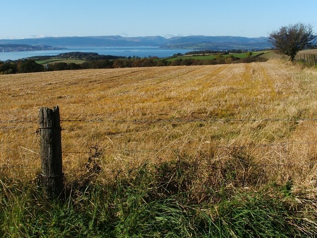
English: Field near High Milndovan Farm. The photo was taken from the section of track that is shown at 1552811; the same field can be seen there, beyond the fence.
In the background, the River Clyde opens up to become the Firth of Clyde. The land jutting in at the left-hand side is the vicinity of Greenock and Gourock, while the Rosneath Peninsula juts in from the right-hand edge to the centre of the photo. A little dark horizontal line that is visible out in the Firth, a little left of centre, is what is locally called the Sugar Boat, the wreck of the Captayannis: https://www.geograph.org.uk/photo/1241371 and http://www.clydesite.co.uk/articles/captayannis.asp A little notch, placed centrally on the distant skyline, marks the presence of 48037, 27km away, flanked by 245468 on the left, and 48041 on its other side. |
| Date | |
| Source | From geograph.org.uk |
| Author | Lairich Rig |
| Attribution (required by the license) | Lairich Rig / Field near High Milndovan Farm / |
| Camera location | | View this and other nearby images on: OpenStreetMap |
|---|
| Object location | | View this and other nearby images on: OpenStreetMap |
|---|
Licensing
[edit]
|
This image was taken from the Geograph project collection. See this photograph's page on the Geograph website for the photographer's contact details. The copyright on this image is owned by Lairich Rig and is licensed for reuse under the Creative Commons Attribution-ShareAlike 2.0 license.
|
- You are free:
- to share – to copy, distribute and transmit the work
- to remix – to adapt the work
- Under the following conditions:
- attribution – You must give appropriate credit, provide a link to the license, and indicate if changes were made. You may do so in any reasonable manner, but not in any way that suggests the licensor endorses you or your use.
- share alike – If you remix, transform, or build upon the material, you must distribute your contributions under the same or compatible license as the original.

_heading:270.00&language=en)
_heading:270.00&language=en)
File history
Click on a date/time to view the file as it appeared at that time.
| Date/Time | Thumbnail | Dimensions | User | Comment | |
|---|---|---|---|---|---|
| current | 13:06, 3 March 2011 | | 640 × 480 (116 KB) | GeographBot (talk | contribs) | == {{int:filedesc}} == {{Information |description={{en|1=Field near High Milndovan Farm The photo was taken from the section of track that is shown at 1552811; the same field can be seen there, beyond the fence. In the background, the River Clyde o |
You cannot overwrite this file.
File usage on Commons
There are no pages that use this file.