File:Fief du Sault-au-Matelot.jpg
Jump to navigation
Jump to search

Size of this preview: 578 × 600 pixels. Other resolutions: 231 × 240 pixels | 463 × 480 pixels | 740 × 768 pixels | 987 × 1,024 pixels | 1,974 × 2,048 pixels | 4,443 × 4,609 pixels.
Original file (4,443 × 4,609 pixels, file size: 4.77 MB, MIME type: image/jpeg)
Captions
Captions
Add a one-line explanation of what this file represents
Summary
[edit]
| Description |
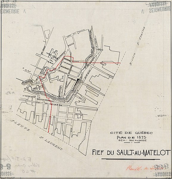
Français : Cité de Québec. Plan de 1875. Fief du Sault-au-Matelot Sur ce plan d'une partie de la ville de Québec figurent le fief du Sault-au-Matelot et celui de la Miséricorde, la localisation du fleuve Saint-Laurent et de la rivière Saint-Charles, les rues, les quais, le relief et les bâtiments. À noter l'ajout à la main d'une ligne rouge délimitant le fief du Sault-au-Matelot |
| Date | |
| Source | https://numerique.banq.qc.ca/patrimoine/details/52327/4274822 |
| Author | BAnQ Québec - Fonds Ministère des Terres et Forêts , |
Licensing
[edit]
|
This work is in the public domain in its country of origin and other countries and areas where the copyright term is the author's life plus 70 years or fewer. This work is in the public domain in the United States because it was published (or registered with the U.S. Copyright Office) before January 1, 1929. | |
| This file has been identified as being free of known restrictions under copyright law, including all related and neighboring rights. | |
File history
Click on a date/time to view the file as it appeared at that time.
| Date/Time | Thumbnail | Dimensions | User | Comment | |
|---|---|---|---|---|---|
| current | 01:49, 17 April 2023 | | 4,443 × 4,609 (4.77 MB) | Jeangagnon (talk | contribs) | Uploaded a work by BAnQ Québec - Fonds Ministère des Terres et Forêts , from https://numerique.banq.qc.ca/patrimoine/details/52327/4274822 with UploadWizard |
You cannot overwrite this file.
File usage on Commons
There are no pages that use this file.
File usage on other wikis
The following other wikis use this file:
- Usage on fr.wikipedia.org
- Usage on www.wikidata.org