File:Fiddlers Lake.jpg
Jump to navigation
Jump to search
Size of this preview: 800 × 229 pixels. Other resolutions: 320 × 92 pixels | 640 × 183 pixels | 1,024 × 293 pixels | 1,280 × 366 pixels | 4,509 × 1,291 pixels.
Original file (4,509 × 1,291 pixels, file size: 682 KB, MIME type: image/jpeg)
Captions
Captions
Add a one-line explanation of what this file represents
Summary
[edit]
| Description |
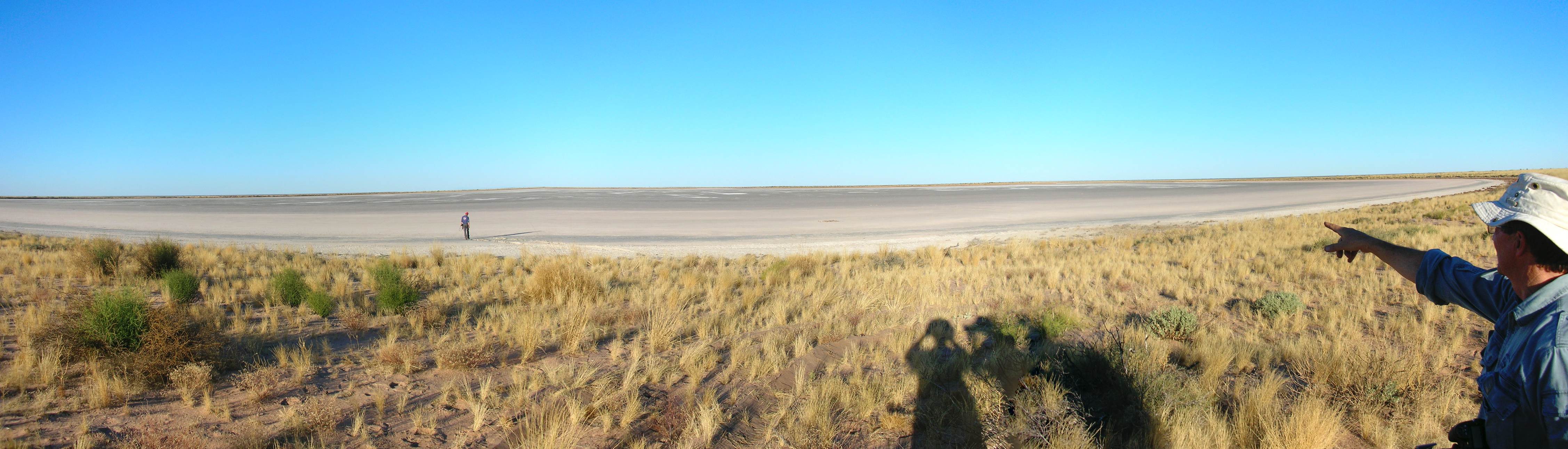
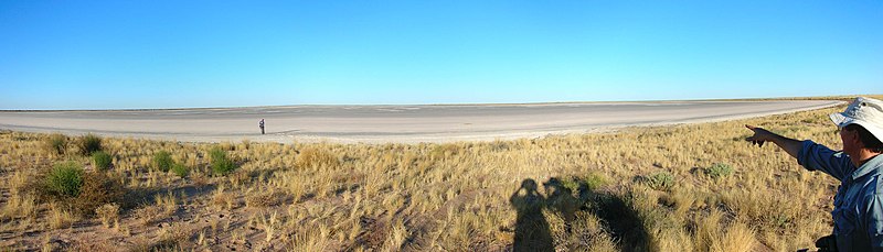
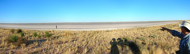
English: Looking south over Fiddlers Lake in the Southern Tanami Indigenous Protected Area. During an excursion on the day of the dedication of the Southern Tanami Indigenous Protected Area. Camera file name DSCN4774-DSCN4776. |
| Date | 10 July 2012, 17:50:59 |
| Source | Own work |
| Author | David Nash |
| Camera location | | View this and other nearby images on: OpenStreetMap |
|---|
Licensing
[edit]
I, the copyright holder of this work, hereby publish it under the following license:
This file is licensed under the Creative Commons Attribution-Share Alike 4.0 International license.
- You are free:
- to share – to copy, distribute and transmit the work
- to remix – to adapt the work
- Under the following conditions:
- attribution – You must give appropriate credit, provide a link to the license, and indicate if changes were made. You may do so in any reasonable manner, but not in any way that suggests the licensor endorses you or your use.
- share alike – If you remix, transform, or build upon the material, you must distribute your contributions under the same or compatible license as the original.
This image was uploaded as part of Wiki Loves Earth 2016.
|
 |
File history
Click on a date/time to view the file as it appeared at that time.
| Date/Time | Thumbnail | Dimensions | User | Comment | |
|---|---|---|---|---|---|
| current | 10:28, 27 May 2016 | 4,509 × 1,291 (682 KB) | DJungarrayi (talk | contribs) | User created page with UploadWizard |
You cannot overwrite this file.
File usage on Commons
There are no pages that use this file.