File:Fenit Harbour Pier - geograph.org.uk - 257040.jpg
Jump to navigation
Jump to search
No higher resolution available.
Fenit_Harbour_Pier_-_geograph.org.uk_-_257040.jpg (640 × 480 pixels, file size: 66 KB, MIME type: image/jpeg)
Captions
Captions
Add a one-line explanation of what this file represents
Summary
[edit]
| Description |
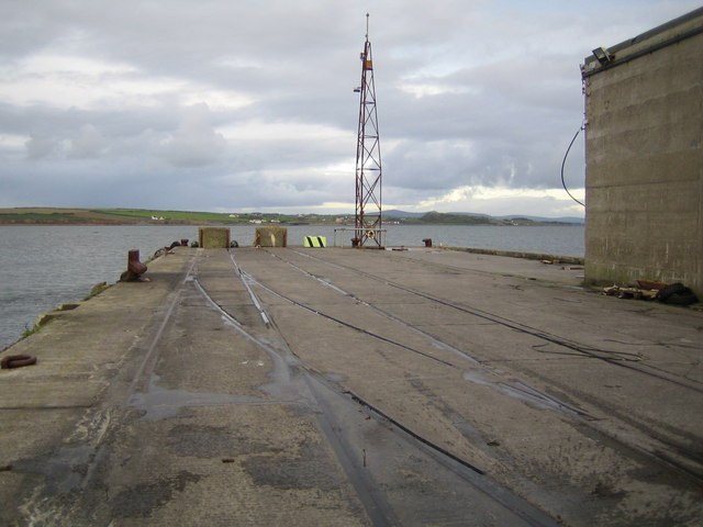
English: Fenit Harbour Pier The buffers at the end of the pier probably represent the very westernmost end of the former mainline railway system that radiated out from Dublin. The operating railway line has now been cut back to Tralee, but the tracks to Fenit from Tralee are still partially in place along the route including those on the quayside here in Fenit. The small gantry tower has a navigation light at its top. |
| Date | |
| Source | From geograph.org.uk |
| Author | Nigel Cox |
| Attribution (required by the license) | Nigel Cox / Fenit Harbour Pier / |
| Camera location | | View this and other nearby images on: OpenStreetMap |
|---|
_heading:67.00&language=en)
| Object location | | View this and other nearby images on: OpenStreetMap |
|---|
_heading:67.00&language=en)
Licensing
[edit]

|
This image was taken from the Geograph project collection. See this photograph's page on the Geograph website for the photographer's contact details. The copyright on this image is owned by Nigel Cox and is licensed for reuse under the Creative Commons Attribution-ShareAlike 2.0 license.
|
This file is licensed under the Creative Commons Attribution-Share Alike 2.0 Generic license.
Attribution: Nigel Cox
- You are free:
- to share – to copy, distribute and transmit the work
- to remix – to adapt the work
- Under the following conditions:
- attribution – You must give appropriate credit, provide a link to the license, and indicate if changes were made. You may do so in any reasonable manner, but not in any way that suggests the licensor endorses you or your use.
- share alike – If you remix, transform, or build upon the material, you must distribute your contributions under the same or compatible license as the original.
File history
Click on a date/time to view the file as it appeared at that time.
| Date/Time | Thumbnail | Dimensions | User | Comment | |
|---|---|---|---|---|---|
| current | 16:58, 25 August 2010 | | 640 × 480 (66 KB) | GeographBot (talk | contribs) | == {{int:filedesc}} == {{Information |description={{en|1=Fenit Harbour Pier The buffers at the end of the pier probably represent the very westernmost end of the former mainline railway system that radiated out from Dublin. The operating railway line has |
You cannot overwrite this file.
File usage on Commons
There are no pages that use this file.