File:Farm Track in Cwm-Llinau - geograph.org.uk - 1093960.jpg
Farm_Track_in_Cwm-Llinau_-_geograph.org.uk_-_1093960.jpg (640 × 480 pixels, file size: 292 KB, MIME type: image/jpeg)
Captions
Captions
Summary
[edit]
| Description |
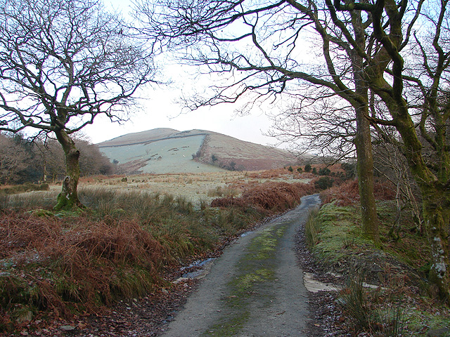
English: Farm Track in Cwm-Llinau. For my walk this week, I chose one of complete contrast to the one described previously (see 1083502) . For a long time now, I've been eyeing a block of 'virgin' squares in the vicinity of Cwm-Llinau, about 9 miles north-east of Machynlleth and beside the main A470 road. Unfortunately, the bus service to the area is not very frequent, so this time I had to use the car to get there. I parked at the end of the public road from Cwm-Llinau at GR SH856081, where there is room for one car on the verge.
The circular route that I took is about seven miles on tracks and public bridleways/footpaths, climbing about 1000', initially beside Afon Llinau, then through the upland bog and forestry area at Waun Llinau, emerging onto the ridge at Mynydd y Cemais (now a windfarm). My descent from Mynydd y Cemais was down a track on the steep scarp to Talyrnau farm and thence back to my start point. If taking this walk, there are a few things to be aware of. The route through the bog at Waun Llinau is nicely waymarked, but even so, a lack of concentration can lead you to the wrong side of it, with the need to retrace your steps, or navigate across it (as I had to!). Also, the marked paths on Mynydd y Cemais are now pretty meaningless as they appear to have been subsumed into the windfarm track network. Another point to note, the farm area at Talyrnau is not walker friendly. There is no waymarking (that I could see), most gates on the right of way are permanently roped shut and one stile has barbed wire set across it. Overall, a very enjoyable walk with some nice winter sunshine with frost on the ground all day (and a bitter east wind blowing across Mynydd y Cemais) and with some magnificent scenery. Navigational skills were tested and it was certainly an excellent way to blow away the Christmas cobwebs. |
| Date | |
| Source | From geograph.org.uk |
| Author | OLU |
| Camera location | | View this and other nearby images on: OpenStreetMap |
|---|
_heading:22.00&language=en)
| Object location | | View this and other nearby images on: OpenStreetMap |
|---|
_heading:22.00&language=en)
Licensing
[edit]

|
This image was taken from the Geograph project collection. See this photograph's page on the Geograph website for the photographer's contact details. The copyright on this image is owned by OLU and is licensed for reuse under the Creative Commons Attribution-ShareAlike 2.0 license.
|
- You are free:
- to share – to copy, distribute and transmit the work
- to remix – to adapt the work
- Under the following conditions:
- attribution – You must give appropriate credit, provide a link to the license, and indicate if changes were made. You may do so in any reasonable manner, but not in any way that suggests the licensor endorses you or your use.
- share alike – If you remix, transform, or build upon the material, you must distribute your contributions under the same or compatible license as the original.
File history
Click on a date/time to view the file as it appeared at that time.
| Date/Time | Thumbnail | Dimensions | User | Comment | |
|---|---|---|---|---|---|
| current | 14:04, 24 February 2011 | | 640 × 480 (292 KB) | GeographBot (talk | contribs) | == {{int:filedesc}} == {{Information |description={{en|1=Farm Track in Cwm-Llinau For my walk this week, I chose one of complete contrast to the one described previously (see 1083502) . For a long time now, I've been eyeing a block of 'virgin' squares |
You cannot overwrite this file.
File usage on Commons
There are no pages that use this file.