File:Fannette Island, Emerald Bay, Tahoe 8-10 (15782675874).jpg
Jump to navigation
Jump to search
Size of this preview: 657 × 599 pixels. Other resolutions: 263 × 240 pixels | 526 × 480 pixels | 842 × 768 pixels | 1,123 × 1,024 pixels | 2,450 × 2,235 pixels.
Original file (2,450 × 2,235 pixels, file size: 1.91 MB, MIME type: image/jpeg)
Captions
Captions
Add a one-line explanation of what this file represents
Summary
[edit].jpg&action=edit§ion=1)
| Description |
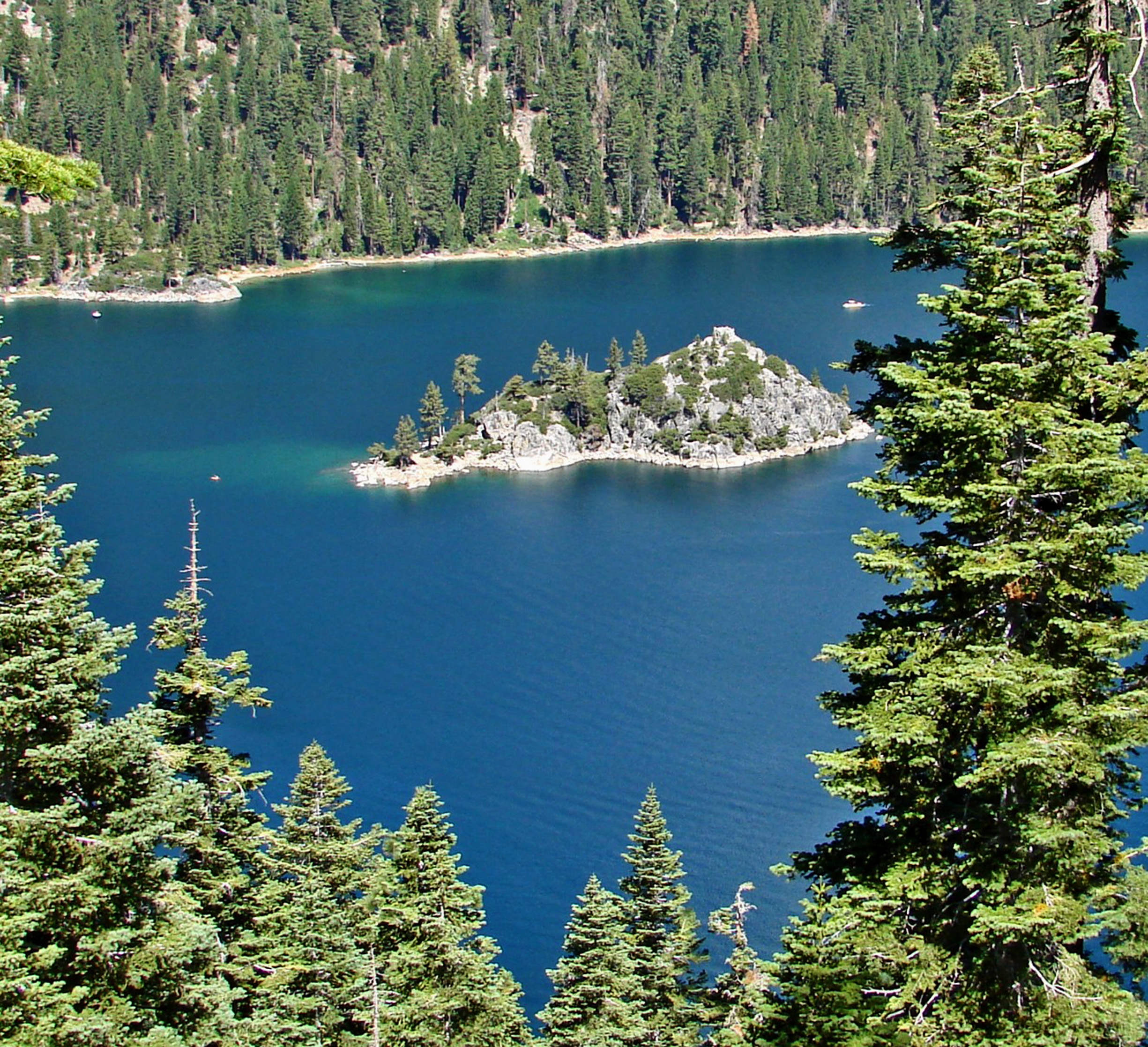
English: (1 in a multiple picture album) At one time a wealthy family owned the stone mansion, called Vikingsholm, that sits on the west side of Emerald Bay (just out of the shot to the left). To add icing to their cake, they built a little stone 'Tea Room' on top of Fannette Island and they would boat their guests out there for afternoon refreshments. (Zoom in to spot it.) It's nice to be rich. |
| Date | |
| Source | https://www.flickr.com/photos/23155134@N06/15782675874/ |
| Author | inkknife_2000 (7.5 million views +) |
| Permission (Reusing this file) |
At the time of upload, the image license was automatically confirmed using the Flickr API. For more information see Flickr API detail. |
| Flickr sets |
|
| Flickr pools |
|
| Flickr tags |
|
| Camera location | | View this and other nearby images on: OpenStreetMap |
|---|
.jpg¶ms=038.937887_N_-120.032626_E_globe:Earth_type:camera__&language=en)
Licensing
[edit].jpg&action=edit§ion=2)
This file is licensed under the Creative Commons Attribution-Share Alike 2.0 Generic license.
- You are free:
- to share – to copy, distribute and transmit the work
- to remix – to adapt the work
- Under the following conditions:
- attribution – You must give appropriate credit, provide a link to the license, and indicate if changes were made. You may do so in any reasonable manner, but not in any way that suggests the licensor endorses you or your use.
- share alike – If you remix, transform, or build upon the material, you must distribute your contributions under the same or compatible license as the original.
| This image was originally posted to Flickr by inkknife_2000 (7.5 million views +) at https://flickr.com/photos/23155134@N06/15782675874. It was reviewed on 29 March 2017 by FlickreviewR and was confirmed to be licensed under the terms of the cc-by-sa-2.0. |
File history
Click on a date/time to view the file as it appeared at that time.
| Date/Time | Thumbnail | Dimensions | User | Comment | |
|---|---|---|---|---|---|
| current | 19:52, 29 March 2017 | | 2,450 × 2,235 (1.91 MB) | Fæ (talk | contribs) | Don Graham, Set 72157626751241978, ID 15782675874, Original title Fannette Island, Emerald Bay, Tahoe 8-10 |
You cannot overwrite this file.
File usage on Commons
There are no pages that use this file.
.jpg&oldid=890669625)