File:Falsgrave Road - geograph.org.uk - 787897.jpg
Original file (3,464 × 2,165 pixels, file size: 3.86 MB, MIME type: image/jpeg)
Captions
Captions
Summary
[edit]
| Description |
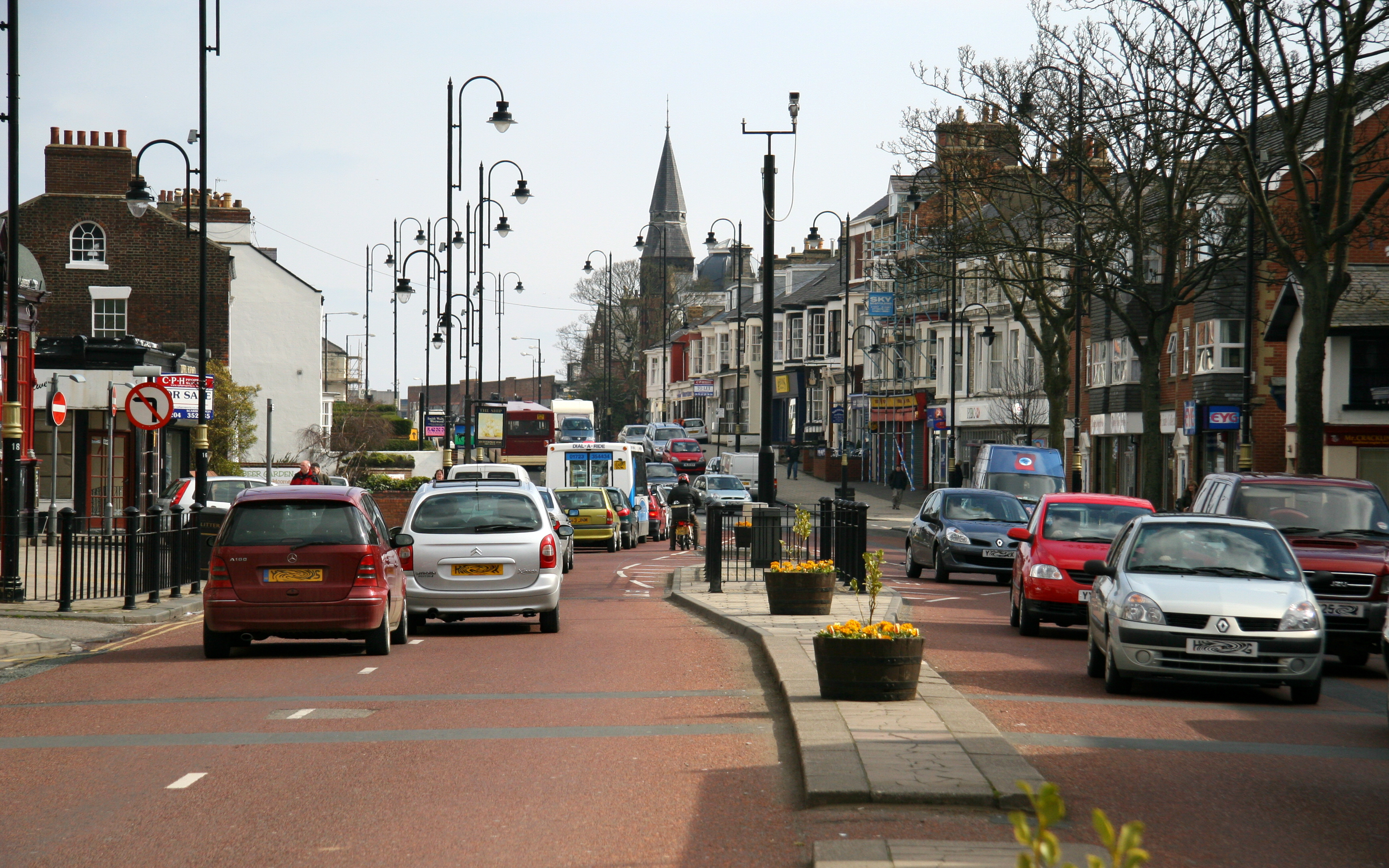
English: Falsgrave Road. This east north-easterly facing photograph was taken from the pedestrian reservation on Falsgrave Road between its junction with 789970 (ahead, left, by the no-entry sign) and 787424 (behind the viewpoint, right).
On the far right of the picture there is a low white and red building, the apex of the roof of which faces the road. By the side of this building is the entrance to an alleyway, which, in the 1950's and 1960's was known locally as 800967. To see a closer view of the entrance to the alleyway, taken from a few metres ahead of the viewpoint, click here 789427. For another photograph of Falsgrave Road, taken from approximately the same viewpoint but facing the opposite direction, click here 787839. Road name information from OS Maps at:- Elgin, http://www.elgin.gov.uk/ |
| Date | |
| Source | From geograph.org.uk |
| Author | Alan Walker |
| Attribution (required by the license) | Alan Walker / Falsgrave Road / |
| Camera location | | View this and other nearby images on: OpenStreetMap |
|---|
_heading:67.00&language=en)
| Object location | | View this and other nearby images on: OpenStreetMap |
|---|
_heading:67.00&language=en)
Licensing
[edit]

|
This image was taken from the Geograph project collection. See this photograph's page on the Geograph website for the photographer's contact details. The copyright on this image is owned by Alan Walker and is licensed for reuse under the Creative Commons Attribution-ShareAlike 2.0 license.
|
- You are free:
- to share – to copy, distribute and transmit the work
- to remix – to adapt the work
- Under the following conditions:
- attribution – You must give appropriate credit, provide a link to the license, and indicate if changes were made. You may do so in any reasonable manner, but not in any way that suggests the licensor endorses you or your use.
- share alike – If you remix, transform, or build upon the material, you must distribute your contributions under the same or compatible license as the original.
File history
Click on a date/time to view the file as it appeared at that time.
| Date/Time | Thumbnail | Dimensions | User | Comment | |
|---|---|---|---|---|---|
| current | 19:00, 31 August 2017 | | 3,464 × 2,165 (3.86 MB) | Geograph Update Bot (talk | contribs) | Higher-resolution version from Geograph. |
| 01:12, 20 February 2011 |  | 640 × 400 (80 KB) | GeographBot (talk | contribs) | == {{int:filedesc}} == {{Information |description={{en|1=Falsgrave Road This east north-easterly facing photograph was taken from the pedestrian reservation on Falsgrave Road between its junction with 789970 (ahead, left, by the no-entry sign) and [[7 |
You cannot overwrite this file.
File usage on Commons
There are no pages that use this file.