File:Falkland Islands topographic map-hr.svg
Jump to navigation
Jump to search

Size of this PNG preview of this SVG file: 768 × 599 pixels. Other resolutions: 308 × 240 pixels | 615 × 480 pixels | 984 × 768 pixels | 1,280 × 999 pixels | 2,560 × 1,998 pixels | 2,550 × 1,990 pixels.
Original file (SVG file, nominally 2,550 × 1,990 pixels, file size: 1.93 MB)
Captions
Captions
Add a one-line explanation of what this file represents
This SVG map uses required raster graphics to show delicate structures.
Summary
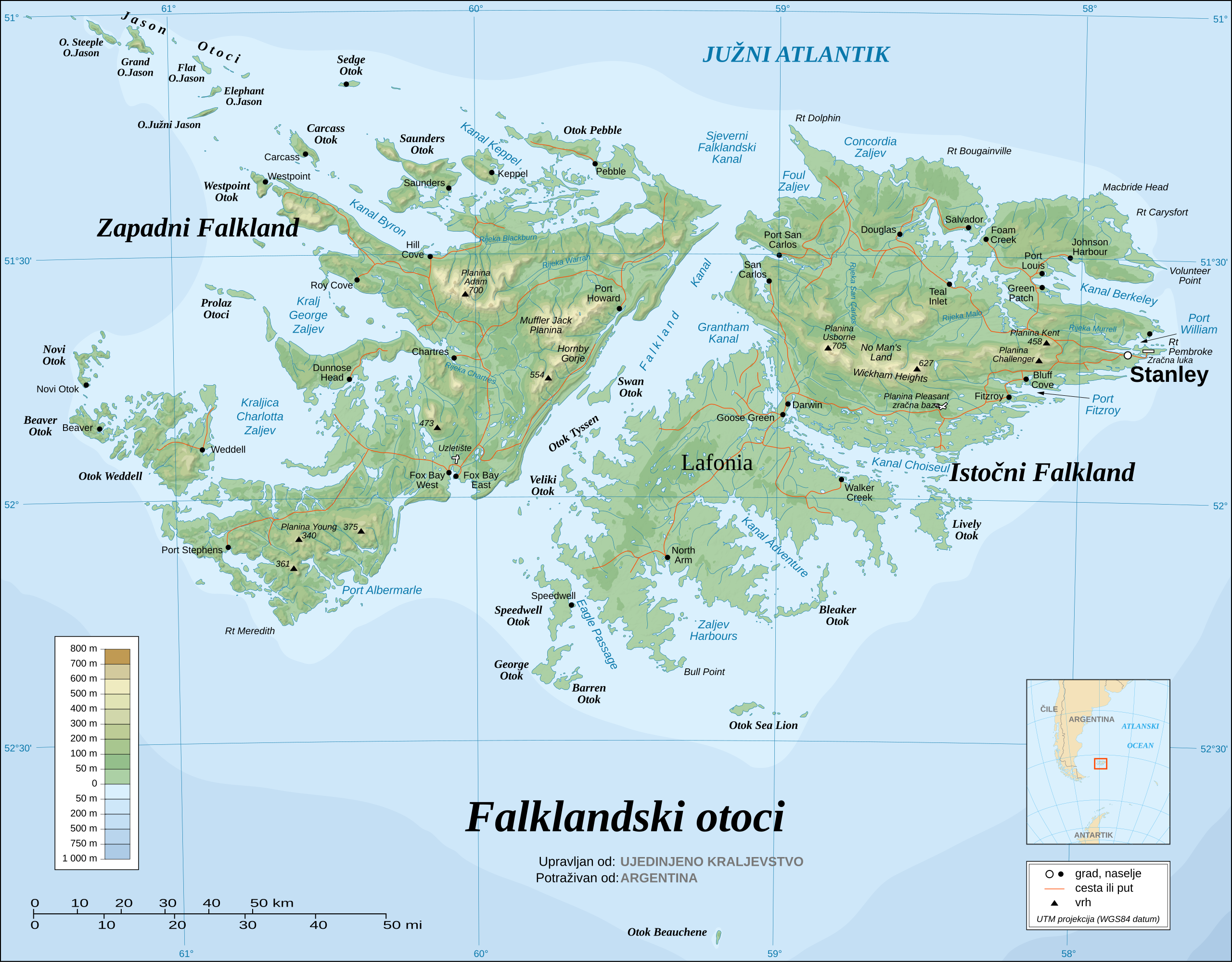
[edit]| Description | Map of the Falkland Islands. Croatian-language version. |
| Date | |
| Source | Falkland Islands topographic map-en.svg |
| Author | Vitek |
| Other versions |
|


.svg)


Licensing
[edit]
This file is licensed under the Creative Commons Attribution-Share Alike 3.0 Unported license.
- You are free:
- to share – to copy, distribute and transmit the work
- to remix – to adapt the work
- Under the following conditions:
- attribution – You must give appropriate credit, provide a link to the license, and indicate if changes were made. You may do so in any reasonable manner, but not in any way that suggests the licensor endorses you or your use.
- share alike – If you remix, transform, or build upon the material, you must distribute your contributions under the same or compatible license as the original.
File history
Click on a date/time to view the file as it appeared at that time.
| Date/Time | Thumbnail | Dimensions | User | Comment | |
|---|---|---|---|---|---|
| current | 20:22, 19 December 2008 | | 2,550 × 1,990 (1.93 MB) | Vitek (talk | contribs) | {{Information |Description=Just Croatian translation |Source=Falkland Islands topographic map-en.svg |Date=19.12.2008. |Author=Vitek |Permission=free |other_versions=Image:Falkland Islands topographic map-de.svg|Deutsch Image:Falkland Islands topographic |
You cannot overwrite this file.
File usage on Commons
The following 23 pages use this file:
- File:Falkland Islands map shaded relief-en.svg
- File:Falkland Islands map shaded relief-fr.svg
- File:Falkland Islands topographic map-ca.svg
- File:Falkland Islands topographic map-da.svg
- File:Falkland Islands topographic map-de.svg
- File:Falkland Islands topographic map-en.svg
- File:Falkland Islands topographic map-en librsvg.png
- File:Falkland Islands topographic map-en rendersvg.png
- File:Falkland Islands topographic map-es.svg
- File:Falkland Islands topographic map-es (argentinian names places).svg
- File:Falkland Islands topographic map-fr.svg
- File:Falkland Islands topographic map-it.svg
- File:Falkland Islands topographic map-ka.svg
- File:Falkland Islands topographic map-mk.svg
- File:Falkland Islands topographic map-nb.svg
- File:Falkland Islands topographic map-nl.svg
- File:Falkland Islands topographic map-nn.svg
- File:Falkland Islands topographic map-pl.svg
- File:Falkland Islands topographic map-pt (argentinian names places).svg
- File:Falkland Islands topographic map-ru.svg
- File:Falkland Islands topographic map-sr.svg
- File:Falkland Islands topographic map-zh-hans.svg
- Template:Other versions/Falkland Islands topographic map
.svg)
File usage on other wikis
The following other wikis use this file:
- Usage on hr.wikipedia.org