File:Factory water tower, Selyemgyár Street, 2020 Sárvár.jpg

Original file (1,704 × 2,272 pixels, file size: 966 KB, MIME type: image/jpeg)
Captions
Captions
Summary
[edit]
| Description |
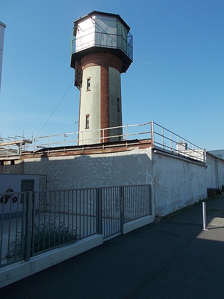
English: : Former rayon factory water tower. Now Sága Foods site. - Selyemgyár Street, Sárvár, Vas County, Hungary.
Magyar: : Volt selyemgyári víztorony. Most részben? Sága Foods Rt. telep (1917–1925 tojáskereskedés, 1925–1942 poultry and game processing 1942–1989 Sárvár Poultry Processing Company, 1989 –1992 Glatter GmbH acquires a stake, since 2003 owned by Bernard Matthews Group UK, Boparan Holdings, since 2020 owned by Master Good Group/ Bárány family). A műselyemgyárat 1904-ben építették fel, 1927-ben megszűntették. 2. vh után itt a Baromfifeldolgozó Vállalat kezdte el működését. azonosító: +01144 ill. 13430 helyrajzi szám: 3185/4 - Vas megye, Sárvár, Selyemgyár utca
|
||
| Date | |||
| Source | Own work | ||
| Author | Globetrotter19 |
| Object location | | View this and other nearby images on: OpenStreetMap |
|---|
| Camera location | | View this and other nearby images on: OpenStreetMap |
|---|
Licensing
[edit]
- You are free:
- to share – to copy, distribute and transmit the work
- to remix – to adapt the work
- Under the following conditions:
- attribution – You must give appropriate credit, provide a link to the license, and indicate if changes were made. You may do so in any reasonable manner, but not in any way that suggests the licensor endorses you or your use.
- share alike – If you remix, transform, or build upon the material, you must distribute your contributions under the same or compatible license as the original.
File history
Click on a date/time to view the file as it appeared at that time.
| Date/Time | Thumbnail | Dimensions | User | Comment | |
|---|---|---|---|---|---|
| current | 22:15, 19 October 2020 | | 1,704 × 2,272 (966 KB) | Globetrotter19 (talk | contribs) | Uploaded own work with UploadWizard |
You cannot overwrite this file.
File usage on Commons
There are no pages that use this file.
File usage on other wikis
The following other wikis use this file:
- Usage on cs.wikipedia.org
Metadata
This file contains additional information such as Exif metadata which may have been added by the digital camera, scanner, or software program used to create or digitize it. If the file has been modified from its original state, some details such as the timestamp may not fully reflect those of the original file. The timestamp is only as accurate as the clock in the camera, and it may be completely wrong.
| Exposure time | 1/160 sec (0.00625) | ||||||||||
|---|---|---|---|---|---|---|---|---|---|---|---|
| F-number | f/8 | ||||||||||
| Lens focal length | 4.6 mm | ||||||||||
| Short title |
| ||||||||||
| Orientation | Normal | ||||||||||
| Horizontal resolution | 300 dpi | ||||||||||
| Vertical resolution | 300 dpi | ||||||||||
| File change date and time | 09:26, 7 August 2021 | ||||||||||
| Y and C positioning | Co-sited | ||||||||||
| Meaning of each component |
| ||||||||||
| Image compression mode | 2 | ||||||||||
| APEX exposure bias | 0 | ||||||||||
| Maximum land aperture | 3.4 APEX (f/3.25) | ||||||||||
| Supported Flashpix version | 1 | ||||||||||
| Color space | sRGB | ||||||||||
| File source | Digital still camera | ||||||||||
| Scene type | A directly photographed image | ||||||||||
| Custom image processing | Normal process | ||||||||||
| Exposure mode | Auto exposure | ||||||||||
| Digital zoom ratio | 0 | ||||||||||
| Scene capture type | Standard | ||||||||||
| Scene control | None | ||||||||||
| Subject distance range | Unknown |