File:FOA20943.jpeg
Jump to navigation
Jump to search
Size of this preview: 800 × 521 pixels. Other resolutions: 320 × 208 pixels | 640 × 416 pixels | 1,024 × 666 pixels | 1,280 × 833 pixels | 1,741 × 1,133 pixels.
Original file (1,741 × 1,133 pixels, file size: 377 KB, MIME type: image/jpeg)
Captions
Captions
Add a one-line explanation of what this file represents
Summary
[edit]
| Photographer |
Unknown author |
|||
| Description |
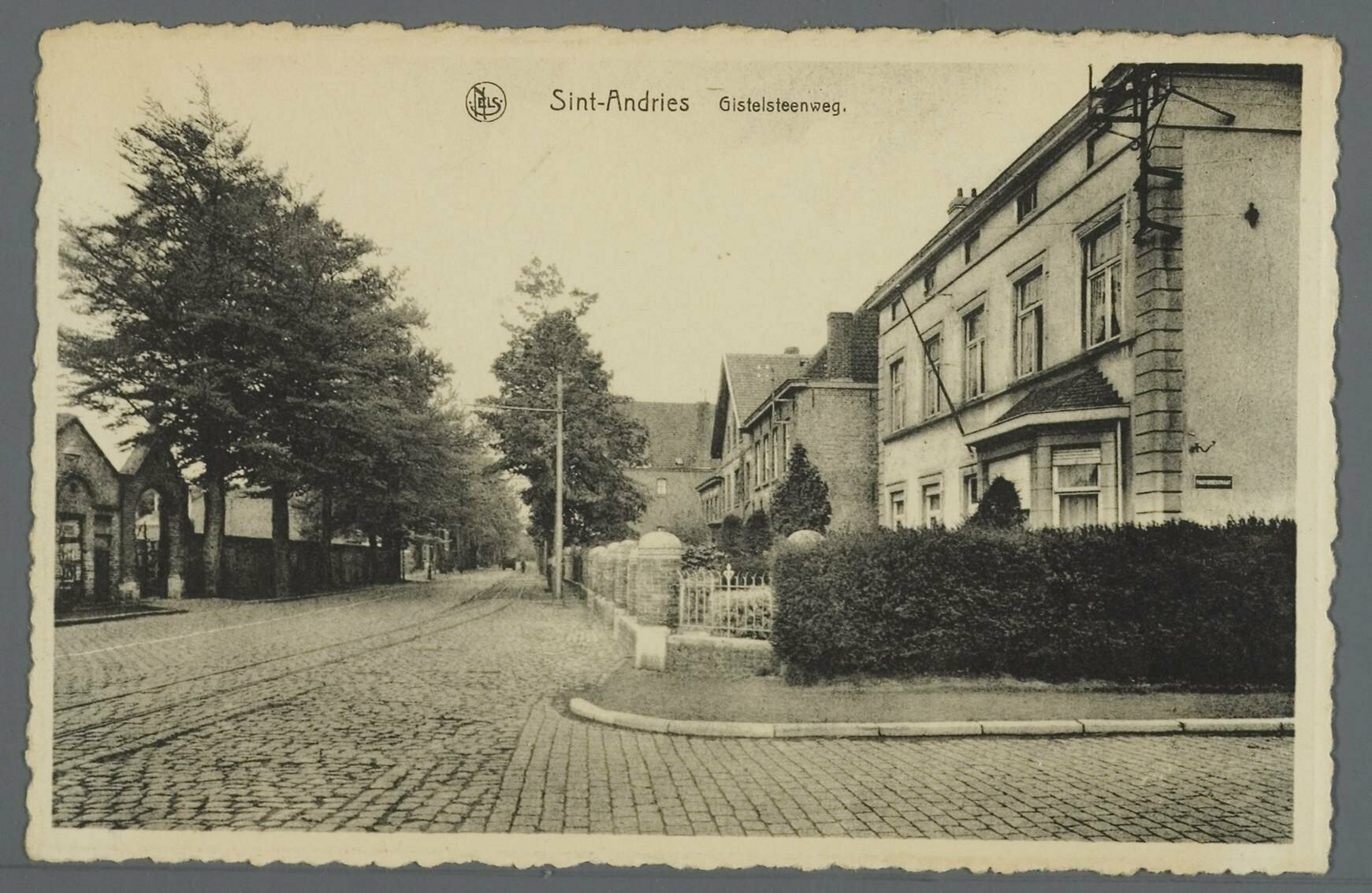
Nederlands: De Gistelse Steenweg situeert zich links op deze opname. We bemerken er de ingang van het kerkhof. Rechts op de voorgrond zien we een huis, gelegen op de hoek van de Gistelse Steenweg en de Pastoriestraat. In dit huis is de pastorie gevestigd. Let even op het straatnaambord op de zijgevel. |
|||
| Date | between 1913 and 1915 | |||
| Source | Stadsarchief Brugge via zoeken.erfgoedbrugge.be Inventarisnummer FO/A20943 | |||
| Permission (Reusing this file) |
|
| Camera location | | View this and other nearby images on: OpenStreetMap |
|---|
Licensing
[edit]
This image (or other media file) is in the public domain because its copyright has expired and its author is anonymous.
This applies to the European Union and those countries with a copyright term of 70 years after the work was made available to the public and the author never disclosed their identity. Important: Always mention where the image comes from, as far as possible, and make sure the author never claimed authorship. Note: In Germany and possibly other countries, certain anonymous works published before July 1, 1995 are copyrighted until 70 years after the death of the author. See Übergangsrecht. Please use this template only if the author never claimed authorship or their authorship never became public in any other way. If the work is anonymous or pseudonymous (e.g., published only under a corporate or organization's name), use this template for images published more than 70 years ago.
For a work made available to the public in the United Kingdom, please use Template:PD-UK-unknown instead.
|
| Annotations | This image is annotated: View the annotations at Commons |
File history
Click on a date/time to view the file as it appeared at that time.
| Date/Time | Thumbnail | Dimensions | User | Comment | |
|---|---|---|---|---|---|
| current | 08:00, 1 August 2023 | | 1,741 × 1,133 (377 KB) | PostcardsBelgium (talk | contribs) | == {{int:filedesc}} == {{Photograph |photographer ={{unknown|author}} |publisher = |title = |description ={{nl|De Gistelse Steenweg situeert zich links op deze opname. We bemerken er de ingang van het kerkhof. Rechts op de voorgrond zien we een huis, gelegen op de hoek van de Gistelse Steenweg en de Pastoriestraat. In dit huis is de pastorie gevestigd. Let even op het straatnaambord op de zijgevel.}} |depicted people = |depicted place = |date... |
You cannot overwrite this file.
File usage on Commons
The following page uses this file: