File:FMIB 40207 Woods Hole Harbor and Vicinity (Based on U S Coast and Geodetic Survey chart no348).jpeg
Jump to navigation
Jump to search
Size of this preview: 800 × 566 pixels. Other resolutions: 320 × 226 pixels | 640 × 453 pixels | 1,024 × 725 pixels | 1,280 × 906 pixels | 1,669 × 1,181 pixels.
Original file (1,669 × 1,181 pixels, file size: 263 KB, MIME type: image/jpeg)
Captions
Captions
Add a one-line explanation of what this file represents
Summary
[edit].jpeg&action=edit§ion=1)
| Author |
English: Raymond C . Osburn
|
||||||||||||||||||||||||||||||||
| Description |
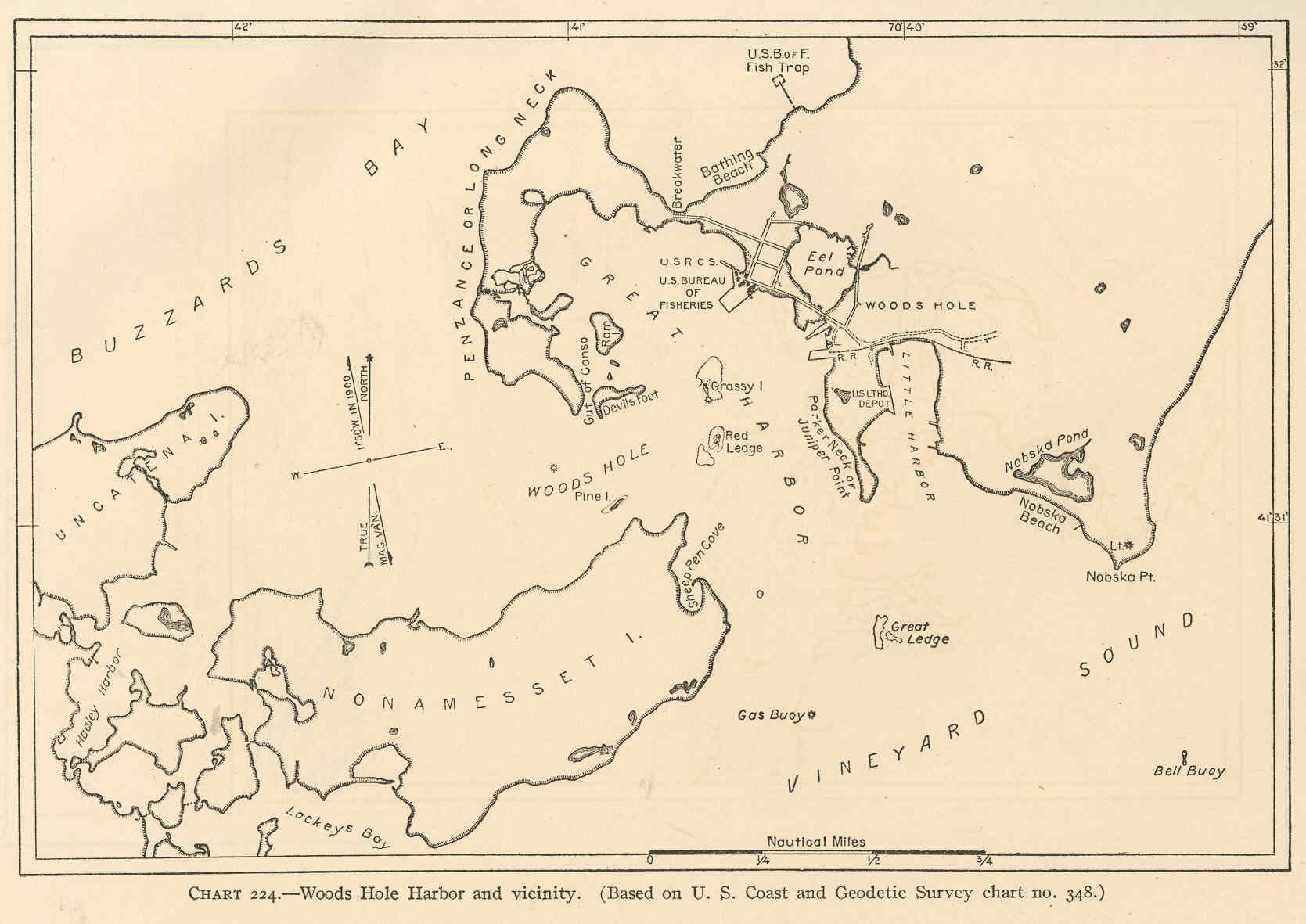
English: Woods Hole Harbor and Vicinity. (Based on U. S. Coast and Geodetic Survey chart no.348)
|
||||||||||||||||||||||||||||||||
| Date | 1913 | ||||||||||||||||||||||||||||||||
| Collection |
|
||||||||||||||||||||||||||||||||
| Current location |
English: Freshwater and Marine Image Bank |
||||||||||||||||||||||||||||||||
| Accession number | |||||||||||||||||||||||||||||||||
| Source/Photographer |
English: Sumner, Francis B .; Osburn, Raymond C .; Cole, Leon J. (1913) Biological Survey of the Waters of Woods Hole and Vicinity: Section I--Physical and theoretical, Bulletin of the Bureau of Fisheries, vol.31, 1911, Washington, DC: Government Printing Office |
||||||||||||||||||||||||||||||||
| Permission (Reusing this file) |
|
||||||||||||||||||||||||||||||||
File history
Click on a date/time to view the file as it appeared at that time.
| Date/Time | Thumbnail | Dimensions | User | Comment | |
|---|---|---|---|---|---|
| current | 08:39, 19 September 2015 | | 1,669 × 1,181 (263 KB) | BMacZeroBot (talk | contribs) |
You cannot overwrite this file.
File usage on Commons
The following page uses this file:
.jpeg)
.jpeg&oldid=699423882)