File:Fábrica de manteiga .jpg

Original file (3,024 × 4,032 pixels, file size: 4.26 MB, MIME type: image/jpeg)
Captions
Captions
Summary
[edit]
| Description |
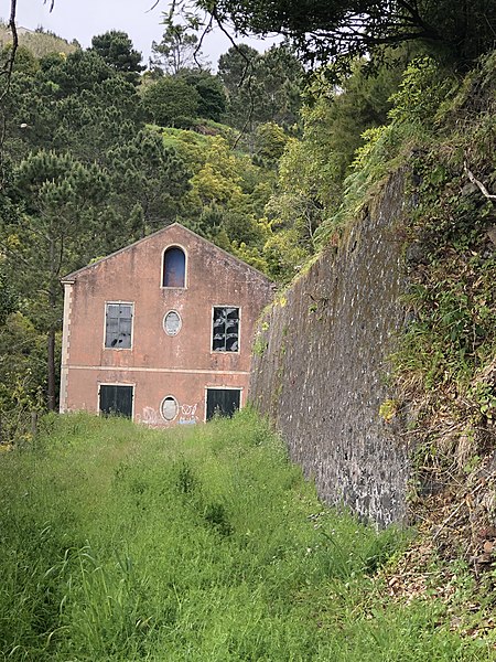
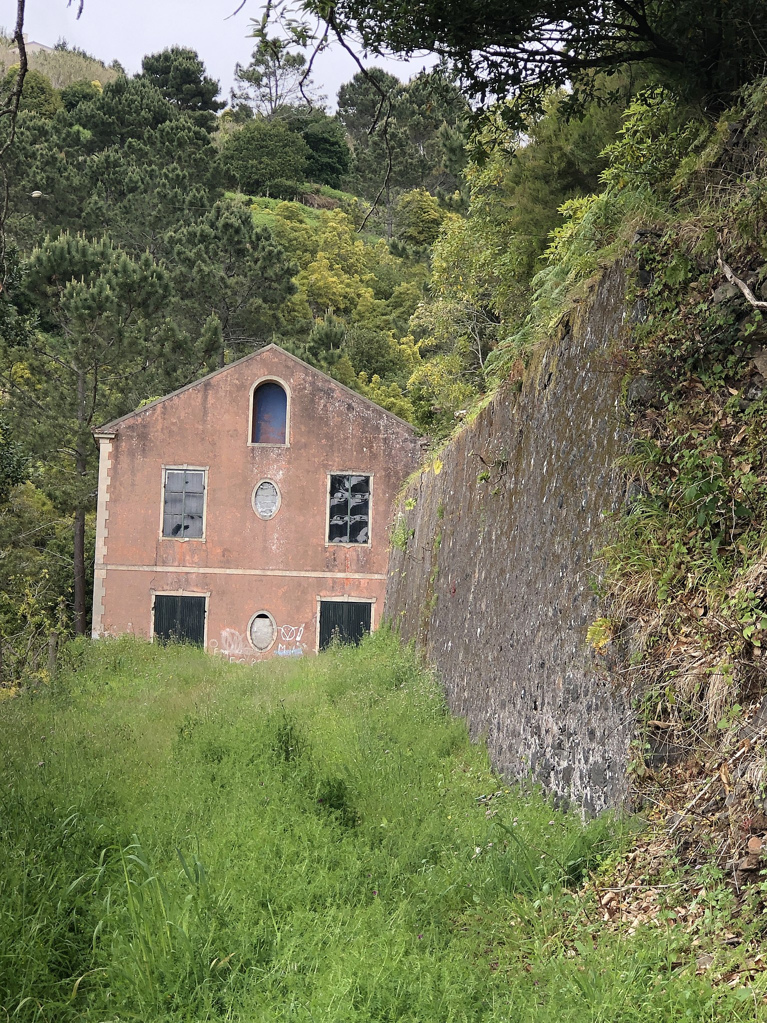
Português: A fábrica de Manteiga da Fajã da Ovelha, foi construída no inicio do século XX,
por volta do ano de 1910, por um senhor chamado Augusto César de Gouveia e o seu filho Pedro de Gouveia. Este senhor era um agricultor, foi uma pessoa muito importante, em que este prestou serviços à população, criou um cordão sanitário nos limites do concelho, impendido a propagação de uma febre que assolou a região nos finais do século XIX, que assim deste modo protegeu a Calheta. O senhor depois acabou por falecer, no Continente, onde estava a fazer tratamentos, acabou por ser trazido de volta para a Ilha da Madeira, onde foi enterrada na Fajã da Ovelha. 13 Seu filho acabou por ser o principal impulsionador da Fábrica da Manteiga, esta localiza-se no sítio de S. Lourenço, é constituída por dois andares. No primeiro andar era produzida a manteiga e na segunda era produzida a massa. Existe ainda uma furna de terra batida onde trabalhavam a folha para elaborar as latas para embalar a manteiga, “Manteiga Águia”. Depois com a II Guerra Mundial deixou de haver folha, então construíram uma serragem atrás da fábrica, em que passaram a elaborar caixas de madeira e a manteiga era embrulhada em papel de manteiga. Uma particularidade, esta fábrica foi o primeiro edifício na freguesia da Fajã da Ovelha a dispor de eletricidade, era produzida através da água que fazia mover os geradores. Esta fábrica foi muito importante para a economia da Fajã da Ovelha e da Ponta do Pargo, em que Manteiga era vendida para o Funchal e para o Continente. Com o passar dos anos a fábrica acabou por ser vendida acabando de deixar de funcionar em 1960, por fim foi vendida a um americano em 1974. Hoje em dia esta à venda e abandonada. |
| Date | |
| Source | Own work |
| Author | Beatrizoliveira |
| Camera location | | View this and other nearby images on: OpenStreetMap |
|---|
Licensing
[edit]
- You are free:
- to share – to copy, distribute and transmit the work
- to remix – to adapt the work
- Under the following conditions:
- attribution – You must give appropriate credit, provide a link to the license, and indicate if changes were made. You may do so in any reasonable manner, but not in any way that suggests the licensor endorses you or your use.
- share alike – If you remix, transform, or build upon the material, you must distribute your contributions under the same or compatible license as the original.
File history
Click on a date/time to view the file as it appeared at that time.
| Date/Time | Thumbnail | Dimensions | User | Comment | |
|---|---|---|---|---|---|
| current | 18:58, 12 June 2019 | | 3,024 × 4,032 (4.26 MB) | Beatrizoliveira (talk | contribs) | Cross-wiki upload from pt.wikipedia.org |
You cannot overwrite this file.
File usage on Commons
The following page uses this file:
File usage on other wikis
The following other wikis use this file:
- Usage on pt.wikipedia.org
- Usage on www.wikidata.org