File:Extreme points japan map (vi).png
Jump to navigation
Jump to search

Size of this preview: 682 × 599 pixels. Other resolutions: 273 × 240 pixels | 546 × 480 pixels | 874 × 768 pixels | 1,165 × 1,024 pixels | 1,752 × 1,540 pixels.
Original file (1,752 × 1,540 pixels, file size: 1.57 MB, MIME type: image/png)
Captions
Captions
Add a one-line explanation of what this file represents
Summary & Licensing
[edit]| Description |
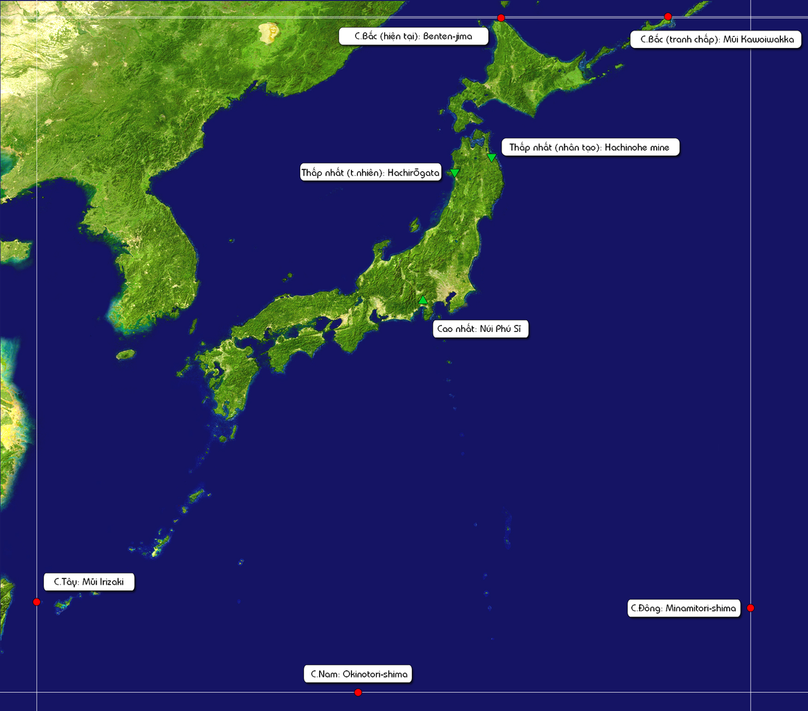
English: Extreme points of Japan.
Tiếng Việt: Các điểm cực của Nhật Bản. |
|||||||||
| Date | (04:37 JST) | |||||||||
| Source |
 |
|||||||||
| Author |
|
|||||||||
| Permission (Reusing this file) |
|
|||||||||
| Other versions |
This file was derived from: |

.png&action=edit§ion=1)
Original upload log
[edit].png&action=edit§ion=2)
This image is a derivative work of the following images:
- File:Japan_satellite.jpg licensed with PD-USGov-NASA
- 2005-08-19T08:04:26Z っ 1557x1419 (971852 Bytes) source: http://visibleearth.nasa.gov/images/2433/land_shallow_topo_21600.tif {{PD-USGov-NASA}} [[Category:Maps of Japan]]
File history
Click on a date/time to view the file as it appeared at that time.
| Date/Time | Thumbnail | Dimensions | User | Comment | |
|---|---|---|---|---|---|
| current | 19:42, 9 July 2014 | | 1,752 × 1,540 (1.57 MB) | Trần Nguyễn Minh Huy (talk | contribs) | {{Information |Description= {{en|Extreme points of Japan.}}<br/>{{vi|Các điểm cực của Nhật Bản.}} |Source= thumb|left |Date= 2014-07-10 (04:37 JST) |Author= *Japan_satellite.jpg: c... |
You cannot overwrite this file.
File usage on Commons
The following page uses this file:
File usage on other wikis
The following other wikis use this file:
- Usage on vi.wikipedia.org
.png&oldid=910746332)