File:Exposition geographique XIII Tableau Comprenant L'Asie et l'Afrique.png
Jump to navigation
Jump to search

Size of this preview: 800 × 589 pixels. Other resolutions: 320 × 236 pixels | 640 × 471 pixels | 1,024 × 754 pixels | 1,280 × 942 pixels | 2,560 × 1,885 pixels | 11,260 × 8,291 pixels.
Original file (11,260 × 8,291 pixels, file size: 121.06 MB, MIME type: image/png)
Captions
Captions
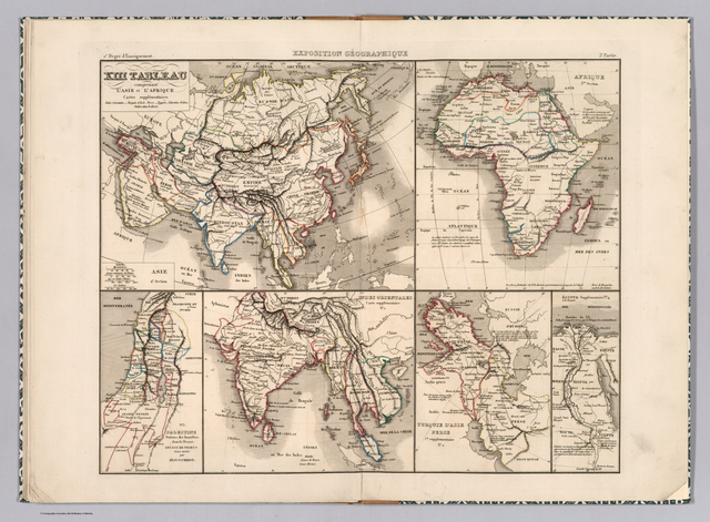
Map of Asia and Africa in 1839
Summary
[edit]
| Warning | The original file is very high-resolution. It might not load properly or could cause your browser to freeze when opened at full size. |
|---|
| Description |
English: Publisher: Bulla
Publisher Location: Paris |
| Date | |
| Source | https://www.davidrumsey.com/luna/servlet/detail/RUMSEY~8~1~312329~90081704:Exposition-geographique-XIII-Tablea |
| Author | Legrand, Augustin |
Licensing
[edit]
The copyright situation of this work is theoretically uncertain, because in the country of origin copyright lasts 70 years after the death of the author, and the date of the author's death is unknown. However, the date of creation of the work was over 120 years ago, and it is thus a reasonable assumption that the copyright has expired (see here for the community discussion). Do not use this template if the date of death of the author is known.
| |
| This file has been identified as being free of known restrictions under copyright law, including all related and neighboring rights. | |
File history
Click on a date/time to view the file as it appeared at that time.
| Date/Time | Thumbnail | Dimensions | User | Comment | |
|---|---|---|---|---|---|
| current | 11:55, 2 November 2021 | | 11,260 × 8,291 (121.06 MB) | Ltn12345 (talk | contribs) | Uploaded a work by Legrand, Augustin from https://www.davidrumsey.com/luna/servlet/detail/RUMSEY~8~1~312329~90081704:Exposition-geographique-XIII-Tablea with UploadWizard |
You cannot overwrite this file.
File usage on Commons
The following 2 pages use this file: