File:Expl1555 - Flickr - NOAA Photo Library.jpg
Jump to navigation
Jump to search

Size of this preview: 800 × 550 pixels. Other resolutions: 320 × 220 pixels | 640 × 440 pixels | 1,024 × 703 pixels | 1,280 × 879 pixels | 1,575 × 1,082 pixels.
Original file (1,575 × 1,082 pixels, file size: 1.5 MB, MIME type: image/jpeg)
Captions
Captions
Add a one-line explanation of what this file represents
Summary
[edit]
| Description |
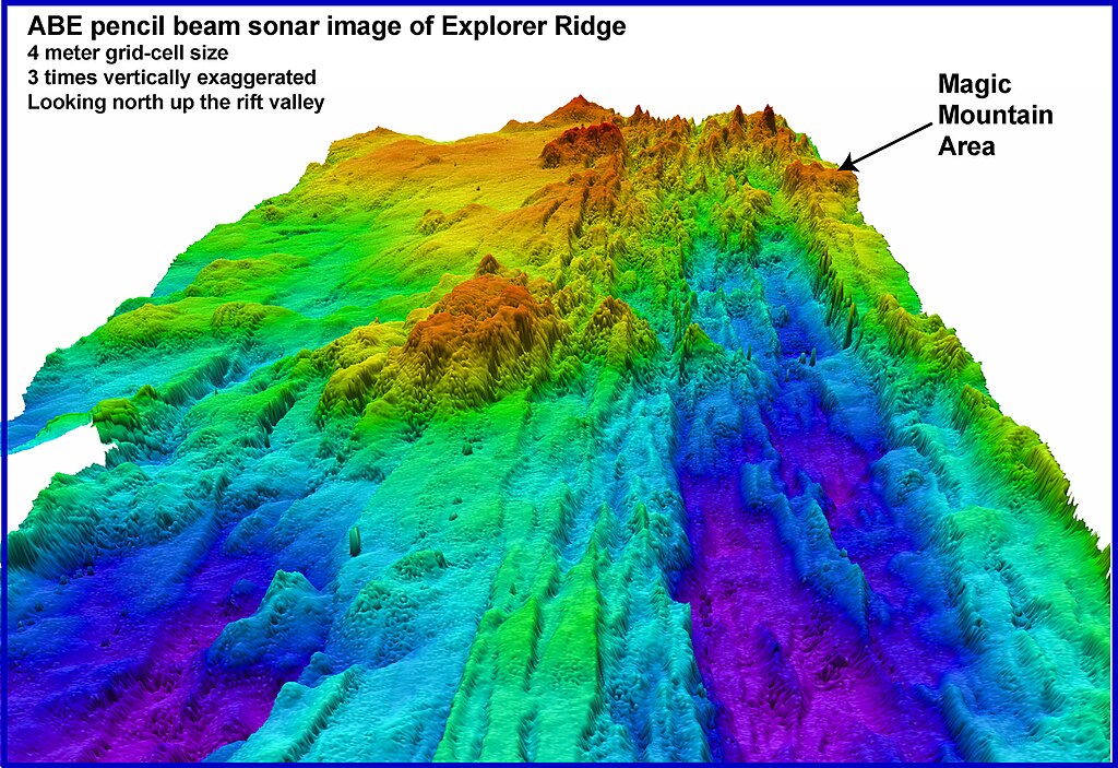
English: Ring of Fire 2002 Expedition. Automated Benthic Explorer (ABE) Imagenex pencil-beam sonar image showing the crest of Southern Explorer Ridge and the location of Magic Mountain hydrothermal site. The image is gridded at 4-meter pixel cell size. Purple and dark blue colors indicate deepest depths. Note that the position of Magic Mountain is on the flank of the axial rift valley. |
| Date | |
| Source | NOAA Photo Library: expl1555 |
| Author | Submarine Ring of Fire 2002, NOAA/OER. |
Licensing
[edit]
This file is licensed under the Creative Commons Attribution 2.0 Generic license.
- You are free:
- to share – to copy, distribute and transmit the work
- to remix – to adapt the work
- Under the following conditions:
- attribution – You must give appropriate credit, provide a link to the license, and indicate if changes were made. You may do so in any reasonable manner, but not in any way that suggests the licensor endorses you or your use.
| This image was originally posted to Flickr by NOAA Photo Library at https://www.flickr.com/photos/51647007@N08/5424617827. It was reviewed on 30 December 2012 by FlickreviewR and was confirmed to be licensed under the terms of the cc-by-2.0. |
This image is in the public domain because it contains materials that originally came from the U.S. National Oceanic and Atmospheric Administration, taken or made as part of an employee's official duties.
|
File history
Click on a date/time to view the file as it appeared at that time.
| Date/Time | Thumbnail | Dimensions | User | Comment | |
|---|---|---|---|---|---|
| current | 10:48, 5 January 2012 | | 1,575 × 1,082 (1.5 MB) | Kobac (talk | contribs) | {{Information |Description=Ring of Fire 2002 Expedition. Automated Benthic Explorer (ABE) Imagenex pencil-beam sonar image showing the crest of Southern Explorer Ridge and the location of Magic Mountain hydrothermal site. The image is gridded at 4-meter p |
You cannot overwrite this file.
File usage on Commons
The following page uses this file:
- File:Bathy expl1555 (5424617827).jpg (file redirect)
.jpg&redirect=no)