File:Evolution of Silverstone Grand Prix Circuit 1949 to present.png
Jump to navigation
Jump to search
Size of this preview: 800 × 494 pixels. Other resolutions: 320 × 197 pixels | 640 × 395 pixels | 1,024 × 632 pixels | 1,280 × 790 pixels | 2,560 × 1,580 pixels | 3,768 × 2,325 pixels.
Original file (3,768 × 2,325 pixels, file size: 882 KB, MIME type: image/png)
Captions
Captions
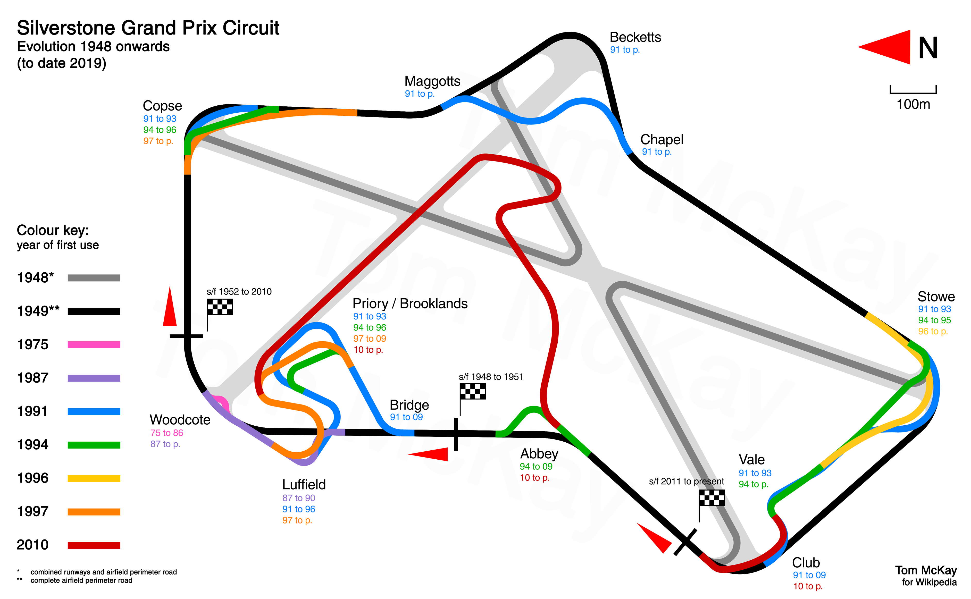
Silverstone track layout evolution

|
This sport map image could be re-created using vector graphics as an SVG file. This has several advantages; see Commons:Media for cleanup for more information. If an SVG form of this image is available, please upload it and afterwards replace this template with
{{vector version available|new image name}}.
It is recommended to name the SVG file “Evolution of Silverstone Grand Prix Circuit 1949 to present.svg”—then the template Vector version available (or Vva) does not need the new image name parameter. |
Summary
[edit]
| Description |
English: Track diagram of Silverstone Circuit in the UK showing evolution from 1949 to present. Made to scale from aerial photographs. |
| Date | |
| Source | Own work |
| Author | Tom McKay |
Licensing
[edit]
I, the copyright holder of this work, hereby publish it under the following license:
This file is licensed under the Creative Commons Attribution-Share Alike 4.0 International license.
- You are free:
- to share – to copy, distribute and transmit the work
- to remix – to adapt the work
- Under the following conditions:
- attribution – You must give appropriate credit, provide a link to the license, and indicate if changes were made. You may do so in any reasonable manner, but not in any way that suggests the licensor endorses you or your use.
- share alike – If you remix, transform, or build upon the material, you must distribute your contributions under the same or compatible license as the original.
File history
Click on a date/time to view the file as it appeared at that time.
| Date/Time | Thumbnail | Dimensions | User | Comment | |
|---|---|---|---|---|---|
| current | 13:47, 3 July 2019 | | 3,768 × 2,325 (882 KB) | McKayF1 (talk | contribs) | Overall original image resolution increase, with slightly reduced width dimensions. Change to colours in diagram for greater clarity. Change to some information in the key. |
| 11:42, 7 July 2018 |  | 3,696 × 2,170 (826 KB) | McKayF1 (talk | contribs) | Date errors fixed, greater clarity for reader, addition of 1948 circuit. | |
| 23:26, 14 April 2016 |  | 1,665 × 1,200 (391 KB) | McKayF1 (talk | contribs) | Error fixed with dates at Woodcote | |
| 17:36, 14 April 2016 |  | 1,665 × 1,200 (387 KB) | McKayF1 (talk | contribs) | User created page with UploadWizard |
You cannot overwrite this file.
File usage on Commons
The following 8 pages use this file:
- User:Chumwa/OgreBot/Potential transport maps/2018 July 1-10
- User:Chumwa/OgreBot/Potential transport maps/2019 July 1-10
- User:Chumwa/OgreBot/Transport Maps/2018 July 1-10
- User:Chumwa/OgreBot/Transport Maps/2019 July 1-10
- User:Chumwa/OgreBot/Travel and communication maps/2018 July 1-10
- User:Chumwa/OgreBot/Travel and communication maps/2019 July 1-10
- Commons:WikiProject Aviation/recent uploads/2018 July 7
- Commons:WikiProject Aviation/recent uploads/2019 July 3
File usage on other wikis
The following other wikis use this file:
- Usage on en.wikipedia.org
- Usage on fi.wikipedia.org
- Usage on gl.wikipedia.org
- Usage on id.wikipedia.org
- Usage on it.wikipedia.org