File:Evesham, St Lawrence's church (38182226326).jpg
Original file (4,591 × 3,289 pixels, file size: 5.32 MB, MIME type: image/jpeg)
Captions
Captions
Summary
[edit].jpg&action=edit§ion=1)
| Description |
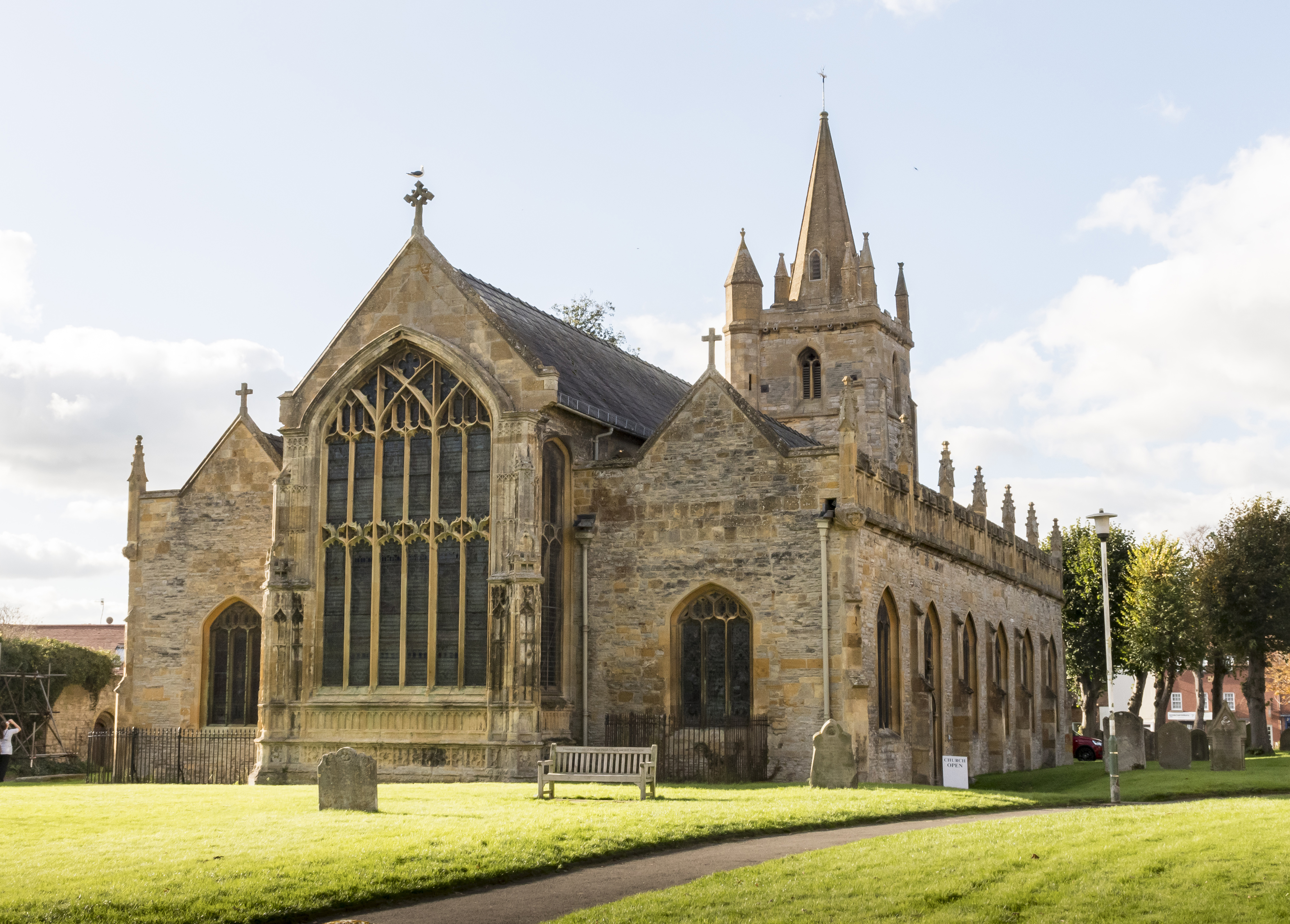
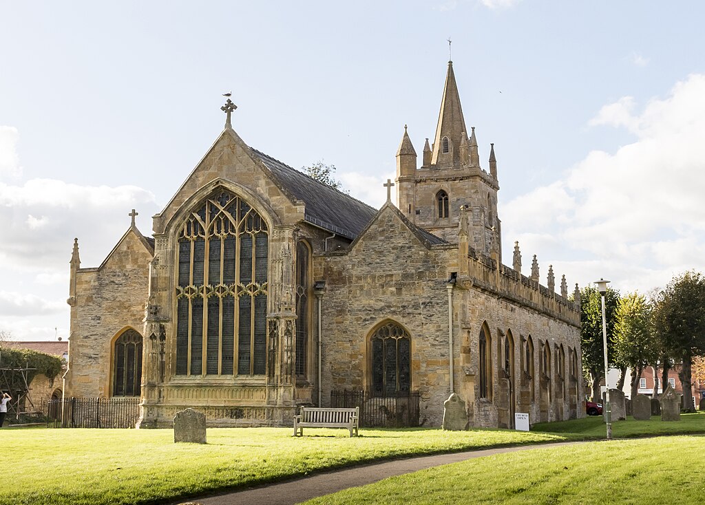
This is one of two parish churches in the precincts of Evesham Abbey. The original church on this site was first mentioned in 1195, and rebuilt about a hundred years later. The present church is from the late fifteenth century with an early sixteenth century south Chapel. After the Abbey's dissolution in 1540 the St Lawrence's fortune declined. It is now looked after by the Churches Conservation Trust, having been declared redundant in 1978. The church consists of a western tower with short spire, west doorway, clerestoried nave with four bay north and south aisles, chancel and chapel off the south aisle. The nave arcades are identical and extend into the chancel. There is no chancel arch. The south chapel is dedicated to Saint Clement and was built by Abbot Lichfield as his chantry around 1500. It has a carved fan vaulted roof with a central pendant. There was once a stone screen across the entrance. By the 18th C. the church had become very dilapidated. An extensive, but poor reconstruction took place in 1730, but by 1800 the roof had collapsed and the church was again unusable. In 1837 it was restored under Harvey Eginton who rebuilt the north side and replaced the roof. He also added a twin pulpit, reredos and reading desk. Further work in 1892 added stepped encaustic tiled floors and new seating. The church has a good selection stained glass windows by a variety of makers over a period of about 100 years. The octagonal font in the south aisle is mediaeval; there is also a replica in the Lichfield Chapel. |
| Date | |
| Source | Evesham, St Lawrence's church |
| Author | Jules & Jenny from Lincoln, UK |
| Camera location | | View this and other nearby images on: OpenStreetMap |
|---|
.jpg¶ms=052.091498_N_-001.947616_E_globe:Earth_type:camera_source:Flickr_&language=en)
Licensing
[edit].jpg&action=edit§ion=2)
- You are free:
- to share – to copy, distribute and transmit the work
- to remix – to adapt the work
- Under the following conditions:
- attribution – You must give appropriate credit, provide a link to the license, and indicate if changes were made. You may do so in any reasonable manner, but not in any way that suggests the licensor endorses you or your use.
| This image was originally posted to Flickr by Jules & Jenny at https://flickr.com/photos/78914786@N06/38182226326 (archive). It was reviewed on 6 August 2018 by FlickreviewR 2 and was confirmed to be licensed under the terms of the cc-by-2.0. |
File history
Click on a date/time to view the file as it appeared at that time.
| Date/Time | Thumbnail | Dimensions | User | Comment | |
|---|---|---|---|---|---|
| current | 01:23, 6 August 2018 | | 4,591 × 3,289 (5.32 MB) | Tm (talk | contribs) | Transferred from Flickr via #flickr2commons |
You cannot overwrite this file.
File usage on Commons
There are no pages that use this file.
File usage on other wikis
The following other wikis use this file:
- Usage on mdf.wikipedia.org
.jpg&oldid=485123744)