File:European Provinces of the Roman Empire.jpg
Jump to navigation
Jump to search

Size of this preview: 767 × 599 pixels. Other resolutions: 307 × 240 pixels | 614 × 480 pixels | 983 × 768 pixels | 1,280 × 1,000 pixels | 2,301 × 1,798 pixels.
Original file (2,301 × 1,798 pixels, file size: 849 KB, MIME type: image/jpeg)
Captions
Captions
Add a one-line explanation of what this file represents
Summary
[edit]| Description |
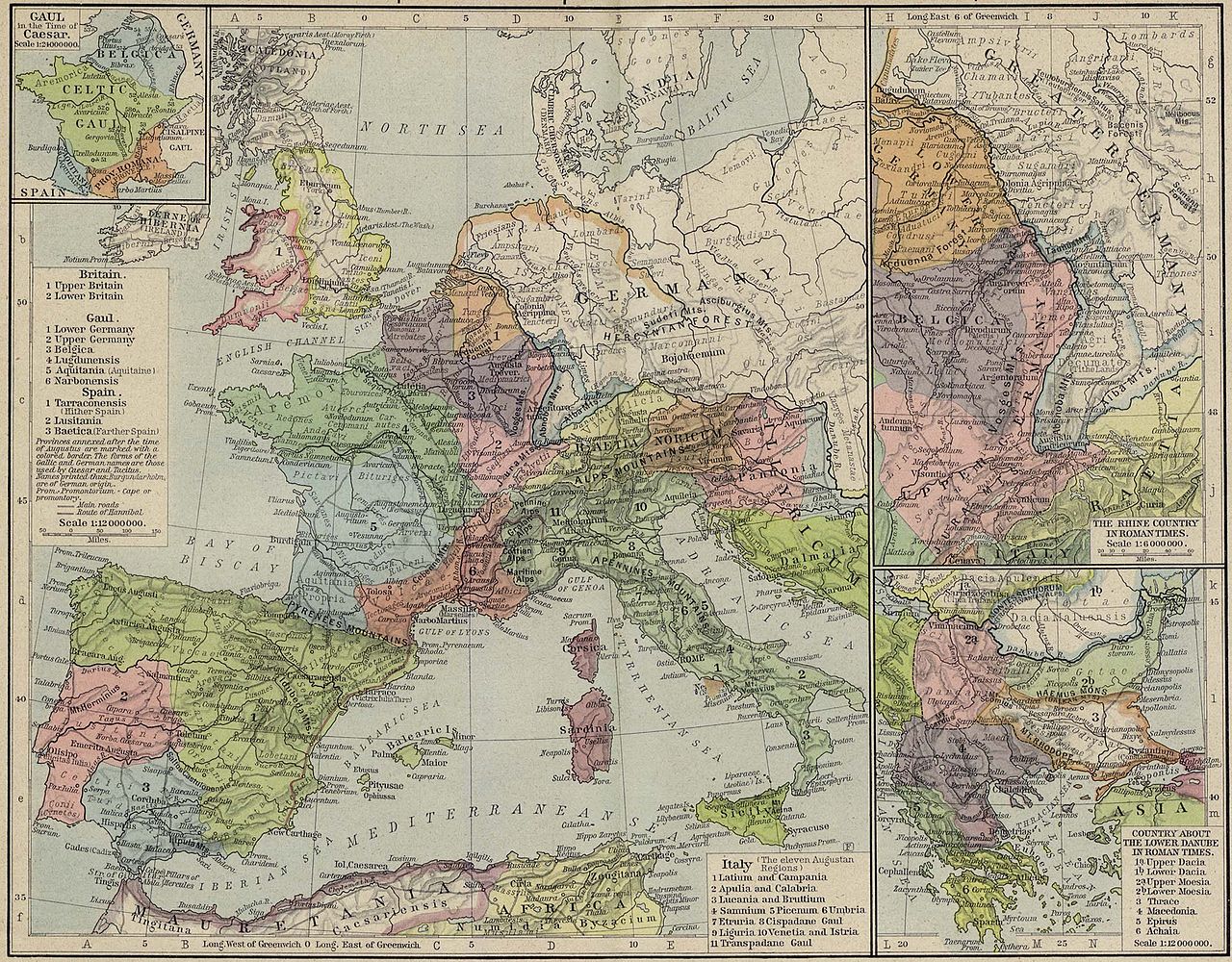
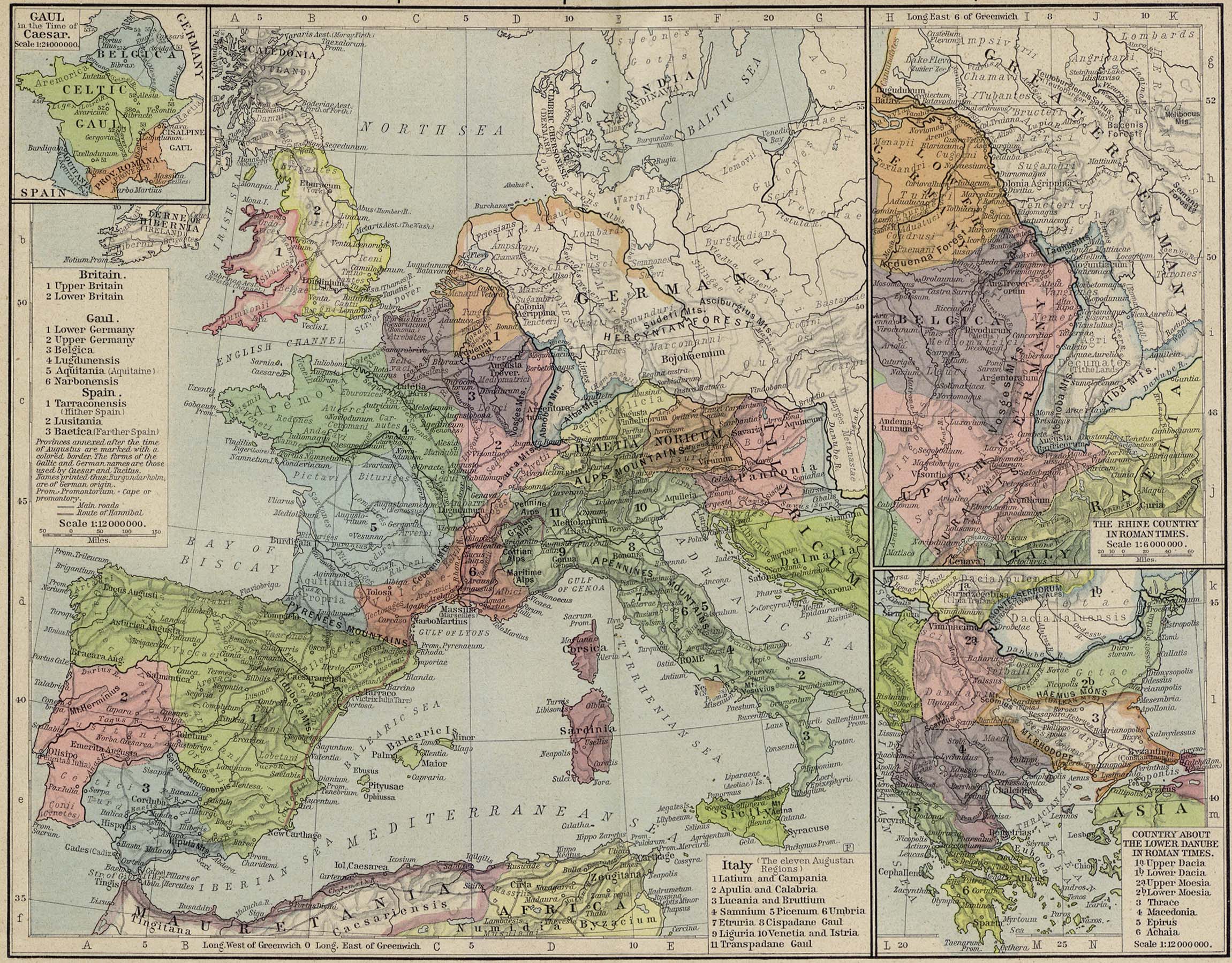
English: Reference Map of the European Provinces of the Roman Empire by William R. Shepherd
|
|||||||||||||||||||||||
| Date | ||||||||||||||||||||||||
| Source | downloaded from european_provinces_rome.jpg, following a link from history_shepherd_1923.html at http://www.lib.utexas.edu | |||||||||||||||||||||||
| Author |
|
|||||||||||||||||||||||
| Permission (Reusing this file) |
|
|||||||||||||||||||||||
| Other versions |
|
|||||||||||||||||||||||
.png)
.jpg)


File history
Click on a date/time to view the file as it appeared at that time.
| Date/Time | Thumbnail | Dimensions | User | Comment | |
|---|---|---|---|---|---|
| current | 19:06, 23 August 2008 | | 2,301 × 1,798 (849 KB) | Erik Warmelink (talk | contribs) | {{Information |Description={{en|1=Reference Map of the European Provinces of the Roman Empire by w:en:William R. Shepherd :Insets: Gaul in the Time of Caesar. The Rhine Country in Roman Times. Country about the Lower Danube in Roman Times.}} |Source= |
You cannot overwrite this file.
File usage on Commons
The following 4 pages use this file:
File usage on other wikis
The following other wikis use this file:
- Usage on et.wikipedia.org