File:Europe of Freedom and Democracy MEPs map.svg
Jump to navigation
Jump to search

Size of this PNG preview of this SVG file: 560 × 599 pixels. Other resolutions: 224 × 240 pixels | 449 × 480 pixels | 718 × 768 pixels | 957 × 1,024 pixels | 1,914 × 2,048 pixels | 645 × 690 pixels.
Original file (SVG file, nominally 645 × 690 pixels, file size: 314 KB)
Captions
Captions
Add a one-line explanation of what this file represents
Summary
[edit]
| Description |
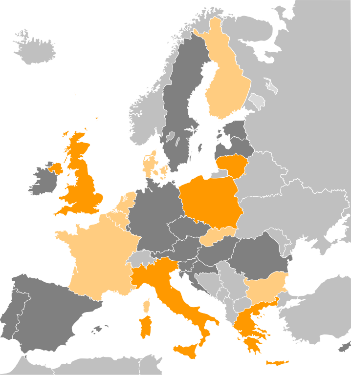
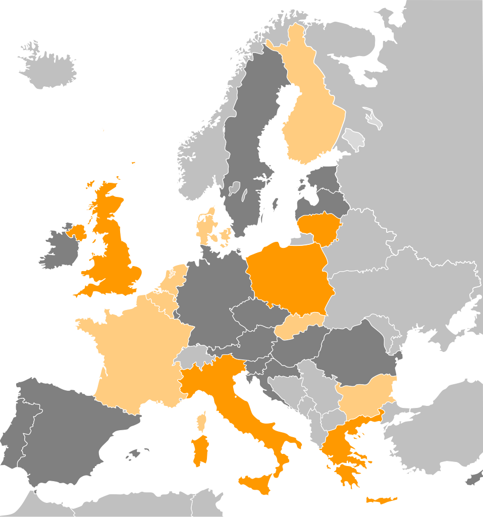
English: Map of the European Union, coloured by the number of MEPs sitting in the Europe of Freedom and Democracy group: orange for more than one, light orange for one, and dark grey for none. Light grey countries are outside the European Union. |
| Date | |
| Source | Own work |
| Author | Bastin |
Licensing
[edit]
I, the copyright holder of this work, hereby publish it under the following license:
This file is licensed under the Creative Commons Attribution-Share Alike 3.0 Unported license.
- You are free:
- to share – to copy, distribute and transmit the work
- to remix – to adapt the work
- Under the following conditions:
- attribution – You must give appropriate credit, provide a link to the license, and indicate if changes were made. You may do so in any reasonable manner, but not in any way that suggests the licensor endorses you or your use.
- share alike – If you remix, transform, or build upon the material, you must distribute your contributions under the same or compatible license as the original.
File history
Click on a date/time to view the file as it appeared at that time.
| Date/Time | Thumbnail | Dimensions | User | Comment | |
|---|---|---|---|---|---|
| current | 18:36, 4 August 2013 | | 645 × 690 (314 KB) | DrKay (talk | contribs) | update Croatia and Bulgaria |
| 22:15, 26 December 2011 |  | 645 × 690 (314 KB) | Bastin (talk | contribs) | Update for United Poland's defection from the ECR. | |
| 14:47, 13 December 2011 |  | 645 × 690 (317 KB) | Bastin (talk | contribs) | Update for Vanhecke defection. | |
| 11:16, 9 July 2011 |  | 645 × 690 (317 KB) | Bastin (talk | contribs) |
You cannot overwrite this file.
File usage on Commons
There are no pages that use this file.
File usage on other wikis
The following other wikis use this file:
- Usage on ca.wikipedia.org
- Usage on da.wikipedia.org
- Usage on el.wikipedia.org
- Usage on en.wikipedia.org
- Usage on ru.wikipedia.org
- Usage on uk.wikipedia.org