File:Europe, large ethnographic, Johnston, 1848.jpg

Original file (753 × 622 pixels, file size: 118 KB, MIME type: image/jpeg)
Captions
Captions
Summary
[edit]
| Description |
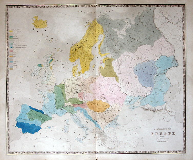
English: "Ethnographic Map of Europe according to Dr. Gustaf Kombst ... by A.K.Johnston FRGS" engraved by W. & A.K. Johnston and published in The National Atlas, 1843. Steel engraved map with original hand colour. Centrefold as published and very slight soiling. Size 59 x 49 cms. (Note - this is a digital camera image with uneven lighting.) Ref E3819 |
| Date | |
| Source | Europe, large ethnographic, Johnston, 1848 |
| Author | A.K.Johnston |
Source:
[edit]
Licensing
[edit]
|
This is a faithful photographic reproduction of a two-dimensional, public domain work of art. The work of art itself is in the public domain for the following reason:
The official position taken by the Wikimedia Foundation is that "faithful reproductions of two-dimensional public domain works of art are public domain". This photographic reproduction is therefore also considered to be in the public domain in the United States. In other jurisdictions, re-use of this content may be restricted; see Reuse of PD-Art photographs for details. {{PD-Art}} template without license parameter: please specify why the underlying work is public domain in both the source country and the United States
(Usage: {{PD-Art|1=|deathyear=''year of author's death''|country=''source country''}}, where parameter 1= can be PD-old-auto, PD-old-auto-expired, PD-old-auto-1996, PD-old-100 or similar. See Commons:Multi-license copyright tags for more information.) | ||||
File history
Click on a date/time to view the file as it appeared at that time.
| Date/Time | Thumbnail | Dimensions | User | Comment | |
|---|---|---|---|---|---|
| current | 03:16, 16 August 2010 | | 753 × 622 (118 KB) | Geagea (talk | contribs) | == {{int:filedesc}} == {{Information |Description={{en|1="Ethnographic Map of Europe according to Dr. Gustaf Kombst ... by A.K.Johnston FRGS" engraved by W. & A.K. Johnston and published in The National Atlas, 1843. Steel engraved map with original hand c |
You cannot overwrite this file.
File usage on Commons
There are no pages that use this file.