File:Euripus SWBD demo.svg
Jump to navigation
Jump to search

Size of this PNG preview of this SVG file: 519 × 600 pixels. Other resolutions: 208 × 240 pixels | 415 × 480 pixels | 664 × 768 pixels | 886 × 1,024 pixels | 1,772 × 2,048 pixels | 1,432 × 1,655 pixels.
Original file (SVG file, nominally 1,432 × 1,655 pixels, file size: 1.78 MB)
Captions
Captions
Add a one-line explanation of what this file represents
Summary
[edit]
| Description | |
| Date | |
| Source | Own work |
| Author | Future Perfect at Sunrise |
Licensing
[edit]
| I, the copyright holder of this work, release this work into the public domain. This applies worldwide. In some countries this may not be legally possible; if so: I grant anyone the right to use this work for any purpose, without any conditions, unless such conditions are required by law. |
File history
Click on a date/time to view the file as it appeared at that time.
| Date/Time | Thumbnail | Dimensions | User | Comment | |
|---|---|---|---|---|---|
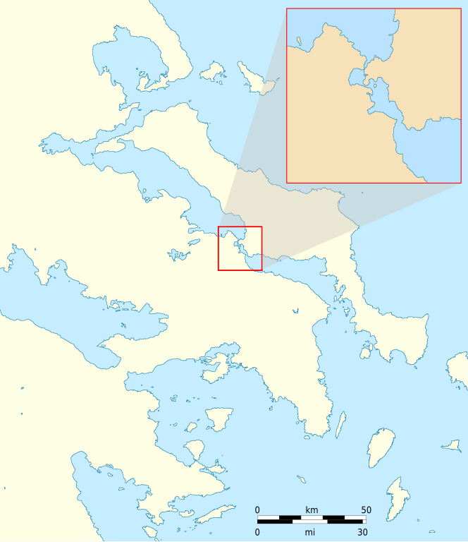
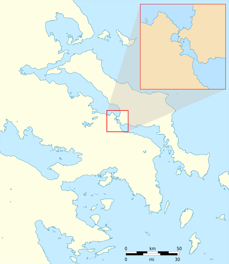
| current | 16:00, 15 August 2009 | | 1,432 × 1,655 (1.78 MB) | Future Perfect at Sunrise (talk | contribs) | {{Information |Description={{en|1=Demo map illustrating the use of SWBD vector coastline data. The region shown is Attica and the island of Euboea in SE Greece; the enlarged 20-km inset is of [[:en |
You cannot overwrite this file.
File usage on Commons
There are no pages that use this file.
File usage on other wikis
The following other wikis use this file:
- Usage on en.wikipedia.org