File:Etzlaub Landstrassen 1501.jpg
Jump to navigation
Jump to search

Size of this preview: 460 × 600 pixels. Other resolutions: 184 × 240 pixels | 368 × 480 pixels | 589 × 768 pixels | 785 × 1,024 pixels | 1,571 × 2,048 pixels | 5,174 × 6,746 pixels.
Original file (5,174 × 6,746 pixels, file size: 32.4 MB, MIME type: image/jpeg)
Captions
Captions
Add a one-line explanation of what this file represents
Summary
[edit]
| Description |
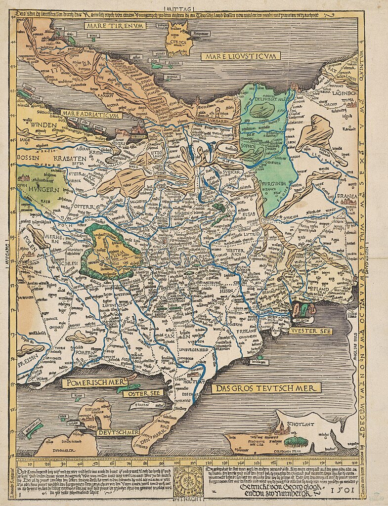
English: Map of trade routes in central Europe. Nuremberg 1501.
Deutsch: "Das sein dy lantstrassen durch das Romisch reych", Karte der Handelsstraßen in Mitteleuropa. Nürnberg 1501. |
|||||||||||||||||||
| Date | ||||||||||||||||||||
| Source | Harvard Mac Collection (Houghton Library copy image) | |||||||||||||||||||
| Author |
|
|||||||||||||||||||
You will find a more detailed and zoomable version here / Eine detailreichere und zoombare Version findet sich hier.
Licensing
[edit]
|
This is a faithful photographic reproduction of a two-dimensional, public domain work of art. The work of art itself is in the public domain for the following reason:
The official position taken by the Wikimedia Foundation is that "faithful reproductions of two-dimensional public domain works of art are public domain".
This photographic reproduction is therefore also considered to be in the public domain in the United States. In other jurisdictions, re-use of this content may be restricted; see Reuse of PD-Art photographs for details. | ||||
File history
Click on a date/time to view the file as it appeared at that time.
| Date/Time | Thumbnail | Dimensions | User | Comment | |
|---|---|---|---|---|---|
| current | 19:04, 11 December 2023 | | 5,174 × 6,746 (32.4 MB) | Don-vip (talk | contribs) | full-res from https://dezoomify.ophir.dev/#https://iiif.lib.harvard.edu/manifests/ids:2655377 |
| 16:38, 11 June 2010 |  | 1,675 × 2,277 (1.96 MB) | Pirkheimer (talk | contribs) | Rand abgeschnitten | |
| 16:16, 11 June 2010 |  | 1,928 × 2,399 (1.21 MB) | Pirkheimer (talk | contribs) | {{Information |Description={{en|1=Map of trade routes in central Europe. Nuremberg 1501.}} {{de|1="Das sein dy lantstrassen durch das Romisch reych", Karte der Handelsstraßen in Mitteleuropa. Nürnberg 1501.}} |Source=[http://nrs.harvard.edu/urn-3:FHCL:5 |
You cannot overwrite this file.
File usage on Commons
There are no pages that use this file.
File usage on other wikis
The following other wikis use this file:
- Usage on cs.wikipedia.org
- Usage on de.wikipedia.org