File:EtiopíaTopográfica.svg
Jump to navigation
Jump to search

Size of this PNG preview of this SVG file: 761 × 599 pixels. Other resolutions: 305 × 240 pixels | 609 × 480 pixels | 975 × 768 pixels | 1,280 × 1,008 pixels | 2,560 × 2,017 pixels | 2,026 × 1,596 pixels.
Original file (SVG file, nominally 2,026 × 1,596 pixels, file size: 24.43 MB)
Captions
Captions
Add a one-line explanation of what this file represents
Summary
[edit]
| Description |
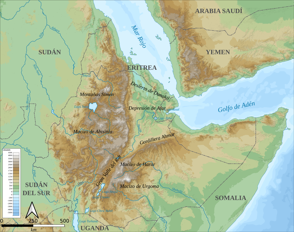
Español: Mapa topográfico de Etiopía. |
| Date | |
| Source |
Own work
|
| Author | Rowanwindwhistler |
Licensing
[edit]
I, the copyright holder of this work, hereby publish it under the following license:
This file is licensed under the Creative Commons Attribution-Share Alike 4.0 International license.
- You are free:
- to share – to copy, distribute and transmit the work
- to remix – to adapt the work
- Under the following conditions:
- attribution – You must give appropriate credit, provide a link to the license, and indicate if changes were made. You may do so in any reasonable manner, but not in any way that suggests the licensor endorses you or your use.
- share alike – If you remix, transform, or build upon the material, you must distribute your contributions under the same or compatible license as the original.
File history
Click on a date/time to view the file as it appeared at that time.
| Date/Time | Thumbnail | Dimensions | User | Comment | |
|---|---|---|---|---|---|
| current | 12:44, 12 July 2021 | | 2,026 × 1,596 (24.43 MB) | Rowanwindwhistler (talk | contribs) | Depressed land added |
| 12:03, 12 July 2021 |  | 2,026 × 1,596 (24.32 MB) | Rowanwindwhistler (talk | contribs) | Topography layers put in the right order and colours set right too | |
| 11:30, 12 July 2021 |  | 2,026 × 1,596 (24.3 MB) | Rowanwindwhistler (talk | contribs) | Uploaded own work with UploadWizard |
You cannot overwrite this file.
File usage on Commons
The following page uses this file:
File usage on other wikis
The following other wikis use this file:
- Usage on es.wikipedia.org