File:Etang de Vidalon.jpg
Jump to navigation
Jump to search

Size of this preview: 800 × 538 pixels. Other resolutions: 320 × 215 pixels | 640 × 430 pixels | 1,024 × 689 pixels | 1,280 × 861 pixels | 2,364 × 1,590 pixels.
Original file (2,364 × 1,590 pixels, file size: 677 KB, MIME type: image/jpeg)
Captions
Captions
Add a one-line explanation of what this file represents
Summary
[edit]
| Description | |
| Date | |
| Source | Own work |
| Author | Sarang |
| Object location | | View this and other nearby images on: OpenStreetMap |
|---|
Licensing
[edit]
| I, the copyright holder of this work, release this work into the public domain. This applies worldwide. In some countries this may not be legally possible; if so: I grant anyone the right to use this work for any purpose, without any conditions, unless such conditions are required by law. |
| Annotations | This image is annotated: View the annotations at Commons |
File history
Click on a date/time to view the file as it appeared at that time.
| Date/Time | Thumbnail | Dimensions | User | Comment | |
|---|---|---|---|---|---|
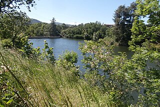
| current | 15:24, 24 June 2020 | | 2,364 × 1,590 (677 KB) | Sarang (talk | contribs) | {{Information |description={{fr|L'Etang de Vidalon. Le ''ruisseau de Chante-Caille'' remplit le lac<br> et forme la frontière entre {{Wf|Davézieux}} et {{Wf|Boulieu-lès-Annonay|Boulieu}}.}} |date=2020-05-20 |source={{Own}} |author={{U|Sarang}} }} {{Object location|45°15′32.1″N 04°41′02.8″E}} == {{int:license-header}} == {{PD-self}} Category:Lakes of Ardèche Category:Davézieux Category:Boulieu-lès-Annonay |
You cannot overwrite this file.
File usage on Commons
There are no pages that use this file.