File:Estuary Map 2.jpg
Jump to navigation
Jump to search
Size of this preview: 454 × 599 pixels. Other resolutions: 182 × 240 pixels | 363 × 480 pixels | 582 × 768 pixels | 776 × 1,024 pixels | 1,443 × 1,905 pixels.
Original file (1,443 × 1,905 pixels, file size: 1.19 MB, MIME type: image/jpeg)
Captions
Captions
Add a one-line explanation of what this file represents
Summary
[edit]
Licensing
[edit]
| I, the copyright holder of this work, release this work into the public domain. This applies worldwide. In some countries this may not be legally possible; if so: I grant anyone the right to use this work for any purpose, without any conditions, unless such conditions are required by law. |
File history
Click on a date/time to view the file as it appeared at that time.
| Date/Time | Thumbnail | Dimensions | User | Comment | |
|---|---|---|---|---|---|
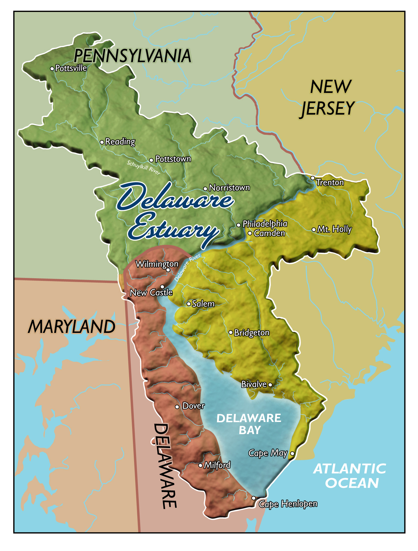
| current | 18:06, 30 March 2009 | | 1,443 × 1,905 (1.19 MB) | Mr SBailey (talk | contribs) | {{Information |Description={{en|1=The Delaware Estuary, or tidal Delaware River Watershed}} |Source=Partnership for the Delaware Estuary |Author=Partnership for the Delaware Estuary |Date= |Permission= |other_versions= }} <!--{{ImageUpload|full}}--> |
You cannot overwrite this file.
File usage on Commons
There are no pages that use this file.
File usage on other wikis
The following other wikis use this file:
- Usage on en.wikipedia.org