File:Map of the Singapore Strait (Spanish).png
(Redirected from File:EstrechoSingapur.PNG)

Size of this preview: 667 × 600 pixels. Other resolutions: 267 × 240 pixels | 534 × 480 pixels | 854 × 768 pixels | 1,139 × 1,024 pixels | 2,278 × 2,048 pixels | 2,790 × 2,508 pixels.
Original file (2,790 × 2,508 pixels, file size: 134 KB, MIME type: image/png)
Captions
Captions
Add a one-line explanation of what this file represents
Summary
[edit].png&action=edit§ion=1)
| Description |
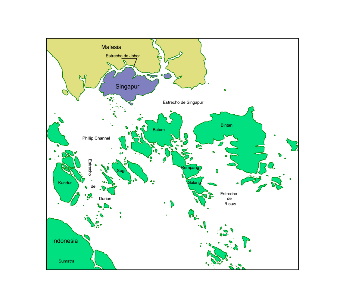
English: A map of the Singapore Strait with Spanish labels.
Español: Un mapa del estrecho de Singapur con marcas españolas. El presente gráfico no incluye las islas artificiales ni los terrenos ganados al mar. |
| Date | |
| Source | Own work |
| Author | Claudio Elias. |
Licensing
[edit].png&action=edit§ion=2)
| I, the copyright holder of this work, release this work into the public domain. This applies worldwide. In some countries this may not be legally possible; if so: I grant anyone the right to use this work for any purpose, without any conditions, unless such conditions are required by law. |
File history
Click on a date/time to view the file as it appeared at that time.
| Date/Time | Thumbnail | Dimensions | User | Comment | |
|---|---|---|---|---|---|
| current | 15:33, 14 March 2007 | | 2,790 × 2,508 (134 KB) | Claudio Elias (talk | contribs) | {{Information |Description=ES: Estrecho de Singapur, el presente gráfico no incluye las islas artificiales ni los terrenos ganados al mar. EN:Strait of Singapore, present graphic not include artificial island in area. |Source=own work |Date=march 2007 |A |
You cannot overwrite this file.
File usage on Commons
The following 2 pages use this file:
.png)
File usage on other wikis
The following other wikis use this file:
- Usage on bn.wikipedia.org
- Usage on ca.wikipedia.org
- Usage on et.wikipedia.org
- Usage on fi.wikipedia.org
- Usage on fr.wikipedia.org
- Usage on gl.wikipedia.org
- Usage on he.wikipedia.org
- Usage on it.wikipedia.org
- Usage on mk.wikipedia.org
- Usage on pt.wikipedia.org
.png&oldid=601463128)