File:Estado actual del lugar donde se construirá la plaza del Colegio Mayor de Nuestra Señora del Rosario.jpg
Jump to navigation
Jump to search

Size of this preview: 800 × 599 pixels. Other resolutions: 320 × 240 pixels | 640 × 479 pixels | 1,024 × 767 pixels | 1,280 × 959 pixels | 1,769 × 1,325 pixels.
Original file (1,769 × 1,325 pixels, file size: 933 KB, MIME type: image/jpeg)
Captions
Captions
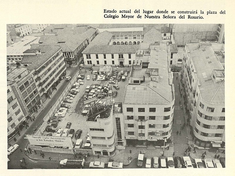
Demolition of buildings to build the square, ca. 1969.
Summary
[edit]
| Description |
Español: Vista del pasaje Santafé y de los dos módulos del edificio homónimo, hacia 1969.
English: View of the Santafé passage and the two modules of the homonymous building, ca.1969. |
| Date | |
| Source | Tres años de administración distrital, 1967-1969. |
| Author | Bogotá. Departamento Administrativo de Planificación Distrital. |
Licensing
[edit]
This file is licensed under the Creative Commons Attribution-Share Alike 4.0 International license.
- You are free:
- to share – to copy, distribute and transmit the work
- to remix – to adapt the work
- Under the following conditions:
- attribution – You must give appropriate credit, provide a link to the license, and indicate if changes were made. You may do so in any reasonable manner, but not in any way that suggests the licensor endorses you or your use.
- share alike – If you remix, transform, or build upon the material, you must distribute your contributions under the same or compatible license as the original.
File history
Click on a date/time to view the file as it appeared at that time.
| Date/Time | Thumbnail | Dimensions | User | Comment | |
|---|---|---|---|---|---|
| current | 15:50, 8 November 2022 | | 1,769 × 1,325 (933 KB) | Elkin.saboya.r (talk | contribs) | Uploaded a work by Bogotá. Departamento Administrativo de Planificación Distrital. from Tres años de administración distrital, 1967-1969. with UploadWizard |
You cannot overwrite this file.
File usage on Commons
There are no pages that use this file.
File usage on other wikis
The following other wikis use this file:
- Usage on es.wikipedia.org