File:Erythrocharax altipinnis distribution map.png
Jump to navigation
Jump to search
Size of this preview: 761 × 599 pixels. Other resolutions: 305 × 240 pixels | 610 × 480 pixels | 975 × 768 pixels | 1,280 × 1,008 pixels | 2,061 × 1,623 pixels.
Original file (2,061 × 1,623 pixels, file size: 893 KB, MIME type: image/png)
Captions
Captions
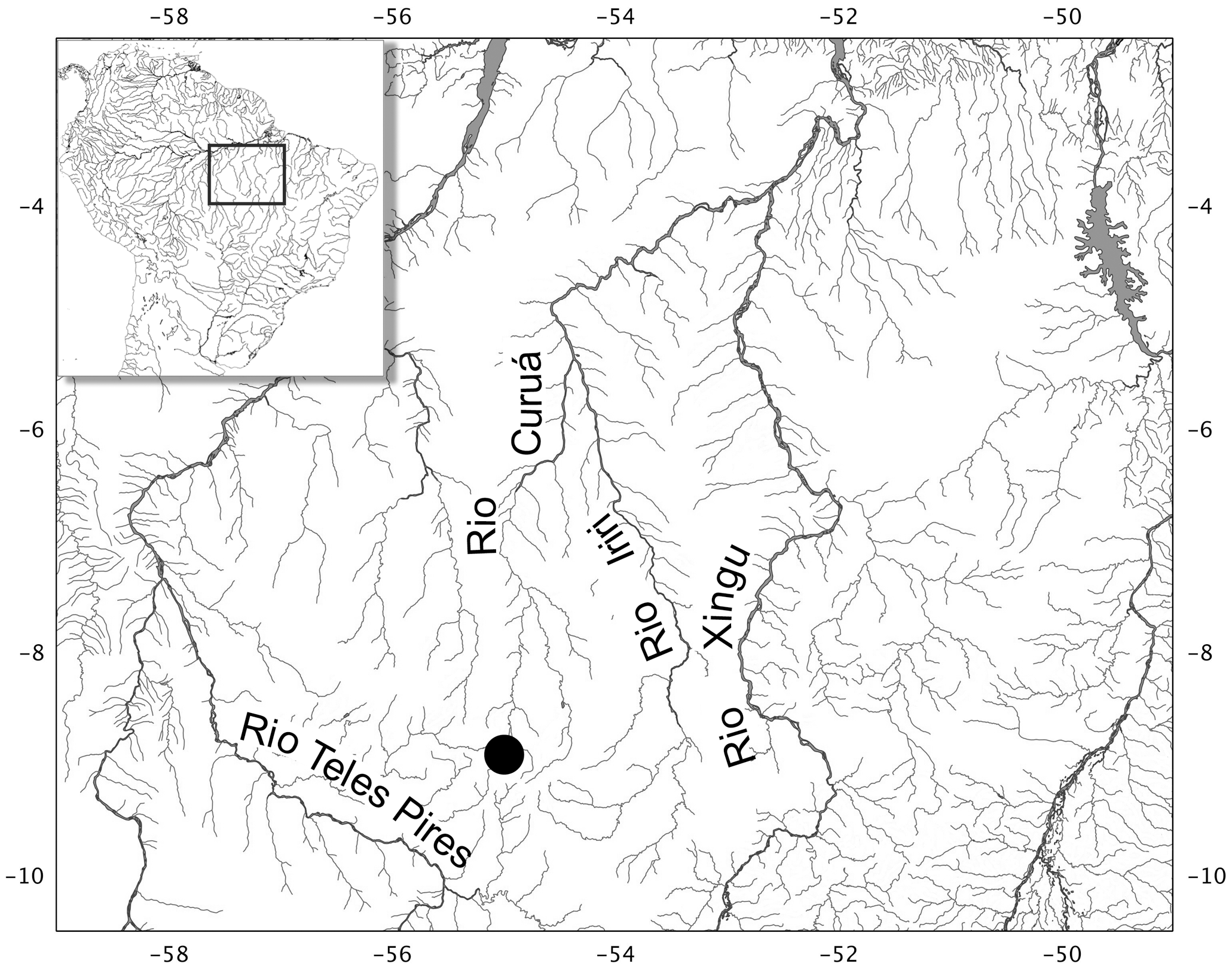
Erythrocharax altipinnis distribution map
Summary
[edit]
| Description |
English: Map of Serra do Cachimbo and adjoining areas, showing distribution of Erythrocharax altipinnis. |
| Date | January 2, 2013 |
| Source | https://journals.plos.org/plosone/article?id=10.1371/journal.pone.0052098 |
| Author | André Luiz Netto-Ferreira, José Luís Olivan Birindelli,Leandro Melo de Sousa, and Tatiane Casagrande Mariguela,Claudio Oliveira |
Licensing
[edit]
This file is licensed under the Creative Commons Attribution 4.0 International license.
- You are free:
- to share – to copy, distribute and transmit the work
- to remix – to adapt the work
- Under the following conditions:
- attribution – You must give appropriate credit, provide a link to the license, and indicate if changes were made. You may do so in any reasonable manner, but not in any way that suggests the licensor endorses you or your use.
File history
Click on a date/time to view the file as it appeared at that time.
| Date/Time | Thumbnail | Dimensions | User | Comment | |
|---|---|---|---|---|---|
| current | 02:00, 13 October 2023 | | 2,061 × 1,623 (893 KB) | Snugglyaggron (talk | contribs) | Uploaded a work by André Luiz Netto-Ferreira, José Luís Olivan Birindelli,Leandro Melo de Sousa, and Tatiane Casagrande Mariguela,Claudio Oliveira from https://journals.plos.org/plosone/article?id=10.1371/journal.pone.0052098 with UploadWizard |
You cannot overwrite this file.
File usage on Commons
There are no pages that use this file.