File:Erie County NY map labeled.png
Jump to navigation
Jump to search
Size of this preview: 667 × 599 pixels. Other resolutions: 267 × 240 pixels | 534 × 480 pixels | 708 × 636 pixels.
Original file (708 × 636 pixels, file size: 180 KB, MIME type: image/png)
Captions
Captions
Add a one-line explanation of what this file represents
Summary
[edit]

|
This locator map image could be re-created using vector graphics as an SVG file. This has several advantages; see Commons:Media for cleanup for more information. If an SVG form of this image is available, please upload it and afterwards replace this template with
{{vector version available|new image name}}.
It is recommended to name the SVG file “Erie County NY map labeled.svg”—then the template Vector version available (or Vva) does not need the new image name parameter. |
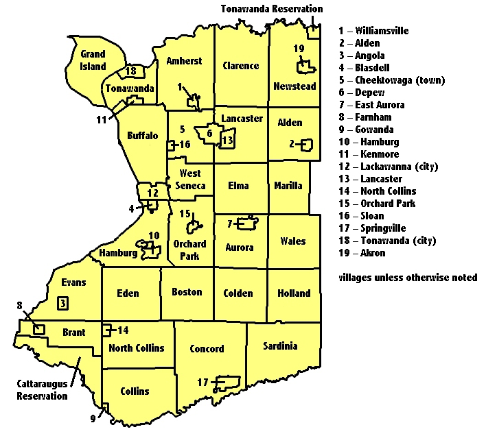
| Description | en:User:Vesperholly added text labels to Erie County map image created by en:User:Osgoodelawyer. |
| Date | 13 September 2006 (original upload date) |
| Source | Transferred from en.wikipedia to Commons. |
| Author | The original uploader was Vesperholly at English Wikipedia. |
Licensing
[edit]

|
Permission is granted to copy, distribute and/or modify this document under the terms of the GNU Free Documentation License, Version 1.2 or any later version published by the Free Software Foundation; with no Invariant Sections, no Front-Cover Texts, and no Back-Cover Texts. A copy of the license is included in the section entitled GNU Free Documentation License. |
| This file is licensed under the Creative Commons Attribution-Share Alike 3.0 Unported license. | ||
| ||
| This licensing tag was added to this file as part of the GFDL licensing update. |
Original upload log
[edit]
The original description page was here. All following user names refer to en.wikipedia.
- 2006-09-13 09:24 Vesperholly 708×636×8 (184587 bytes) [[User:Vesperholly]] added text labels to [http://en.wikipedia.org/wiki/Image:Erie_County%2C_NY_Map.png|GFDL Erie County map image] created by [[User:Osgoodelawyer]].
File history
Click on a date/time to view the file as it appeared at that time.
| Date/Time | Thumbnail | Dimensions | User | Comment | |
|---|---|---|---|---|---|
| current | 06:27, 13 August 2007 | | 708 × 636 (180 KB) | Fuzzy510 (talk | contribs) | {{Information |Description=en:User:Vesperholly added text labels to [http://en.wikipedia.org/wiki/Image:Erie_County%2C_NY_Map.png Erie County map image] created by en:User:Osgoodelawyer. |Source=Originally from [http://en.wikipedia.org en.wikipe |
You cannot overwrite this file.
File usage on Commons
There are no pages that use this file.
File usage on other wikis
The following other wikis use this file:
- Usage on es.wikipedia.org
- Usage on fr.wikipedia.org
- Usage on ja.wikipedia.org
- Usage on kw.wikipedia.org
- Usage on nl.wikipedia.org
- Usage on pt.wikipedia.org