File:Erhard Etzlaub 1511 Sundial miniature map.png
Jump to navigation
Jump to search
Size of this preview: 452 × 599 pixels. Other resolutions: 181 × 240 pixels | 362 × 480 pixels | 579 × 768 pixels | 772 × 1,024 pixels | 1,827 × 2,423 pixels.
Original file (1,827 × 2,423 pixels, file size: 1.53 MB, MIME type: image/png)
Captions
Captions
Add a one-line explanation of what this file represents
Summary
[edit]| Description |
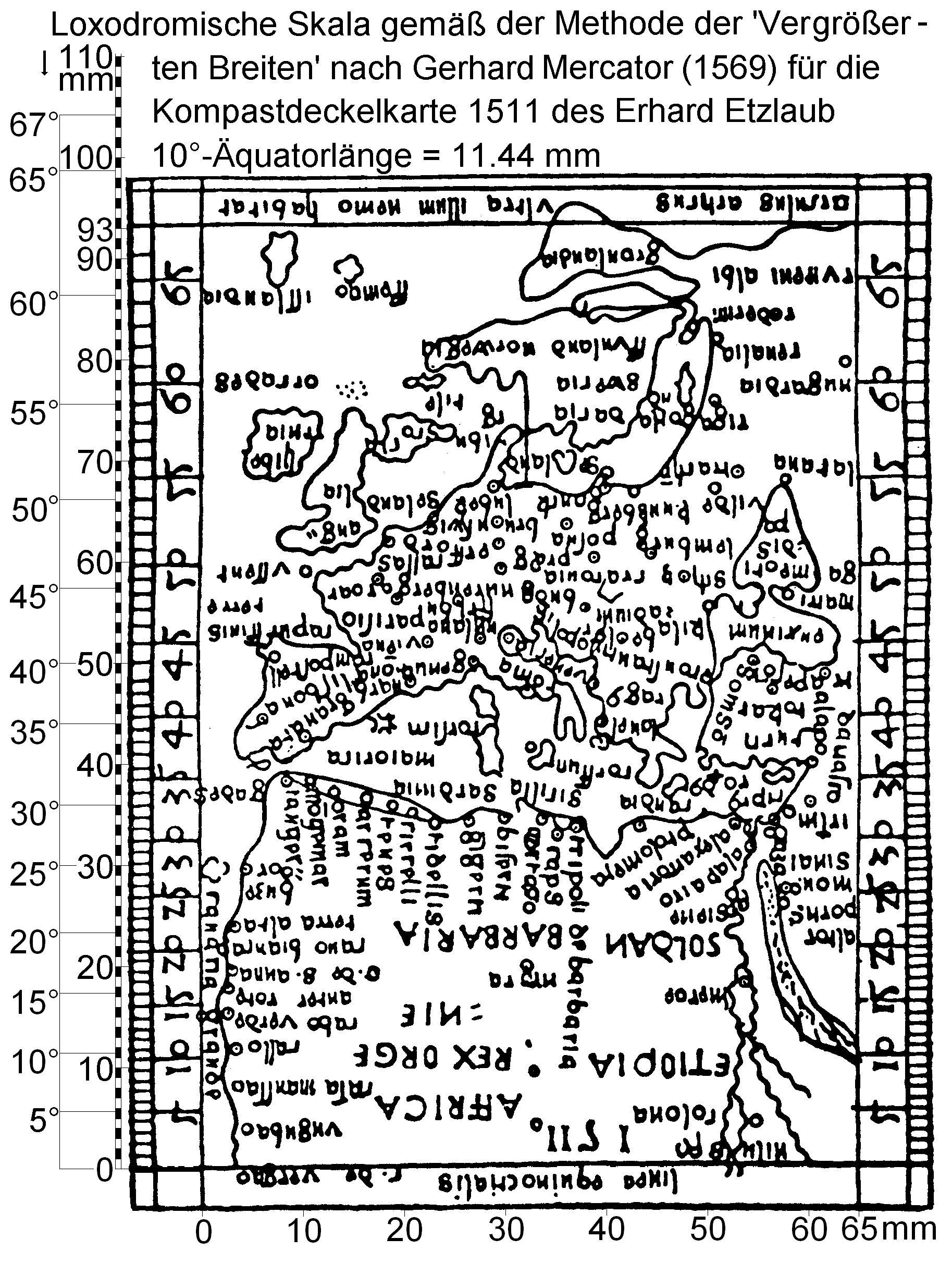
English: Miniature map from outside of hinged lid of Etzlaub's 1511 sundial. Size is 93x65 mm, orientation is "South-up", no longitudes are given. Latitudes printed in grey numbers (see right margin) were calculated by Krücken (2004, see "Source") for a Mercator projection of same area and prove that Etzlaub's approach was completely different.
height: 93 mm (3.66 in); width: 65 mm (2.55 in)These maps were designed to adjust sundials (called "Kompast" [sic!] in late medieval German) for user's latitude. Instructions were given by Etzlaub in Codex ad Compastum Norembergensem which was kept by Staatsbibliothek, Munich, Germany, but seems lost. |
|||||||||||||||||||
| Date | ||||||||||||||||||||
| Source | http://www.wilhelmkruecken.de/Etzlaub/etzREK.JPG | |||||||||||||||||||
| Author |
|
|||||||||||||||||||
| Permission (Reusing this file) |
PD-Art | |||||||||||||||||||
| Other versions |
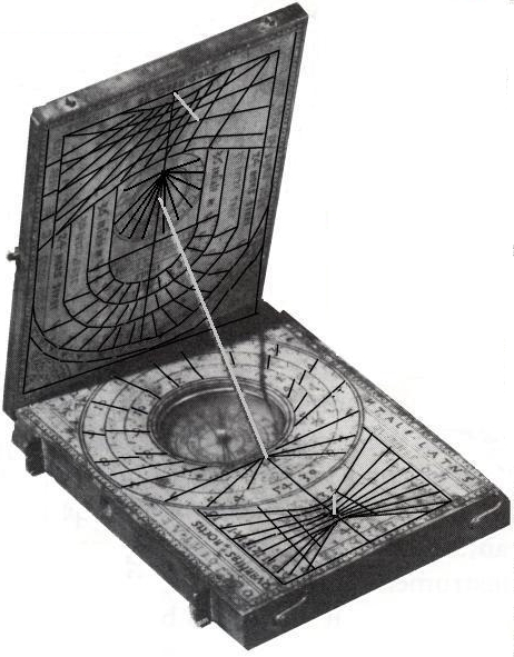
See copyrighted photograph of the 1511 sample
|
|||||||||||||||||||


Licensing
[edit]
|
This is a faithful photographic reproduction of a two-dimensional, public domain work of art. The work of art itself is in the public domain for the following reason:
The official position taken by the Wikimedia Foundation is that "faithful reproductions of two-dimensional public domain works of art are public domain".
This photographic reproduction is therefore also considered to be in the public domain in the United States. In other jurisdictions, re-use of this content may be restricted; see Reuse of PD-Art photographs for details. | ||||
File history
Click on a date/time to view the file as it appeared at that time.
| Date/Time | Thumbnail | Dimensions | User | Comment | |
|---|---|---|---|---|---|
| current | 05:34, 6 May 2020 | | 1,827 × 2,423 (1.53 MB) | Yamaplos (talk | contribs) | directly from http://www.wilhelmkruecken.de/Etzlaub/etzREK.jpg |
| 15:40, 21 February 2007 |  | 326 × 380 (27 KB) | I.R. Annie IP. (talk | contribs) | ||
| 10:56, 21 February 2007 |  | 326 × 380 (27 KB) | I.R. Annie IP. (talk | contribs) | {{Information |Description= Miniature map from outside of hinged lid of Etzlaub's 1511 sundial. Size is 93x65 mm, orientation is "South-up", no longitudes are given. Latitudes printed in grey numbers (see right margin) were calculated by ''Krücken'' (200 |
You cannot overwrite this file.
File usage on Commons
The following 5 pages use this file:
File usage on other wikis
The following other wikis use this file:
- Usage on de.wikipedia.org
- Usage on en.wikipedia.org