File:Erfurt Rathaus Partnerstaedte.JPG
Jump to navigation
Jump to search

Size of this preview: 800 × 600 pixels. Other resolutions: 320 × 240 pixels | 640 × 480 pixels | 1,024 × 768 pixels | 1,280 × 960 pixels | 2,560 × 1,920 pixels | 2,816 × 2,112 pixels.
Original file (2,816 × 2,112 pixels, file size: 1.27 MB, MIME type: image/jpeg)
Captions
Captions
Add a one-line explanation of what this file represents
Summary
[edit]
| Description |
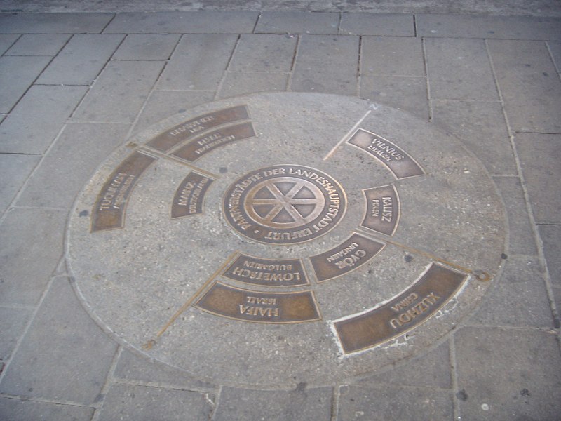
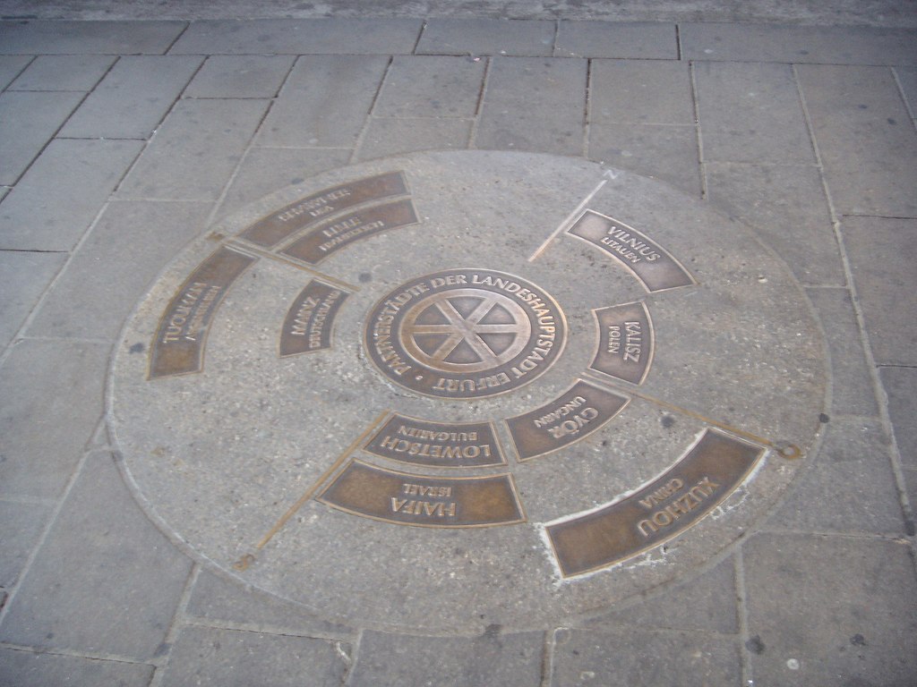
Deutsch: Kompass mit Himmelsrichtungen und Partnerstädten, der vor dem Rathaus Erfurt in den Boden eingelassen ist. |
| Date | |
| Source | Own work |
| Author | Christoph Eichhorn 19:51, 26 February 2007 (UTC) |
| Permission (Reusing this file) |
public domain |
| Object location | | View this and other nearby images on: OpenStreetMap |
|---|
Licensing
[edit]
| I, the copyright holder of this work, release this work into the public domain. This applies worldwide. In some countries this may not be legally possible; if so: I grant anyone the right to use this work for any purpose, without any conditions, unless such conditions are required by law. |
File history
Click on a date/time to view the file as it appeared at that time.
| Date/Time | Thumbnail | Dimensions | User | Comment | |
|---|---|---|---|---|---|
| current | 19:51, 26 February 2007 | | 2,816 × 2,112 (1.27 MB) | Christoph Eichhorn~commonswiki (talk | contribs) | {{Information |Description=Kompass mit Himmelsrichtungen und Partnerstädten, der vor dem Rathaus Erfurt in den Boden eingelassen ist. |Source=own work |Date=26.02.2007 |Author=~~~~ |Permission=public domain |other_versions=none }} |
You cannot overwrite this file.
File usage on Commons
The following page uses this file:
File usage on other wikis
The following other wikis use this file:
- Usage on eo.wikipedia.org